Last updated: September 5, 2023
Place
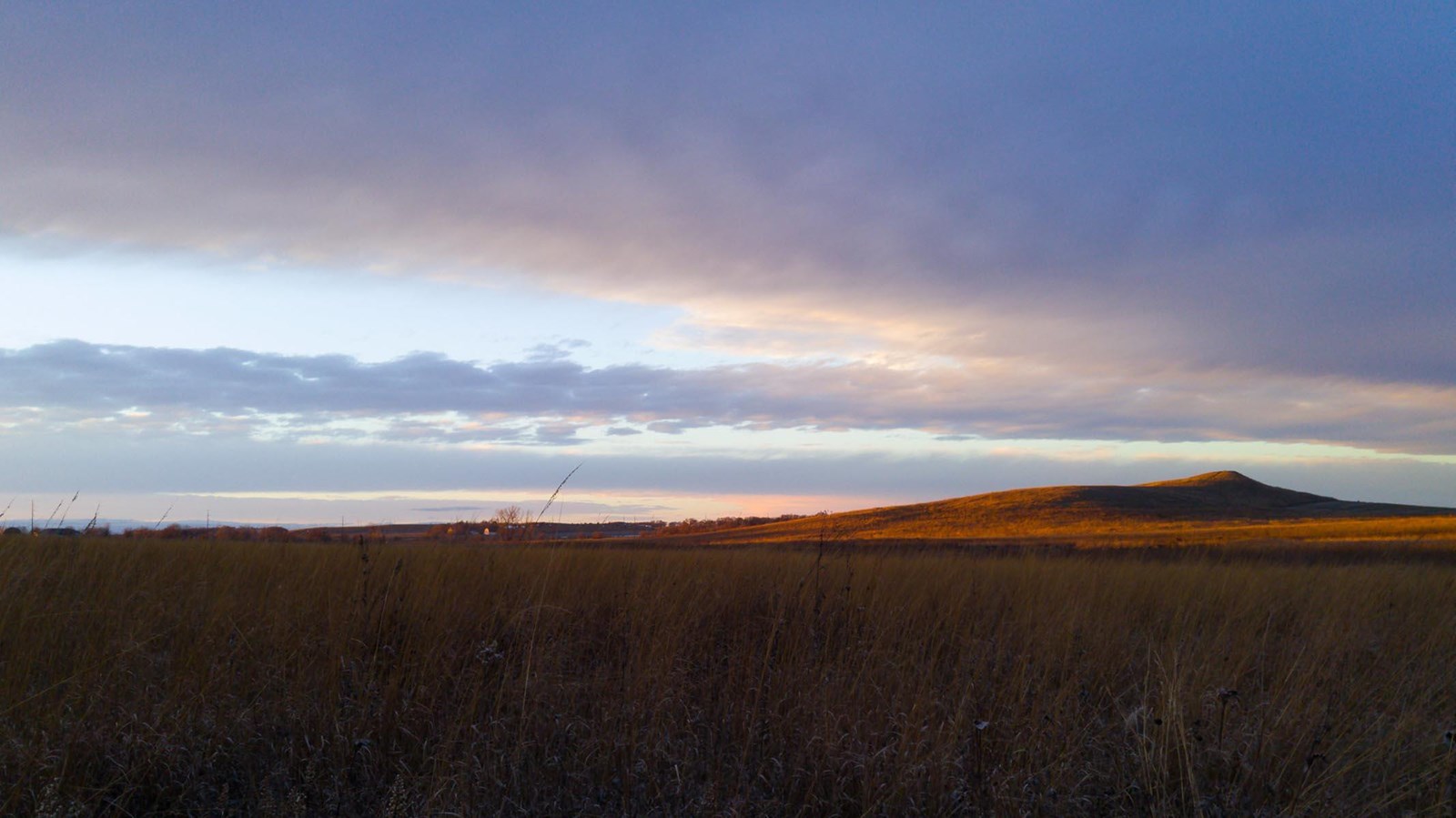
Spirit Mound, South Dakota
https://flic.kr/p/PVqKG2
Quick Facts
Location:
31148 SD Hwy 19, Vermillion, SD 57069
Significance:
Meriwether Lewis and William Clark visited this Lakota sacred site in 1804.
Designation:
National Register of Historic Places (designated 1974); State Historic Prairie
MANAGED BY:
Amenities
10 listed
Historical/Interpretive Information/Exhibits, Information - Maps Available, Information Kiosk/Bulletin Board, Picnic Shelter/Pavilion, Picnic Table, Restroom, Toilet - Vault/Composting, Trailhead, Water - Drinking/Potable, Wheelchair Accessible
On a sweltering August day in 1804, Meriwether Lewis, William Clark, and a small party of men walked nine miles from the Missouri River to a place called Spirit Mound. Otoe and Missouria people had told them about this place a few weeks earlier.
According to Lakota oral traditions, the Spirit Mound was home to a group of small people called Can O’ti na, or Little Tree Dwellers. The Can O’ti na sometimes behaved mischievously and played tricks on humans. They could also serve as spiritual helpers. Today, Lakota ceremonies still include the Little Tree Dweller’s Medicine Bundle. This important medicine traces its origins to Spirit Mound.
It is impossible to know exactly what stories Otoe, Missouri, or Lakota people told Lewis and Clark about Spirit Mound. We do know that they told Lewis and Clark that it was unwise to approach the hill where these little spirits lived.
But Lewis, Clark, and a party of nine men decided to go to the hill anyway. The heat was oppressive, and Lewis almost did not make the journey. They observed the hill, took notes about the birds and rocks they saw, made up their own explanations about this place, and then returned to the river.
How would you react if visitors to your home toured sites that were spiritually important to you and made judgments regarding your beliefs?
About this article: This article is part of series called “Pivotal Places: Stories from the Lewis and Clark National Historic Trail.”
Lewis and Clark NHT Visitor Centers and Museums
This map shows a range of features associated with the Lewis and Clark National Historic Trail, which commemorates the 1803-1806 Lewis and Clark Expedition. The trail spans a large portion of the North American continent, from the Ohio River in Pittsburgh, Pennsylvania, to the mouth of the Columbia River in Oregon and Washington. The trail is comprised of the historic route of the Lewis and Clark Expedition, an auto tour route, high potential historic sites (shown in black), visitor centers (shown in orange), and pivotal places (shown in green). These features can be selected on the map to reveal additional information. Also shown is a base map displaying state boundaries, cities, rivers, and highways. The map conveys how a significant area of the North American continent was traversed by the Lewis and Clark Expedition and indicates the many places where visitors can learn about their journey and experience the landscape through which they traveled.