Last updated: December 30, 2021
Place
Snake River Confluence
Quick Facts
Location:
2503 Sacajawea Park Road Pasco, WA 99301
Designation:
National Register of Historic Places
MANAGED BY:
Lewis and Clark NHT Visitor Centers and Museums
This map shows a range of features associated with the Lewis and Clark National Historic Trail, which commemorates the 1803-1806 Lewis and Clark Expedition. The trail spans a large portion of the North American continent, from the Ohio River in Pittsburgh, Pennsylvania, to the mouth of the Columbia River in Oregon and Washington. The trail is comprised of the historic route of the Lewis and Clark Expedition, an auto tour route, high potential historic sites (shown in black), visitor centers (shown in orange), and pivotal places (shown in green). These features can be selected on the map to reveal additional information. Also shown is a base map displaying state boundaries, cities, rivers, and highways. The map conveys how a significant area of the North American continent was traversed by the Lewis and Clark Expedition and indicates the many places where visitors can learn about their journey and experience the landscape through which they traveled.
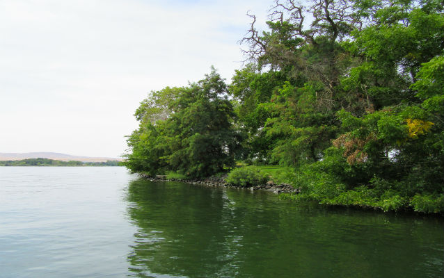
On October 16, 1805, Lewis and Clark reached the confluence of the Snake and Columbia rivers. Here they received a friendly reception from the Yakamas and Wanapams. According to Clark, “we formed a camp at the point [and] after we had our camp fixed and fires made, a Chief came from their Camp which was about ¼ of a mile up the Columbia river at the head of about 200 men Singing and beeting on their drums Stick and keeping time to the musik, they formed a half circle around us and Sung for Some time, we gave them all Smoke, and Spoke to their Chiefs as well as we could by Signs informing them of our friendly disposition to all nations”. During their stay, the expedition purchased dozens of dogs to eat and received gifts of fish, horse meat, and fire kindling. The next day Clark and two other men explored the Columbia River ten miles upstream. He documented numerous settlements and vast quantities of salmon. On October 18, Lewis and Clark made celestial observations and took measurements of the Snake and Columbia rivers. They held a final council, and began their voyage down the Columbia.
The campsite at the point of the confluence is now within the boundaries of the 284-acre Sacajawea State Park. The day-use park affords a wide range of land and water-based recreational opportunities. It includes the Sacajawea Interpretive Center, which interprets the Lewis and Clark expedition and highlights the role played by Sacagawea. The park was established in 1927 and is now listed in the National Register as a significant example of the PWA Moderne architectural style.