



Last updated: June 13, 2026
Place
Silver Zone Pass
L. Kreutzer
Quick Facts
Location:
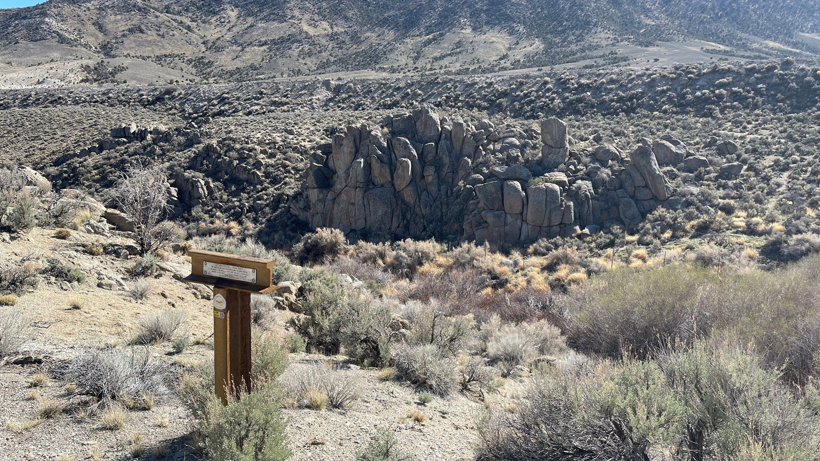
The Hastings Cutoff and I-80 share a corridor over Silver Zone Pass in the Toano Range, about 20 miles northwest of West Wendover, NV. The highway sign that marks Silver Zone Pass is at approximately GPS 40.925895 -114.327789. Approaching the pass, some travelers visited a spring in ravine next to today’s freeway. A trails organization has posted a T-shaped trail marker near the trail along the frontage road (old US-40) above the spring.
Significance:
Emigrants traveling to California on the Hastings Cutoff (1846-1850) crossed Silver Zone Pass over the Toano Mountains. Some emigrants found a small but desperately needed spring beside the trail in this area.
Designation:
Historic Site on the California NHT.
MANAGED BY:
Bureau of Land Management
Amenities
1 listed
Scenic View/Photo Spot
It was a 2-day drive from Halls Spring, in present-day Utah, to the next plentiful source of water beyond Nevada’s Toano Mountains. On the hot climb to Silver Zone Pass, a small spring in the bottom of a ravine provided a bit of relief for thirsty livestock.
First to make note of the spring was Heinrich Lienhard, traveling ahead of the Donner-Reed Party with one of the first wagon companies on the Hastings Cutoff in 1846. He estimated the “spring hole” to be about 12 feet deep but did not describe it further.
Arriving in 1850, after thousands of livestock and emigrants had passed by on their way to the California gold fields, John Wood seemed disappointed in the spring. “We traveled on until 10 o'clock, when we reached some water, nothing but a deep hole dug in the side of the road,” Wood wrote in his journal. “Our cattle must now have grass or they are gone; and here we can find but little, so our stay must be short here, and yet it is eighteen miles further to water and grass, and we must reach there this night.” His company left the spring late that afternoon, crossing the pass and an 18-mile desert before reaching “plenty of water and tolerable good grass” in Goshute Valley, west of the Toanos.
Today’s westbound visitors cross Silver Zone Pass on I-80 about 20 miles northwest of West Wendover, NV. On the climb to the pass, the freeway begins curving left and passes a roadside storage area heaped with highway gravel. Beyond the heaps, I-80 crosses a bridge over railroad tracks and begins curving to the right. About 0.4 miles past the track crossing (highway GPS location 40.902249 -114.294000), look into the ravine on the right to glimpse the tops of willows that grow at the spring site. Sharp eyes might also spot the T-shaped trail marker above the spring on the opposite side of the ravine.
Please do not stop on the freeway.
Site Information
Location (The Hastings Cutoff and I-80 share a corridor over Silver Zone Pass in the Toano Range, about 20 miles northwest of West Wendover, NV. The highway sign that marks Silver Zone Pass is at approximately GPS 40.925895 -114.327789.
Approaching the pass, some travelers visited a spring in ravine next to today’s freeway. A trails organization has posted a T-shaped trail marker near the trail along the frontage road (old US-40) above the spring.)