Last updated: October 8, 2021
Place
Shatter Zone

NPS Photo / Alex Ennes
Beach/Water Access
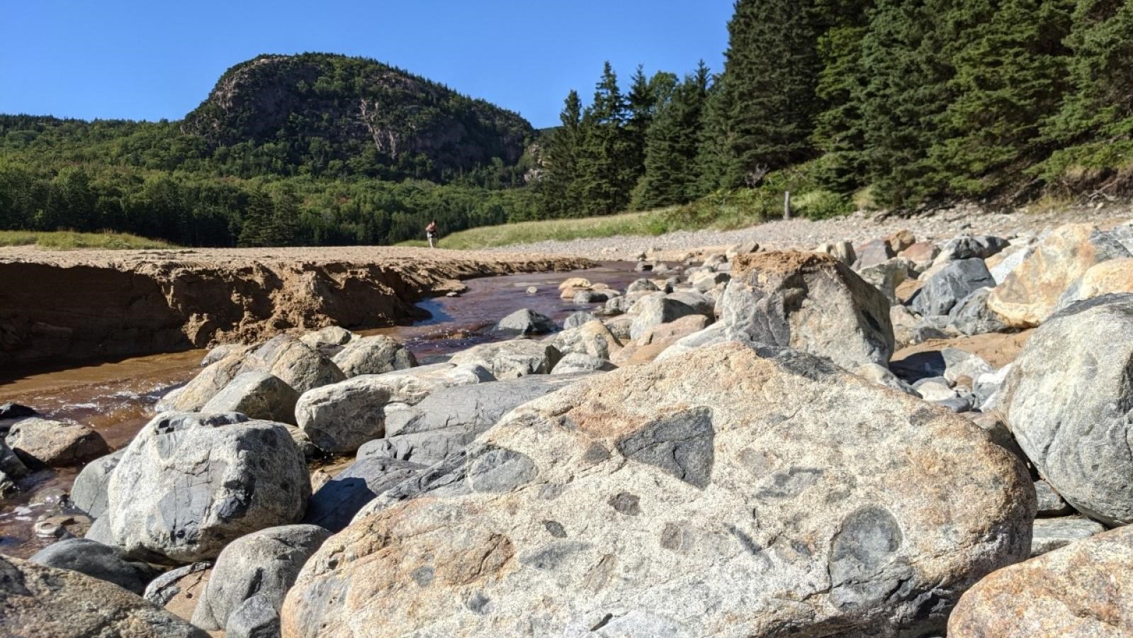
Here, on the eastern side of Sand Beach, large chunks of rock lie along the coast of Great Head. Look a little closer: what do you see in these rocks? Do you notice that they have the appearance of a chocolate chip cookie, with little chunks of different rocks embedded in the larger boulder? These rocks are called the Shatter Zone in Acadia, and to geologists they’re known as a volcanic breccia.
But hang on… volcanic? Do you see a volcano anywhere nearby? Probably not! The volcano that made these rocks existed on Mount Desert Island 420 million years ago – it has long since cooled and become the rock that makes up most of the island. The Cadillac Granite, the pink granite seen throughout much of Acadia, represents the ancient core of that volcano. The Shatter Zone, which we are looking at now, is the perimeter of that volcano’s caldera.
A caldera is a volcanic crater, formed at the mouth of a volcano after it erupts. The rocks at the edge of the Mount Desert Island volcano crumbled into the empty space left by the magma after it erupted. The magma remaining in the volcano at that time cooling, but still molten – similar in consistency to a gel. When crumbled rocks fell into it, they got stuck in the magma. Because this magma was cooling, it didn’t melt the fallen chunks of rock completely, and that’s why we can still see those rocks stuck in the magma (which is now granite) of the Shatter Zone today.
Geologists today use the Shatter Zone to help trace the ancient perimeter of the volcano because rocks only fell into the caldera around its edges. Using a geologic map, you can see that the Shatter Zone is represented by the dark brown crescent on the eastern coast of MDI. By studying the Shatter Zone, geologists have found that the caldera of this volcano would have been 10 miles wide – about five times the total distance of this hike!
