Last updated: March 28, 2025
Place
Scenic Drive Stop 10

NPS / E. Van Ness
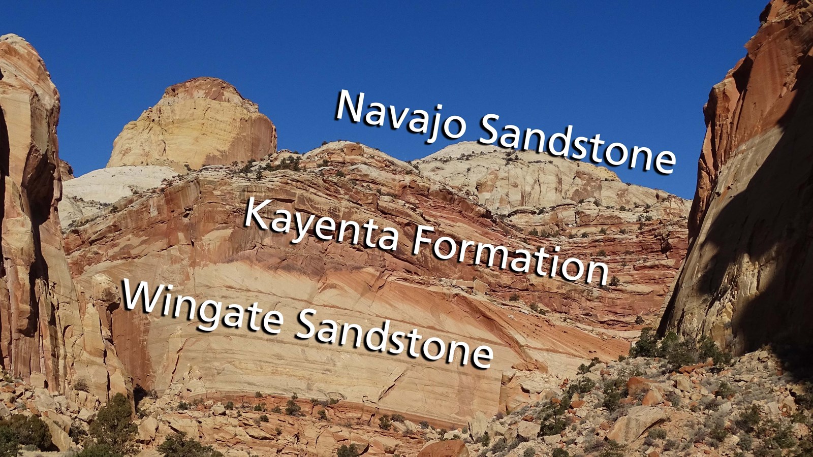
There is no pullout here due to the narrowness of the road. As you continue to drive into Capitol Gorge, additional rock layers are revealed. Near the base of the cliffs, Wingate Sandstone forms a sheer rock wall. Above, the cliff forms ledges dotted with green vegetation, like shrubs and trees. This “ledge-y, veggie” layer is the Kayenta Formation. Alternating layers of floodplain mudstones and river-channel sandstones form the stepped cliff band frequented by bighorn sheep.
Above the Kayenta, the Navajo Sandstone forms rounded domes of white rock. Windblown dunes returned to the area to form this iconic layer, also visible in Zion, Arches, and Canyonlands national parks. The sandstone domes, reminiscent of the U.S. Capitol Building, inspired the “Capitol” portion of the park’s name. “Reef” references a barrier to travel, borrowed from the nautical term. Rather than a barrier reef, this area is a barrier of rock.
Above the Kayenta, the Navajo Sandstone forms rounded domes of white rock. Windblown dunes returned to the area to form this iconic layer, also visible in Zion, Arches, and Canyonlands national parks. The sandstone domes, reminiscent of the U.S. Capitol Building, inspired the “Capitol” portion of the park’s name. “Reef” references a barrier to travel, borrowed from the nautical term. Rather than a barrier reef, this area is a barrier of rock.
