Last updated: March 22, 2023
Place
Savage River
NPS
Quick Facts
Location:
Mile 15, Denali Park Road
Amenities
9 listed
Benches/Seating, First Aid Kit Available, Information - Ranger/Staff Member Present, Restroom, Restroom - Accessible, Scenic View/Photo Spot, Toilet - Vault/Composting, Trailhead, Trash/Litter Receptacles
Savage River Area Trails
Trails near Savage River, in Denali. Switch between basemaps in the upper right for a satellite imagery view.
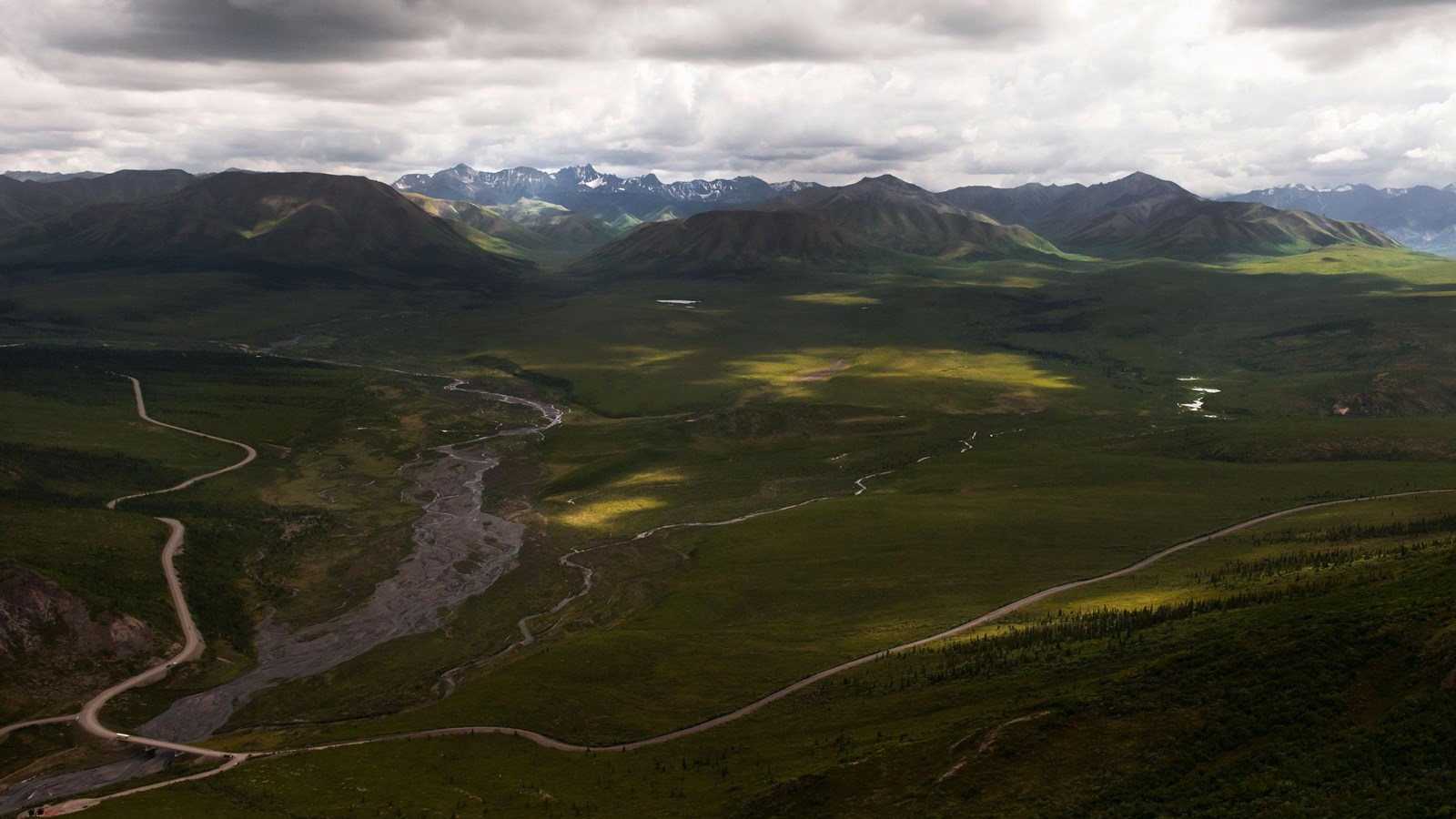
It is at this point that Denali's sole road changes from pavement to dirt, and traffic beyond the river is only possible by bus or under human power (e.g., bicycle).
In summer, rangers are at Savage River throughout most of the day. Several trails in the area offer visitors a chance to go for a short or long hike. All visitors should be wildlife-aware and know how to behave in case of an encounter with a bear, moose or wolf.
Geology
Savage River is one of several braided rivers in Denali that are characterized by transitory channels meandering across wide beds of sediment over time. However this behavior is not the result of glacial melt, as is the case for most braided rivers in the park, because no glaciers remain in the Savage River watershed. Savage River is braided because of high sediment input from brittle rock, and from a relative lack of vegetation stabilizing its headwaters.
An important transition zone that illustrates the glacial history of this area is located about halfway between the Savage River vehicular bridge and the Savage River Loop Trail footbridge to the north. Upstream (south) from this point, Savage River runs wide and shallow in a U-shaped valley typical of glacial scouring. Downstream (north), Savage River runs fast and restricted through a V-shaped valley typical of river erosion. Look for these distinctive shapes as you cross the vehicular bridge. While more extensive glaciations have affected the topography of the canyon in the past, they occurred over two million years ago. The river has therefore had substantial time to erode the V-shaped canyon that we see today.
The Savage River canyon is one of the few places where erosion has exposed the Yukon-Tanana Terrane bedrock along the road. Take a closer look and you’ll notice large amounts of mica-quartz schist, a shiny rock that gets its sparkle from the flaky mineral sericite and quartz veins. The varieties of metamorphic rock in the Yukon-Tanana Terrane, along with the degree to which they have been folded and faulted, attest to the terrane’s age and dynamic history.
Savage Rock, the jagged outcrop that you can walk to just uphill from the Savage River parking lot, is a surprising stumper. Why this outcrop is so prominent compared to its surroundings—despite being made of similar rocks—remains a mystery. One theory is that faulting caused the rock to protrude from the surrounding topography. A second is that it slid down from above. Or Savage Rock could be made of more resistant schist than the surrounding metamorphic rock. Further studies are needed to resolve this enigma.