Last updated: January 23, 2024
Place
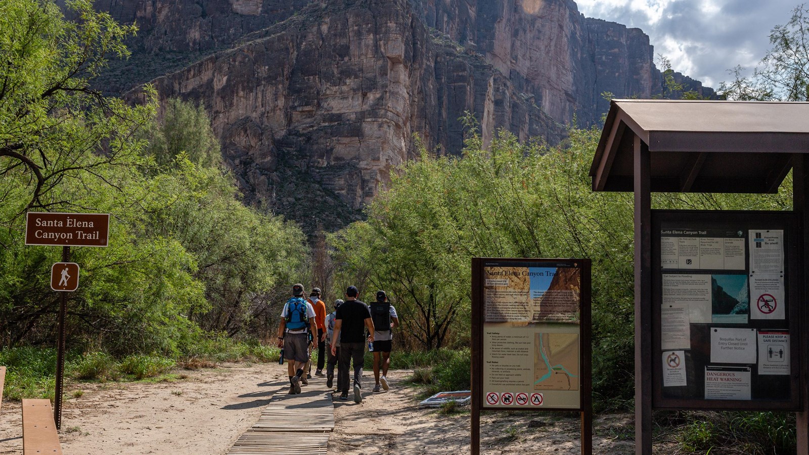
Santa Elena Canyon Trail
NPS PHOTO/ Cathy Hoyt
Quick Facts
Location:
The end of Ross Maxwell Scenic Drive
Amenities
12 listed
Beach/Water Access, Bicycle - Rack, Canoe/Kayak/Small Boat Launch, Historical/Interpretive Information/Exhibits, Information Kiosk/Bulletin Board, Parking - Auto, Parking - Bus/RV, Picnic Table, Scenic View/Photo Spot, Toilet - Vault/Composting, Trailhead, Trash/Litter Receptacles
Trail Information
Roundtrip Distance: 1.6 miles (2.6 km)
Elevation Change: 80 feet (26 m)
Average Hiking Time: 1 hour
Dogs and other pets are not allowed on any trails in the park.
The trail begins at the end of the Ross Maxwell Scenic Drive and is one of the prettiest short trails in the park. To access the trail, hikers must first cross the bed of Terlingua Creek, and climb a short but steep bank. Conditions change constantly at this location. As the trail enters the canyon mouth, it climbs a series of concrete steps to a high viewpoint. From the viewpoint, the trail slopes gradually down to the river’s edge and continues winding among large boulders until it ends abruptly where the canyon wall meets the Rio Grande. This is one of the narrowest places in the seven-mile long Santa Elena Canyon. Rest for a bit, and listen for the descending notes of the canyon wren or the call of the raven high along the canyon walls.
Safety Alert: Santa Elena Canyon Trail
To access the trail into the canyon, you must first cross the bed of Terlingua Creek, and climb a short but steep bank. Conditions change constantly at this location. Depending upon recent rains, Terlingua Creek may be dry sand, thick mud, or flowing water. Carefully assess conditions before attempting to cross. Many hikers try to keep their feet dry and take long circuitous routes up Terlingua Creek into dangerous cliff areas. This is NOT the maintained trail and can be extremely dangerous.
Accessibility
This trail may be impassable due to flooding during the summer rainy season. Check with park staff about the current trail condition. Wear old shoes in case the Terlingua Creek crossing is muddy. If the water here is deep and swift, do not cross. Just enjoy the spectacular views into the canyon, and try again in drier weather.
A paved parking lot at the trailhead provides parking for about 20 vehicles.
Hike Smart
Bring plenty of water!
Carry 1 liter of water per person per hour that you plan to hike. The importance of carrying enough water in this hot, dry climate cannot be overstated!
Eat
Your body needs food for energy and salts and electrolytes to replace what it's losing from perspiration. The dry climate at Big Bend means that sweat often evaporates almost instantly; your body is likely losing lots of moisture and salts without you even realizing it. Eat plenty of salty snacks to keep your body's salt-to-water ratio in balance.
Sun protection
Carry sunscreen and use it liberally. Hats are also strongly recommended. It may seem strange to wear long-sleeved shirts and pants in hot weather, but many hikers choose lightweight, breathable clothing which covers their arms and legs to protect themselves from the sun.
Don't leave people behind
If you're hiking in a group, make sure the person in the back always has someone to help.
Be aware of wildlife
Keep an eye out for snakes, and remember to maintain a safe distance between yourself and all wildlife. Animals in the park are wild and should never be approached, harassed or fed.
Don't stack rocks
Cairns are stacks of rocks which are sometimes used to mark trails in areas where they are hard to follow. Randomly stacked rocks can lure hikers off the correct trail.