Last updated: April 8, 2024
Place
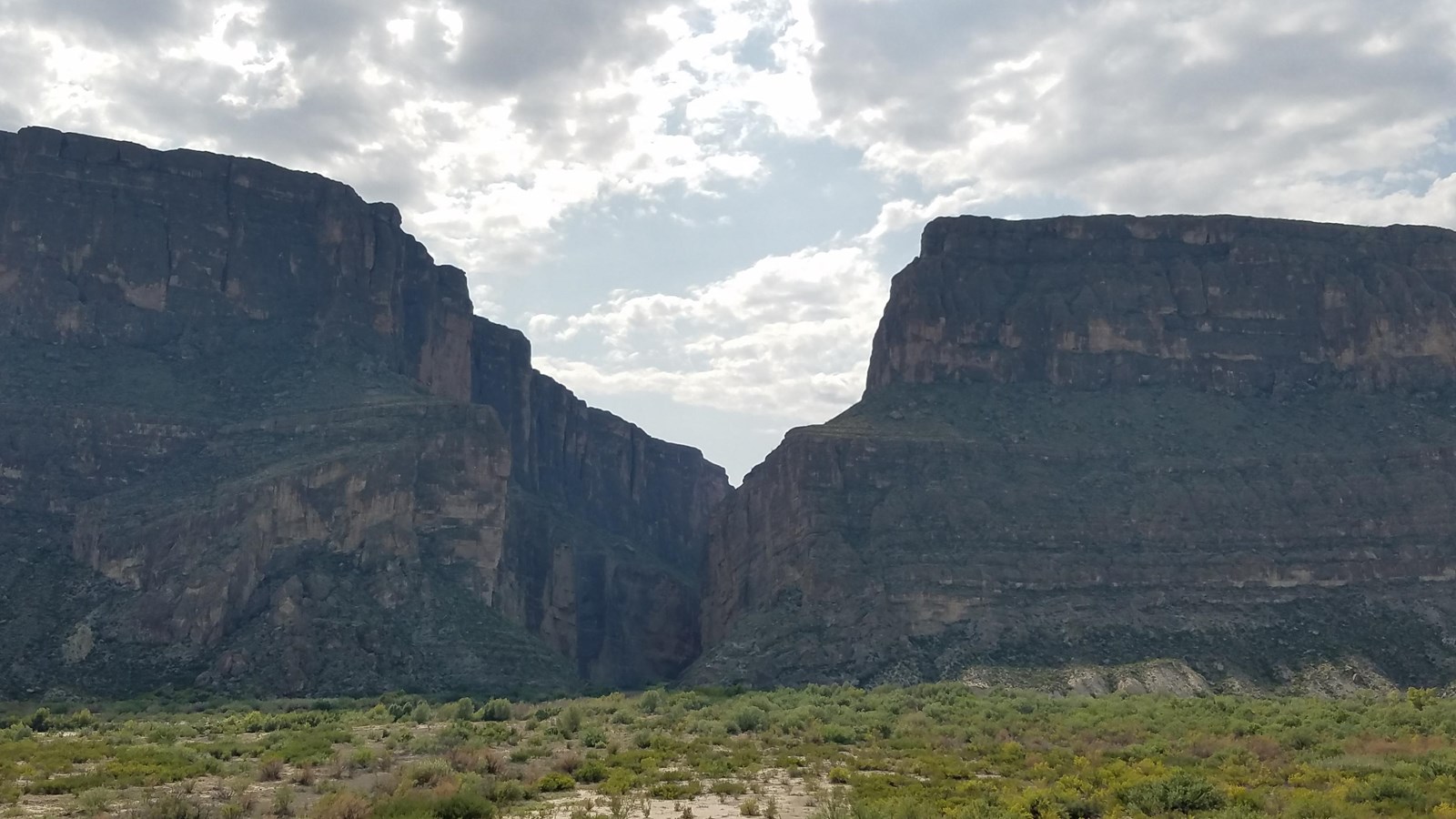
Santa Elena Canyon Overlook
NPS PHOTO
Quick Facts
Location:
The end of Ross Maxwell Scenic Drive
Amenities
4 listed
Historical/Interpretive Information/Exhibits, Parking - Auto, Parking - Bus/RV, Scenic View/Photo Spot
At this spectacular viewpoint, one is unaware of the length and splendor of Santa Elena Canyon. Santa Elena Canyon is 8 miles (13km) long and 1,500 feet (450 m) deep. In some places the canyon walls are only 30 feet (9 meters) wide. The Rio Grande established its present course on basin-filling sediments that covered the rocks and faults we see exposed today. The river eroded through the surface layers and cut steep-sided canyons in the more resistant Lower Cretaceous limestones. Today you can see those ancient limestone formations exposed in the canyon walls. A popular way to explore the length of Santa Elena Canyon is on a two or three-day river rafting trip that begins in the town of Lajitas, located outside the national park.