Last updated: November 27, 2020
Place
Sacajawea Park
Quick Facts
Location:
Livingston, MT
MANAGED BY:
Lewis and Clark NHT Visitor Centers and Museums
This map shows a range of features associated with the Lewis and Clark National Historic Trail, which commemorates the 1803-1806 Lewis and Clark Expedition. The trail spans a large portion of the North American continent, from the Ohio River in Pittsburgh, Pennsylvania, to the mouth of the Columbia River in Oregon and Washington. The trail is comprised of the historic route of the Lewis and Clark Expedition, an auto tour route, high potential historic sites (shown in black), visitor centers (shown in orange), and pivotal places (shown in green). These features can be selected on the map to reveal additional information. Also shown is a base map displaying state boundaries, cities, rivers, and highways. The map conveys how a significant area of the North American continent was traversed by the Lewis and Clark Expedition and indicates the many places where visitors can learn about their journey and experience the landscape through which they traveled.
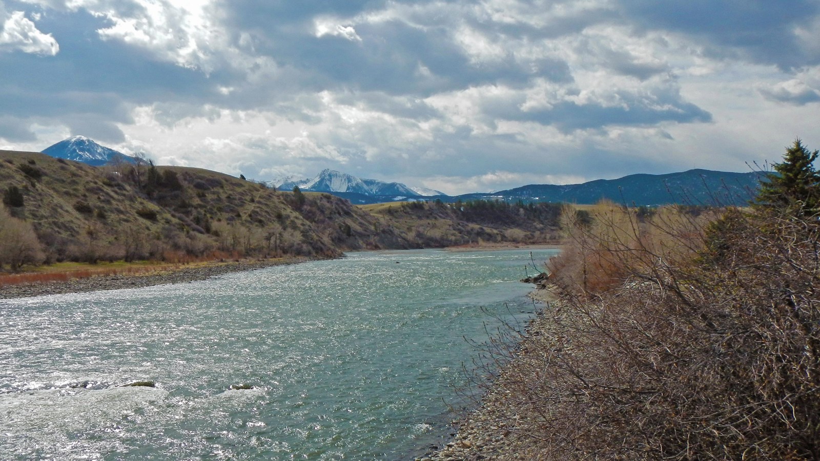
During the return journey, Clark separated at the Three Forks of the Missouri with a contingent of twelve to explore the Yellowstone River. Traveling overland, they reached the Yellowstone River valley on July 15, 1806, near the present-day city of Livingston. As Clark described, “1½ miles below the plain the river Passes out of the rocky mountains high on each Side bottom in those mountains narrow. river about 120 yds wide bold and deep the water of a whiteish blue Colour a mountan which is ruged N. W has Snow on parts of it. Those above & on the East Side of the river is rugid and covered with Snow those on the West is also high but have no Snow. much Dead timber on its N. Side.” They camped along the Yellowstone that evening, and then began the 19-day journey downriver to the Missouri.
The Corps of Discovery’s entry into the Yellowstone River valley is commemorated at Sacajawea Park in the city of Livingston. The municipal park is about a half-mile downriver from the probable location where the expedition reached the river. A statue of Sacagawea mounted upon a horse and holding her son, Jean Baptiste, is supplemented by interpretive wayside exhibits. Visitors are afforded similar expansive views of the mountain-bounded valley as recorded by Clark in 1806.