Last updated: November 27, 2020
Place
Ross’ Hole
Quick Facts
Location:
Sula, Montana, Viewable at Roadside Pull Out
OPEN TO PUBLIC:
No
Lewis and Clark NHT Visitor Centers and Museums
This map shows a range of features associated with the Lewis and Clark National Historic Trail, which commemorates the 1803-1806 Lewis and Clark Expedition. The trail spans a large portion of the North American continent, from the Ohio River in Pittsburgh, Pennsylvania, to the mouth of the Columbia River in Oregon and Washington. The trail is comprised of the historic route of the Lewis and Clark Expedition, an auto tour route, high potential historic sites (shown in black), visitor centers (shown in orange), and pivotal places (shown in green). These features can be selected on the map to reveal additional information. Also shown is a base map displaying state boundaries, cities, rivers, and highways. The map conveys how a significant area of the North American continent was traversed by the Lewis and Clark Expedition and indicates the many places where visitors can learn about their journey and experience the landscape through which they traveled.
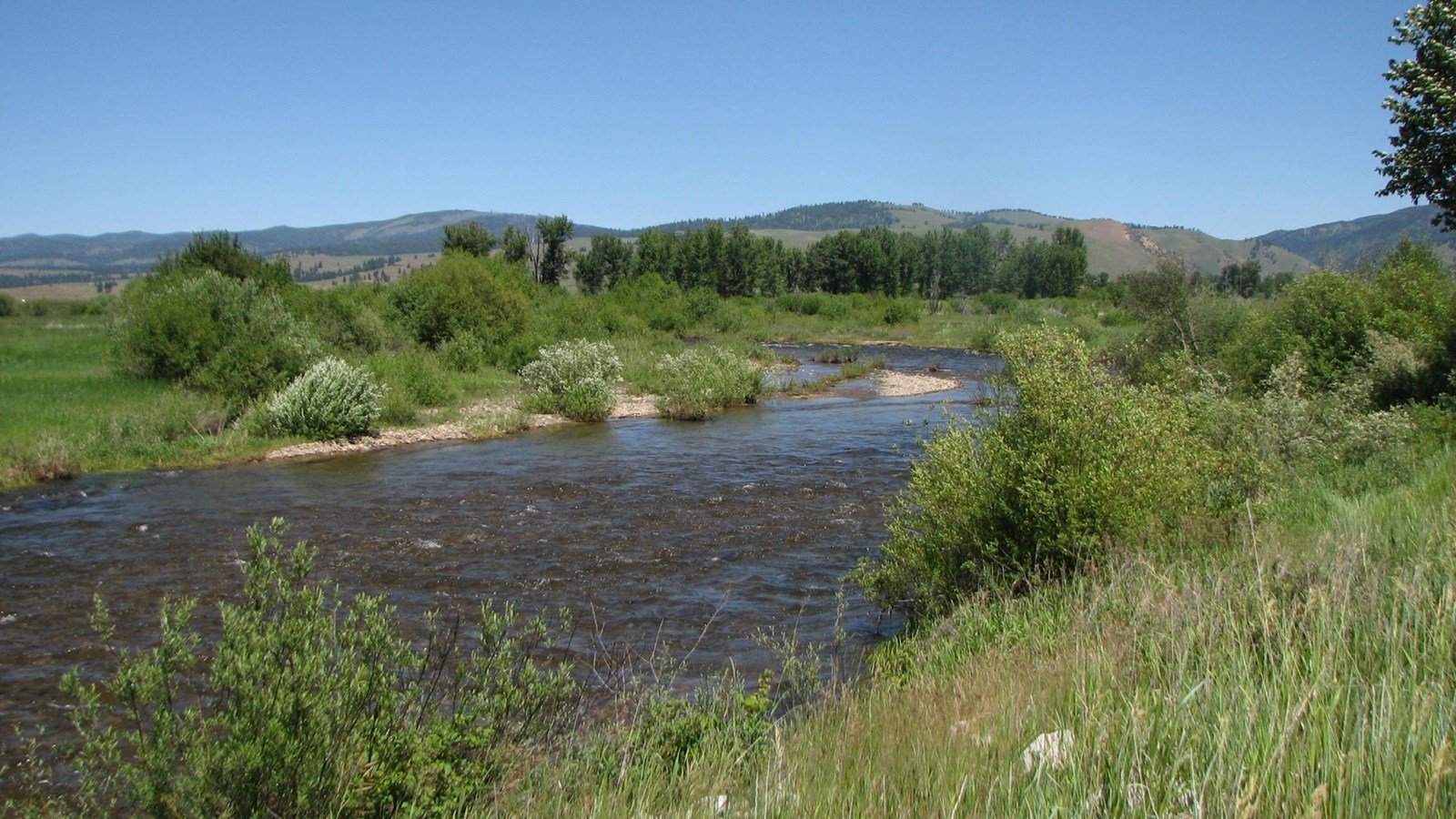
On September 4, 1805 the expedition had crossed near modern-day Lost Trail Pass and descended into an open valley, now called Ross’ Hole, where Clark estimated there to be 400 Salish Indians with 500 horses encamped. The Salish, called “Flathead” by members of the expedition, gave them a warm welcome. Ordway wrote, “when our officers went to their lodges they gave them each a white robe of dressed skins, and spread them over their Shoulders and put their arms around our necks instead of Shakeing hands as that is their way they appeared glad to See us. they Smoaked with us, then gave us a pleanty Such as they had to eat…” Lewis and Clark spent the next day communicating with chiefs (complicated by the task of translating across several languages), exchanging gifts, bartering goods, and purchasing horses. Rested and refitted, on the afternoon of September 6 the Corps of Discovery continued north along the Bitterroot valley.
Ross’ Hole was later named for Alexander Ross, a fur trader with the Hudson Bay Company who camped there on March 12, 1824. The site is currently experienced as a wayside stop along US Highway 93, next to the Sula Country Store. A roadside pull-off is lined by an array of interpretive signage that detail the story of Lewis and Clark’s visit, later exploration and development, and the settlement of Sula. Despite prominent modern intrusions in the foreground, this vantage point allows expansive views of Ross’ Hole and conveys the timeless quality of the natural landscape.