



Last updated: June 16, 2026
Place
Rock Ledge Overlook
Photo/Steve Allison
Quick Facts
Location:
Public Property, access road is gated. The site is about 12 miles southwest of UT-196 junction with I-80, on the west side of UT-196/Skull Valley Rd about 3 ½ miles southwest of the Horseshoe Springs Interpretive Site entrance. Look on the right for an asphalt turnout leading to a green steel gate. Pass through, closing the gate behind you, and bear right onto the 2-track road. Continue for about 1/10 mile and park. The rock ledge is visible ahead. Always re-close the gate during and after your visit if it was closed when you arrived, to prevent livestock from straying onto the highway. GPS 40.5665638889 -112.7361
Significance:
This rock ledge with Native American petroglyphs overlooks the junction the Forty-niner Trail with the Hastings Cutoff in Skull Valley, UT. The Forty-niner Trail is a detour that splits off the Hastings Cutoff and climbs the foothills to Dell Spring and then rejoins the cutoff below this ledge.
Designation:
Historic site on the California National Historic Trail.
MANAGED BY:
Bureau of Land Management
Amenities
1 listed
Scenic View/Photo Spot
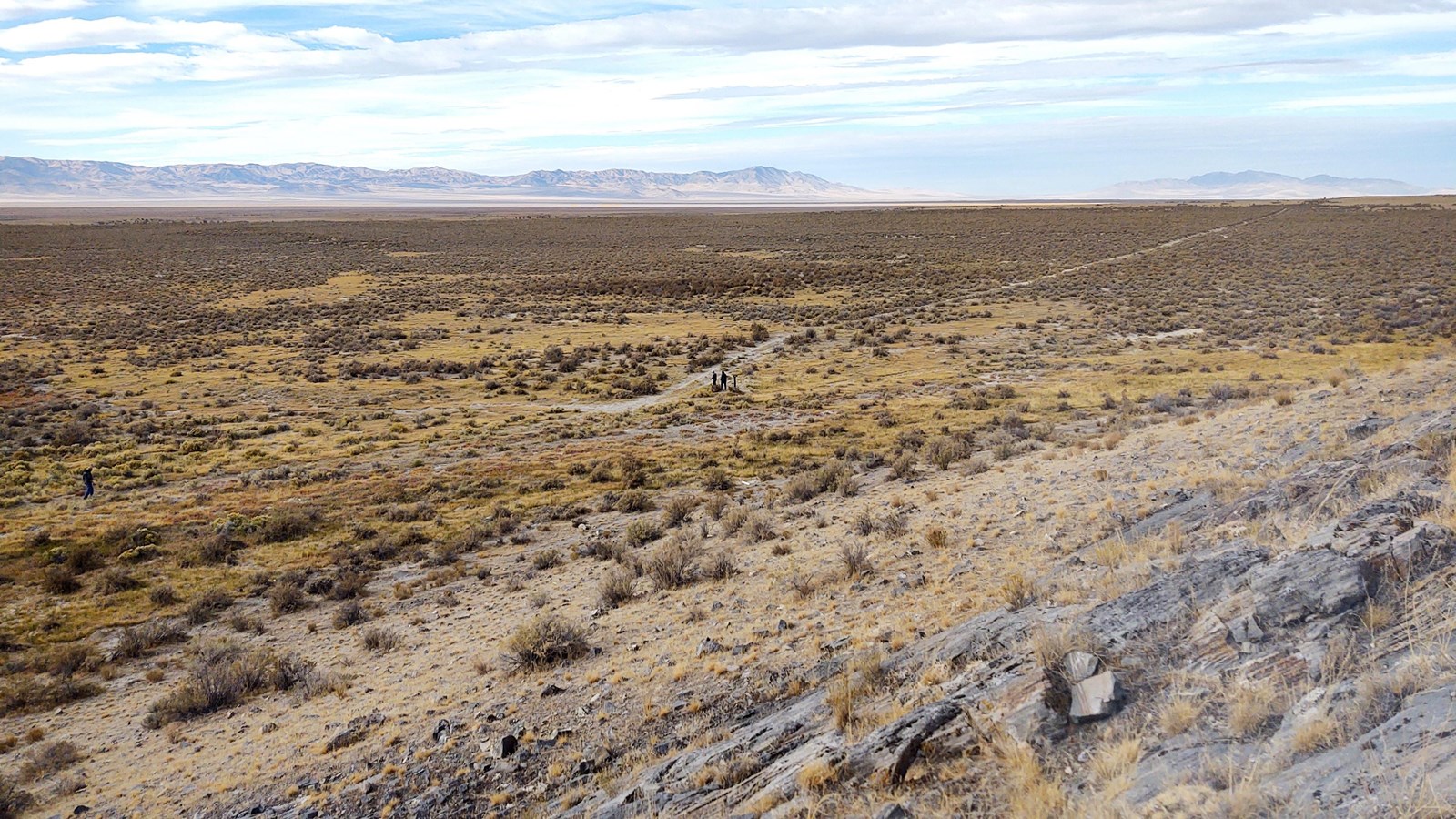
“Rock Ledge Overlook” is an elevated, rocky exposure on the east side of Skull Valley, providing a view of Hastings Cutoff (approaching from Horseshoe Springs) and the Forty-niner Trail (coming from Dell Springs). Several American Indian petroglyphs, unrelated to the trail, can be found on the rocks.
To reach the overlook, drive 9 ½ miles from the freeway exit to the entrance of the Horseshoe Springs Interpretive Site entrance, an unsigned gravel road leading to a lush, green area that can be seen from Skull Valley Rd. (Visitors to that site will find interpretive signs and wagon swale there.) Continue southwest on the highway for
another 3 ½ miles to a rough asphalt turnout on the right that leads to a green steel gate. Drive through, closing the gate behind you unless it was open when you arrived, and bear right onto a 2-track road for about 1/10 mile.
Park and walk to the rock ledge. Below the overlook, the wagon trail is clearly seen approaching from Horseshoe Springs. The Forty-niner Trail from Dell Springs, converging from the right, is not as clear. The junction of the two trails is marked with a t-shaped post that can be seen from the overlook. Please do not mark the rocks.
When leaving the overlook, pause to re-close the gate if it was shut when you arrived.
Site Information
Location (Public Property, access road is gated. The site is about 12 miles southwest of UT-196 junction with I-80, on the west side of UT-196/Skull Valley Rd about 3 ½ miles southwest of the Horseshoe Springs Interpretive Site entrance. Look on the right for an asphalt turnout leading to a green steel gate. Pass through, closing the gate behind you, and bear right onto the 2-track road. Continue for about 1/10 mile and park. The rock ledge is visible ahead. Always re-close the gate during and after your visit if it was closed when you arrived, to prevent livestock from straying onto the highway. GPS 40.5665638889 -112.7361)