Last updated: November 28, 2023
Place
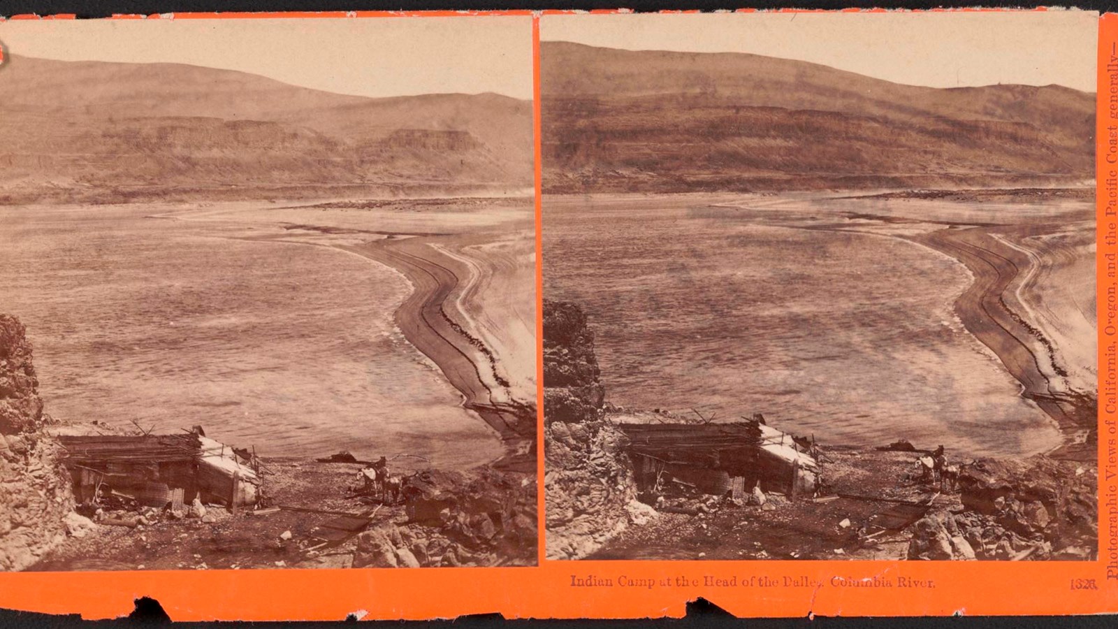
Rock Fort Campsite, Oregon
Oregon Historical Society
Quick Facts
Location:
Riverfront Park Rd, The Dalles, OR 97058
Significance:
Meriwether Lewis, William Clark, and their party camped here for several nights on their journey down and then back up the Columbia River.
Designation:
Lewis and Clark National Historic Trail
Amenities
3 listed
Historical/Interpretive Information/Exhibits, Scenic View/Photo Spot, Trailhead
Wasco-Wishram people lived in several villages near the end of the narrow and rocky stretch of the Columbia River downstream from Celilo Falls. In 1805, some White visitors with lots of luggage paid Wasco-Wishram people to help them around these dangerous waterfalls, as others had done before them. After finishing the portage, these visitors—whose leaders were named Meriwether Lewis and William Clark—stopped at a high point not far from the villages.
Local people called the nearby stream Que-nett, while Lewis named their camping spot “Rock Fort.” The visitors stopped here to repair canoes, dry out their soaked belongings, gather food, read the stars, and rest.
People from the Wasco-Wishram villages came to visit, trade, and relax a little with these damp and weary travelers. After exchanging gifts of deer meat, buckskins, clothes, ribbons, and more, some men made a fire, Pierre Cruzatte played the fiddle, and York danced. They all commiserated—maybe through translators, maybe through hand motions—about the annoying fleas present at the campsite. More people joined the next day and they all smoked and ate together—some people came from nearby communities, other traveled from sites farther downstream. The expedition members stayed three nights here.
A year later, the expedition came back up the Columbia River and camped in the same spot. Wasco-Wishram people remembered the travelers from last time and asked for more music and dancing. They taught the visitors games through which players could win goods. The visitors wanted horses, but no one had any to spare. After three days, the party continued upstream.
About this article: This article is part of a series called “Pivotal Places: Stories from the Lewis and Clark National Historic Trail.”
Lewis and Clark NHT Visitor Centers and Museums
This map shows a range of features associated with the Lewis and Clark National Historic Trail, which commemorates the 1803-1806 Lewis and Clark Expedition. The trail spans a large portion of the North American continent, from the Ohio River in Pittsburgh, Pennsylvania, to the mouth of the Columbia River in Oregon and Washington. The trail is comprised of the historic route of the Lewis and Clark Expedition, an auto tour route, high potential historic sites (shown in black), visitor centers (shown in orange), and pivotal places (shown in green). These features can be selected on the map to reveal additional information. Also shown is a base map displaying state boundaries, cities, rivers, and highways. The map conveys how a significant area of the North American continent was traversed by the Lewis and Clark Expedition and indicates the many places where visitors can learn about their journey and experience the landscape through which they traveled.