Last updated: December 9, 2023
Place
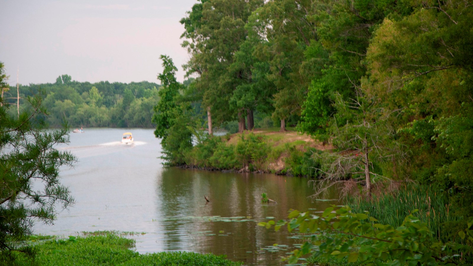
River Bend, Milepost 122.6
NPS Photo/ E Davie
Quick Facts
Location:
Milepost 122.6 on the Natchez Trace Parkway
Significance:
Picnic area, restrooms, scenic view.
Amenities
5 listed
Accessible Sites, Fish-Cleaning Station, Picnic Table, Restroom, Scenic View/Photo Spot
River Bend is a popular spot for picnics where you can enjoy scenic views of the Pearl River as it slows its flow and becomes the Ross Barnett Reservoir. Alligators can sometimes be seen in the water. Herons, egrets, and other water birds are common here. It's also a great spot for fishing.
The Pearl River, named after French Explorer Pierre Le Moyne, Sieur d’Iberville, for the many native plants that he found here, is the focus of this scenic area. The river marks a boundary between Mississippi and Louisiana.
The Pearl River is a river in the U.S. states of Mississippi and Louisiana. It forms in Winston County, Mississippi from the confluence of Nanawaya and Tallahaga Creeks. It is 490 mi long. The Yockanookany and Strong Rivers are tributaries. Northeast of Jackson, the Ross Barnett Reservoir is formed by a dam.
West of Picayune, MS, about 50 mi above the mouth, the river forks. The East Pearl River empties into Lake Borgne where the dredged Pearl River Channel meets the Gulf Intracoastal Waterway. The discharge flows eastward past Grand Island through St. Joe Pass and into the Mississippi Sound. The West Pearl River, on the other hand, flows into The Rigolets, then into Lake Borgne. Both discharges eventually reach the Gulf of Mexico.
The Pearl River serves as the 116-mi boundary between Mississippi and Louisiana, in its lower reach near the Gulf of Mexico.
The U.S. Army Corps of Engineers has undertaken three significant navigation projects in the Pearl River Basin. In 1880, Congress authorized a 5 ft navigation channel on the West Pearl River from Jackson to the Rigolets. That project was discontinued in 1922. Beginning in 1910, a channel was dredged from the mouth of the East Pearl River into Lake Borgne, a project which is maintained on an irregular basis. In 1935, the West Pearl River Navigation Project was authorized. It provided for a navigation channel from Bogalusa to the mouth of the West Pearl River. The project includes a canal with three locks. The Corps of Engineers placed the project in "caretaker" status in the 1970s because of a decline in commercial traffic. Maintenance dredging resumed in December 1988.
In the 1950s, underwater concrete sills were constructed to help maintain water levels in the navigation channel. This has prevented Gulf sturgeon and other migratory species from accessing upstream areas. A rock ramp constructed in 2003 helps fish navigate over one of the sills, but environmental groups propose further work to mitigate the effects of the navigation project.
Hurricane Katrina in August 2005 caused extensive damage in the Pearl River. Bottom sediments and marsh vegetation—including uprooted cypress and oak trees—blocked the mouth of the West Pearl and other parts of the channel, preventing navigation and diverting flow. The Louisiana Department of Wildlife & Fisheries and other agencies removed 27,000 cubic meters of debris.