Last updated: September 19, 2025
Place
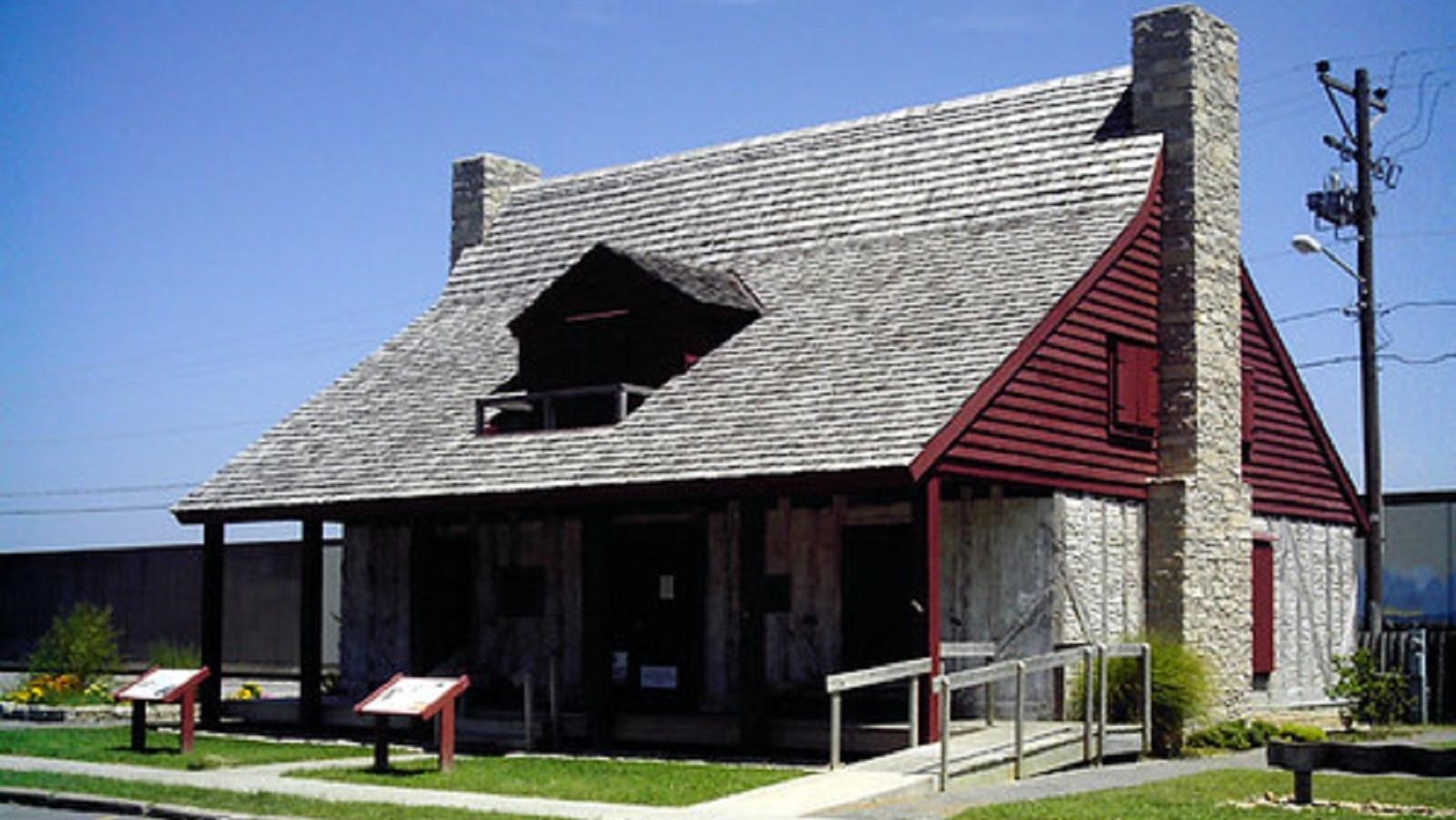
Red House Interpretive Center
"Cape Girardeau 004" by berriehol is licensed under CC BY 2.0
Quick Facts
Location:
Cape Girardeau, MO
MANAGED BY:
Amenities
9 listed
Accessible Sites, Benches/Seating, Cellular Signal, Fire Extinguisher, First Aid Kit Available, Historical/Interpretive Information/Exhibits, Information, Information - Ranger/Staff Member Present, Wheelchair Accessible
The expedition arrived at Cape Girardeau on November 23, 1803. Clark and the boats continued upriver to set up camp while Lewis met with Commandant Pierre-Louis de Lorimier at his residence and headquarters, the Red House. Lewis wrote extensively in his journal about Cape Girardeau, the first non-American settlement they had encountered on the expedition, and Lorimier’s family—the commandant wore his hair in a braid “nearly as low as his knees,” wife Charlotte “dresses after the Shawnee manner,” and his daughter was “much the most descent looking feemale I hae seen since I left the settlement in Kentuckey a little below Louisville.” After supper at the Red House, one of Lorimier’s sons accompanied Lewis to the expedition’s camp at the site of Old Cape Girardeau, today Cape Rock Park.
Former French soldier Jean Baptiste de Girardot established a short-lived trading post on a rocky promontory overlooking the Mississippi River in 1733. Called Cape Girardot, the site retained its name when Lorimier received a grant for 6000 acres in 1793 just south of Girardot’s original site. He built the Red House in 1797, though it was destroyed by a tornado in 1850. An approximate replica using period-appropriate construction was completed in 2003 for the Lewis and Clark Expedition bicentennial celebration and serves as a museum of early Cape Girardeau history.
The Red House Interpretive Center is located in downtown Cape Girardeau, Missouri. Originally built in 1797 by community founder and French-Canadian, Louis Lorimier, the structure overlooks the banks of the Missouri River. Although the original building was destroyed by a tornado in 1850, the site was rebuilt in 2003 thanks to many volunteers using the poteaux-sur-solle ("post-on-sil") technique once favored by French settlers.
In the early 19th Century, the "red house" was the best-known trading post between St. Louis, MO and Memphis, TN. It also served as a fledgling community and government center for the area. In November of 1803, Meriwether Lewis and William Clark stopped to visit with Lorimier's family and purchase supplies for the expedition ahead.
The reconstructed house displays several exhibits depicting the lives of the area's early settlers. Visitors can peruse 19th-century merchandise in Lorimier's Trading Post or visit the Lorimier Room to see how a home of this period may have been decorated. In the Girardeau Room, a large map of the territory under control of Don Louis Lorimier for the Spanish Government is on display. Visitors can also walk through the Historic Gardens on the north side of the house which contains flowers, vegetables, and herbs typical of a garden in 1803.
Today, the Red House Interpretive Center is maintained by the City of Cape Girardeau and is open to visitors from May to October. Admission is free. Guided group tours are available on weekdays by appointment only. Call (573) 339-6340.
Lewis and Clark NHT Visitor Centers and Museums
This map shows a range of features associated with the Lewis and Clark National Historic Trail, which commemorates the 1803-1806 Lewis and Clark Expedition. The trail spans a large portion of the North American continent, from the Ohio River in Pittsburgh, Pennsylvania, to the mouth of the Columbia River in Oregon and Washington. The trail is comprised of the historic route of the Lewis and Clark Expedition, an auto tour route, high potential historic sites (shown in black), visitor centers (shown in orange), and pivotal places (shown in green). These features can be selected on the map to reveal additional information. Also shown is a base map displaying state boundaries, cities, rivers, and highways. The map conveys how a significant area of the North American continent was traversed by the Lewis and Clark Expedition and indicates the many places where visitors can learn about their journey and experience the landscape through which they traveled.