Last updated: August 11, 2020
Place
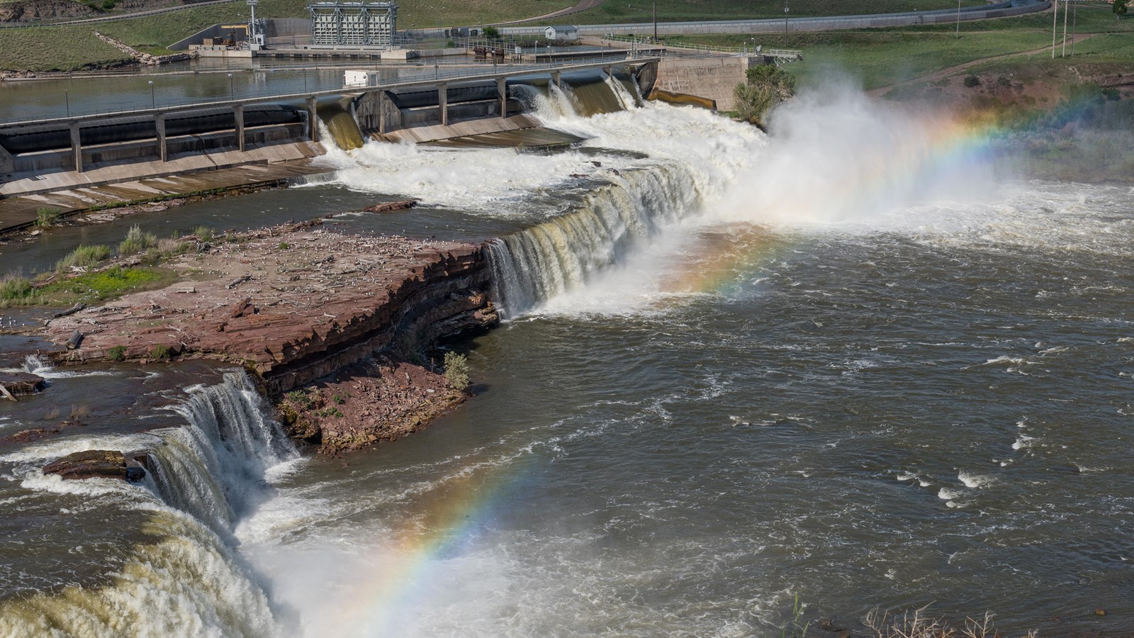
Rainbow Falls
NPS/ Alex Wiles
Quick Facts
Location:
Great Falls, Montana
MANAGED BY:
Lewis and Clark NHT Visitor Centers and Museums
This map shows a range of features associated with the Lewis and Clark National Historic Trail, which commemorates the 1803-1806 Lewis and Clark Expedition. The trail spans a large portion of the North American continent, from the Ohio River in Pittsburgh, Pennsylvania, to the mouth of the Columbia River in Oregon and Washington. The trail is comprised of the historic route of the Lewis and Clark Expedition, an auto tour route, high potential historic sites (shown in black), visitor centers (shown in orange), and pivotal places (shown in green). These features can be selected on the map to reveal additional information. Also shown is a base map displaying state boundaries, cities, rivers, and highways. The map conveys how a significant area of the North American continent was traversed by the Lewis and Clark Expedition and indicates the many places where visitors can learn about their journey and experience the landscape through which they traveled.
On June 14, 1805, as Lewis explored the Great Falls of the Missouri River, he encountered “one of the most beatifull objects in nature, a cascade of about fifty feet perpendicular streching at rightangles across the river from side to side to the distance of at least a quarter of a mile. here the river pitches over a shelving rock, with an edge as regular and as streight as if formed by art, without a nich or brake in it; the water decends in one even and uninterupted sheet to the bottom wher dashing against the rocky bottom rises into foaming billows of great hight and rappidly glides away, hising flashing and sparkling as it departs the sprey rises from one extremity to the other to 50 f. I now thought that if a skillfull painter had been asked to make a beautifull cascade that he would most probably have pesented the precise immage of this one.” Accordingly, Lewis and Clark named this landmark waterfall “Handsome Falls.”
Now called Rainbow Falls, the feature is located directly upstream from Crooked Falls and about a mile downstream from Giant Springs. The height of the falls is crested by Rainbow Dam, which was constructed in 1910. Water flow is diverted to a hydroelectric power plant, which has all but eliminated the tremendous cascade witnessed by Lewis. An overlook of the falls is accessible by roadway or footpath, and a USFS Lewis and Clark Interpretive Center is located about 1.5 miles to the west.