Last updated: March 14, 2024
Place
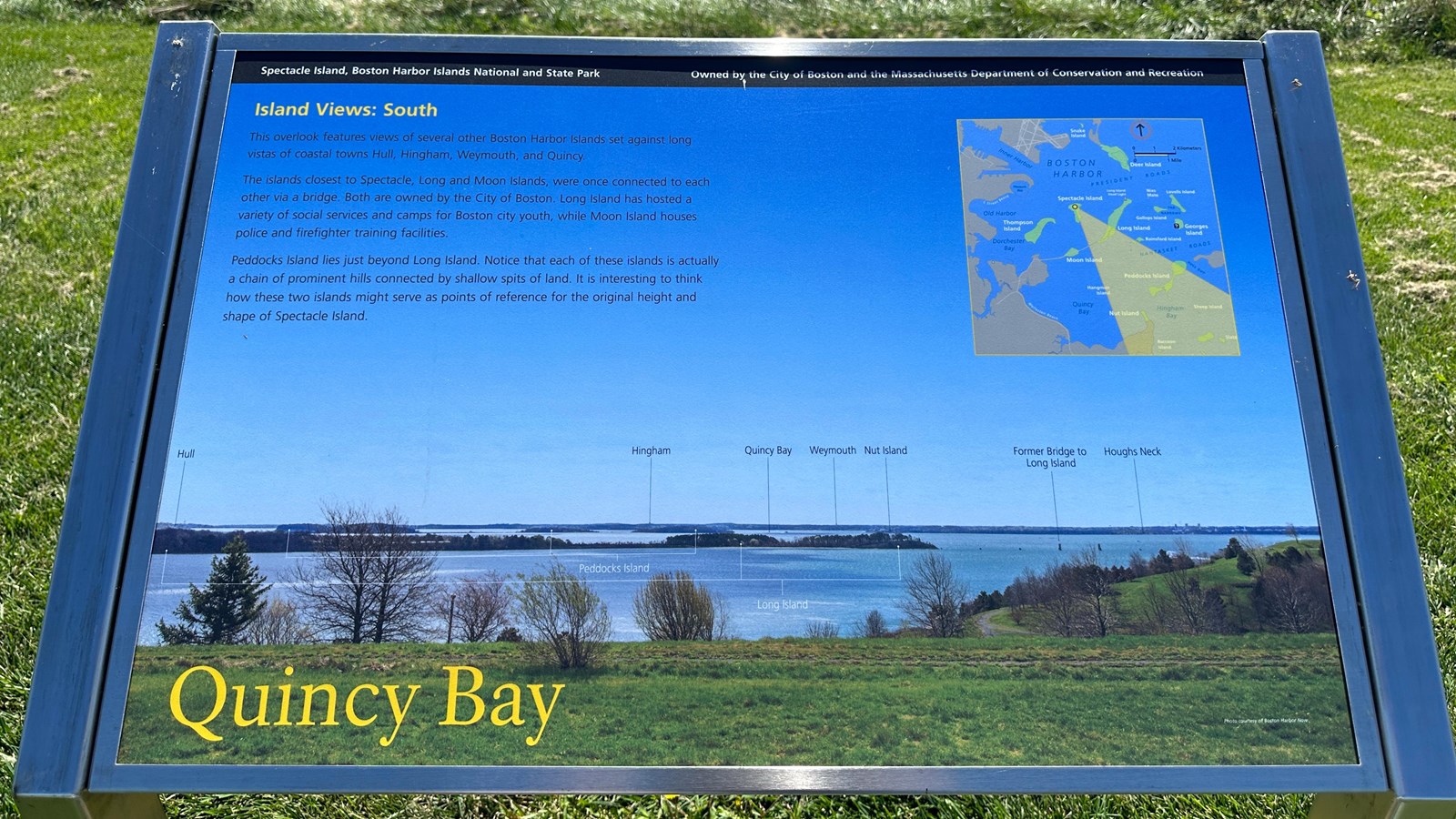
"Quincy Bay" Sign

NPS Photo/M Mark
Historical/Interpretive Information/Exhibits
Description
Low-profile wayside that is 36 x 24 inches, with interpretation panel spanning 36.5 inches wide. It has a grey square base with two rectangular pillars supporting the panel. The panel is framed in grey metal. The sign is located on the interpretive trail on the North Drumlin.
Layout
At the top of the sign is a black banner with white text. Aligned to the left is text that reads “Spectacle Island, Boston Harbor Islands National and State Park.” Aligned to the right is text that reads “Owned by the City of Boston and the Massachusetts Department of Conservation and Recreation.” The section of text is titled, “Island Views: South” in yellow text aligned to the left just underneath the black banner. The panel is made up of a background photo looking out from the North Drumlin looking towards Quincy Bay, with part of the South Drumlin in the right midground. Long Island is in the immediate foreground, with Peddocks and Nut Islands in the distance. The text is in a column with three paragraphs on the left with a map in the upper right corner. At the bottom of the panel the title reads “Quincy Bay” in yellow text.
Image Description (upper right)
An illustrated map of Boston Harbor featuring East Boston, Downtown Boston, South Boston, and Dorchester’s land masses that make up the Boston coastline in white. The Harbor Islands are all depicted in green with their names in white text. Islands included (from approximately north to south): Snake Island, Deer Island, Long Island (with Long Island Head Light labeled on the north edge of the island), Nixes Mate, Lovells Island, Spectacle Island, Gallops Island, Georges Island, Thompson Island, Rainsford Island, Moon Island, Peddocks Island, Hangman Island, Nut Island, and Sheep Island. Georges Island has a small white question mark in a black box indicating a visitor’s center. “Boston Harbor” is labeled in dark blue in the center. On land “Boston Logan International Airport” is labeled and in lighter gray has the runways outline. On the landmass just across the inner harbor, the bridges from Boston to Charlestown are highlighted in a light grey, but remain unlabeled. Other water features going down the coastline are labeled in the same dark blue: “Inner Harbor,” “Pleasure Bay,” “Old Harbor,” “Dorchester Bay,” and “Quincy Bay.” Two beaches on the coastline are labeled in white, the first is above Old Harbor “L Street Beach” and the second is in Quincy Bay, “Wollaston Beach.” Out in the harbor, “President Roads,” between Deer Island and Long Island, is labeled in dark blue, along with “The Narrows” between Gallops Island and Lovells Island. Also labeled in dark blue is “Nantasket Roads” between Peddocks Island and Rainsford Island and Georges Island to the north, as well as “Hull Gut” between Peddocks and an outstretch of land that is presumably Hull. Beneath the harbor islands, at the bottom of the map “Quincy Bay” and Hingham Bay are labelled, with “Hull Gut” labeled on an outstretch of land that is presumably Hull. The top right of the map is labeled “Massachusetts Bay” in a light blue with an arrow pointing upwards in a red circle that indicates “North.” Underneath the arrow is a small-scale image, depicting the scale of the map, on top it has 2 kilometers labeled in black, and 1 mile labeled in white. On Spectacle Island there is a yellow dot which has a triangulated yellow field showing the field of vision from that spot on Spectacle Island. Within this yellow field it looks out towards Hingham Bay, including Long Island, Nut Island, Peddocks Island, Nantasket Roads, Sheep Island, and Hull Gut.
Image Description (background)
A photo looking out towards Quincy Bay. In the foreground is the slope of the North Drumlin covered in trees and small brush. To the right stretching into the midground is part of the South Drumlin. The rest of the photo captures Boston Harbor, islands, and the coastline against a clear blue sky. The land mass at the furthest distance is labeled in black text and indicated with arrows, left to right: “Hull,” “Hingham,” “Quincy Bay,” “Weymouth,” “Nut Island,” and “Houghs Neck.” Before the furthest landmass is Peddocks Island, composed of several drumlins that are labeled in white. The island closest to Spectacle is Long island, with its drumlins labeled in white. To the right of the island are the remains of pillars labeled “Former Bridge to Long Island.” Next to it is Nut Island and Houghs Neck labeled in white text.
Image Credit
Photo courtesy of Boston Harbor Now
Main Text
This overlook features views of several other Boston Harbor Islands set against long vistas of coastal towns Hull, Hingham, Weymouth, and Quincy.
The islands closet to Spectacle, Long and Moon Islands, were once connected to each other via a bridge. Both are owned by the City of Boston. Long Island has hosted a variety of social services and camps for Boston city youth, while Moon Island houses police and firefighter training facilities.
Peddocks Island lies just beyond Long Island. Notice that each of these islands is actually a chain of prominent hills connected by shallow spits of land. It is interesting to think how these two islands might serve as points of reference for the original height and shape of Spectacle Island.
