Last updated: June 6, 2023
Place
Pompeys Pillar
Quick Facts
Location:
Yellowstone County, MT
Designation:
National Register of Historic Places, National Historic Landmark
MANAGED BY:
Lewis and Clark NHT Visitor Centers and Museums
This map shows a range of features associated with the Lewis and Clark National Historic Trail, which commemorates the 1803-1806 Lewis and Clark Expedition. The trail spans a large portion of the North American continent, from the Ohio River in Pittsburgh, Pennsylvania, to the mouth of the Columbia River in Oregon and Washington. The trail is comprised of the historic route of the Lewis and Clark Expedition, an auto tour route, high potential historic sites (shown in black), visitor centers (shown in orange), and pivotal places (shown in green). These features can be selected on the map to reveal additional information. Also shown is a base map displaying state boundaries, cities, rivers, and highways. The map conveys how a significant area of the North American continent was traversed by the Lewis and Clark Expedition and indicates the many places where visitors can learn about their journey and experience the landscape through which they traveled.
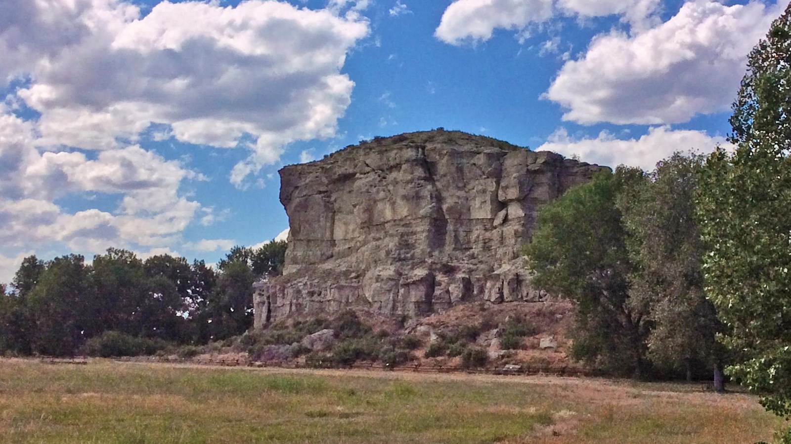
Pompeys Pillar is a High Potential Historic Site on the Lewis and Clark National Historic Trail.
On July 25, 1806, while descending the Yellowstone River, Clark “arived at a remarkable rock Situated in an extensive bottom on the Stard. Side of the river & 250 paces from it.” He wrote that, “this rock I ascended and from it’s top had a most extensive view in every direction. This rock which I shall Call Pompy’s Tower [named for Jean Baptiste ‘Pomp’ Charbonneau] is 200 feet high and 400 paces in secumphrance and only axcessable on one Side which is from the N. E the other parts of it being a perpendicular Clift of lightish Coloured gritty rock on the top there is a tolerable Soil of about 5 or 6 feet thick Covered with Short grass. The Indians have made 2 piles of Stone on the top of this Tower. The nativs have ingraved on the face of this rock the figures of animals &c. near which I marked my name and the day of the month & year.”
Although Clark named the feature “Pompys Tower” in his original journal entry, Nicholas Biddle altered the name to “Pompey’s Pillar” for the 1814 published history of the expedition. Clark’s inscription is the only known visible evidence of the entire journey that remains intact. Pompeys Pillar was established as a national monument in 2001. An on-site visitor center interprets the expedition’s travels through the Yellowstone River valley.