Last updated: March 14, 2024
Place
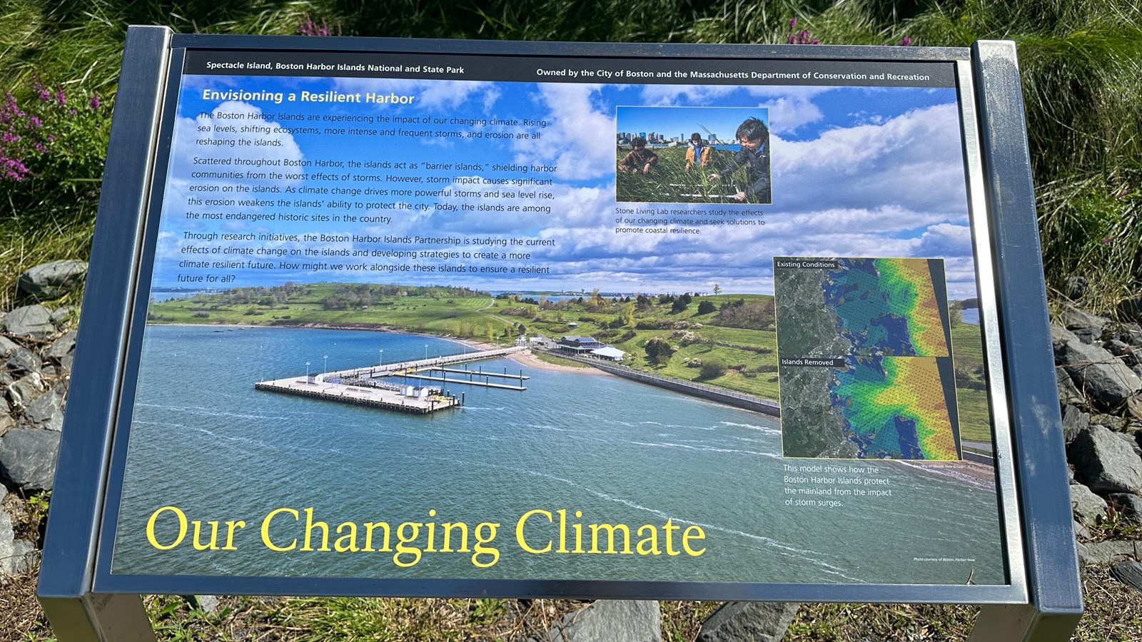
"Our Changing Climate" Sign

NPS Photo/M Mark
Historical/Interpretive Information/Exhibits
Description
Low-profile wayside that is 40.5 x 24 3/8 inches, with interpretation panel spanning 36.5 inches wide. It has a grey square base with two rectangular pillars supporting the panel. The panel is framed in grey metal. The sign is located on the perimeter accessible trail on the South Drumlin.
Layout
At the top of the sign is a black banner with white text. Aligned to the left is text that reads “Spectacle Island, Boston Harbor Islands National and State Park.” Aligned to the right is text that reads “Owned by the City of Boston and the Massachusetts Department of Conservation and Recreation.” The section of text is titled, “Envisioning a Resilient Harbor“ aligned to the left in yellow text. The rest of the panel is filled with an aerial view of Spectacle Island. The block of text on the left is arranged into three paragraphs. There are two images on the right, offset of each other. On the very bottom left of the sign the title reads “Our Changing Climate” in yellow text.
Image (background)
An aerial view of Spectacle Island, with both the North and South drumlins rising above the rest of the island. The pier juts out in front of the island into blue green water. To the right of where the pier connects to the island is the grey visitor center with two peaks in its roof. Next to that is a white tent. Around the front of the island, to the right of the pier and visitor center, a grey stone walkway hugs the shore. On the north of the island is a small sandy beach. The whole island is green and vibrant, covered in a smattering of trees, bushes, and small vegetation. Water peaks out in the dip between the drumlins. Other islands sit in the distance. The sky above is a vibrant light blue with a blanket of fluffy white clouds.
Images (right side, top)
Three people standing in tall grass at the edge of the harbor. The person on the left has black hair and wears a brown coat. The person in the middle is wearing a blue sweatshirt under a light brown jacket. On the right is an older man with black hair holding square contraption made out of white pvc pipe in front of him in the grass. Behind the group of three, stone blocks are stacked on a ledge in front of bright blue water. In the far distance is Boston’s city skyline.
Image Caption
Stone Living Lab researchers study the effects of our changing climate and seek solutions to promote coastal resilience.
Images (right side, bottom)
Two geographic maps are stacked on top of one another. Both maps show the Boston Harbor with a storm surge map overlay. The map on top says in the top left corner “Existing conditions” and shows light blue colors over the current islands, signifying lower levels of surging, and more intense red, yellow, orange, and green colors out further into the ocean. The second map, below, does not include the Harbor Islands and reads “Islands Removed” in the top left corner. The colors signifying low levels of surging – light blues—are less prominent and replaced by the colors signifying higher levels of storm surges (greens to yellow, orange, and red) creeping into the harbor and sometimes touching the coastline and outer peninsulas.
Image Caption
This model shows how the Boston Harbor Islands protect the mainland from the impact of storm surges.
Image Credit
Courtesy of Woods Hole Group.
Main Text
The Boston Harbor Islands are experiencing the impact of our changing climate. Rising sea levels, shifting ecosystems, more intense and frequent storms, and erosion are all reshaping the islands.
Scattered throughout the Boston Harbor, the islands act as “barrier islands,” shielding harbor communities from the worsts effects of storms. However, storm impact causes significant erosion on the islands. As climate change drives more powerful storms and sea level rise, this erosion weakens the islands’ ability to protect the city. Today, the islands are among the most endangered historic sites in the country.
Through research initiatives, the Boston Harbor Islands Partnership is studying the current effects of climate change on the islands and developing strategies to create a more climate resilient future. How might we work alongside these islands to ensure a resilient future for all?
