Last updated: March 17, 2026
Place
Arizona: Old Trails Bridge
Photo/Rhys Martin
Quick Facts
Location:
The Old Trails Bridge is several hundred feet south of Interstate 40 where it crosses the Colorado River at Topock, Arizona.
Significance:
Historic bridge along Route 66
Designation:
National Register of Historic Places
Amenities
1 listed
Historical/Interpretive Information/Exhibits
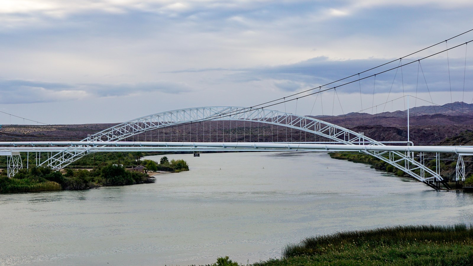
The steel arch of the Old Trails Bridge simply soars. An innovative piece of engineering, one enormous span of 600 feet supports the 800-foot bridge that crosses the Colorado River in Topock, halfway between Yuma and the Utah border. The bridge carried automobile traffic over the Colorado River from 1916 until 1948.
Builders constructed the Old Trails Bridge in 1914 partly to compete with the Ocean-to-Ocean Bridge being built in Yuma, south of Topock. To entice traffic farther north, the States of Arizona and California and the Bureau of Indian Affairs decided to erect another substantial span over the Colorado River. The new bridge would be part of the National Old Trails Road, an early transcontinental route well underway to connecting St. Louis to Los Angeles by 1914. In the process, the designers created a landmark of American civil engineering.
Technologically, the structure is nationally significant as an outstanding example of steel arch construction. The engineers for the Old Trails Bridge had studied the problems builders and engineers encountered while constructing the Ocean-to-Ocean Bridge. They knew the engineers there had found constructing and securing a large span over the deep Colorado gorge difficult, so they tried the task a different way.
In Topock, engineers used a unique cantilever method of construction assembling bridge halves on their sides on the ground and hoisting them into place using a ball-and-socket center hinge. This meant that the structure was not supported by traditional spans from the ground up as it was being built. The use of the cantilever was a daring move for its time, creating the longest arched bridge in America. At 360 tons, it was the lightest and longest bridge of its kind. From the day it opened, this graceful arch and the deck it supported were a pivotal Colorado River crossing, first on the transcontinental National Old Trails Road and, by 1926, on Route 66.
The Old Trails Bridge carried traffic until 1948 when cars and trucks began moving onto interstate systems. In 1948, the deck was removed so the bridge could accommodate a natural gas pipeline, which it still carries. The bridge was listed in the National Register of Historic Places in 1988.
The Old Trails Bridge is several hundred feet south of Interstate 40 where it crosses the Colorado River at Topock, AZ. To park and view the bridge, take the Interstate 40 exit for Park Moabi, the last California exit from the west and the first from the east. Signs direct visitors to the park. Follow the Park Moabi Entrance Rd. north to its intersection with the National Trails Highway/Park Moabi Rd. then turn right. The first vantage point is from an old brick bridge nearly a mile from the intersection. Visitors can park on the side of the road and walk down the bridge top. The second vantage point is nearly two miles from the intersection. Visitors should continue along the National Trails Highway/Park Moabi Rd. past the first vantage point and intersection with Interstate 40; then look for a historic concrete billboard and adjacent pullout pad. This location provides the best view of the bridge.
Site Information
Location (The Old Trails Bridge is several hundred feet south of Interstate 40 where it crosses the Colorado River at Topock, Arizona.)