Last updated: November 28, 2023
Place
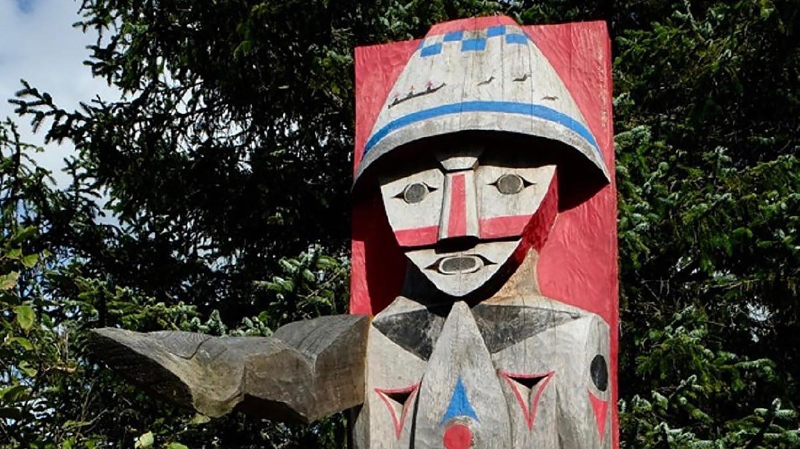
NeCus’ Village / Ecola Creek Village
NPS
Quick Facts
Location:
268 Beaver St, Cannon Beach, OR 97110
Significance:
There was a Nehalem village, NeCus’, near this site. The residents met William Clark and other members of his party here in January 1806. At the time, there was a beached whale nearby. Clark bought whale blubber and oil from residents of this village.
Designation:
Lewis and Clark National Historic Trail, Lewis and Clark National Historical Park
Amenities
7 listed
Beach/Water Access, Benches/Seating, Grill, Historical/Interpretive Information/Exhibits, Parking - Auto, Picnic Table, Trailhead
The village where Ecola Creek met the Pacific Ocean was called NeCus’, meaning a “place of the receding tide.” People who lived here were likely Nehalem (northern Tillamook) people. They traded often with Clatsop, Chinookan, and Cathlamet people via a system of well-established roads, as well as canoes that could handle ocean or river waters.
In 1806, there were four longhouses at NeCus’, built mostly from cedar planks. Each was home to an extended family—some 100 people may have lived in the village. They caught fish, and when the tide was low, they gathered crabs, mussels, snails, and barnacles. Some men in the village hunted seals and sea lions. To walk down to the beach, they carved handholds in the rocky cliff.
White men and a Shoshone woman, members of the Lewis and Clark Expedition, arrived at NeCus’ in January 1806 during a time of bounty and commotion: a huge whale had just washed ashore!
The whale blessed them with enough food for themselves and to trade with their neighbors, Clatsop and Chinookan people. Nehalem people were hard at work boiling the whale for oil and cutting up the blubber, to prepare it to eat or sell.
William Clark wanted to buy some of the whale blubber and oil, trading glass beads for it. He bought so much that some people might have wondered how he planned to carry it back. He did so with the help of others in his party, including Sacagawea. Maybe the people of NeCus’ Village were excited to have such a bustling town with so many visitors—what an opportunity, what a big party! Maybe some children liked meeting all of the visitors from across the region. Older people may have been happy for an excuse to reunite with old friends. And maybe some people were just plain tired of smelling the rotting whale, even if they liked the taste of blubber.
Whatever they felt, NeCus’ Village was the place to be that January.
About this article: This article is part of a series called “Pivotal Places: Stories from the Lewis and Clark National Historic Trail.”
Lewis and Clark NHT Visitor Centers and Museums
This map shows a range of features associated with the Lewis and Clark National Historic Trail, which commemorates the 1803-1806 Lewis and Clark Expedition. The trail spans a large portion of the North American continent, from the Ohio River in Pittsburgh, Pennsylvania, to the mouth of the Columbia River in Oregon and Washington. The trail is comprised of the historic route of the Lewis and Clark Expedition, an auto tour route, high potential historic sites (shown in black), visitor centers (shown in orange), and pivotal places (shown in green). These features can be selected on the map to reveal additional information. Also shown is a base map displaying state boundaries, cities, rivers, and highways. The map conveys how a significant area of the North American continent was traversed by the Lewis and Clark Expedition and indicates the many places where visitors can learn about their journey and experience the landscape through which they traveled.