Last updated: December 7, 2020
Place
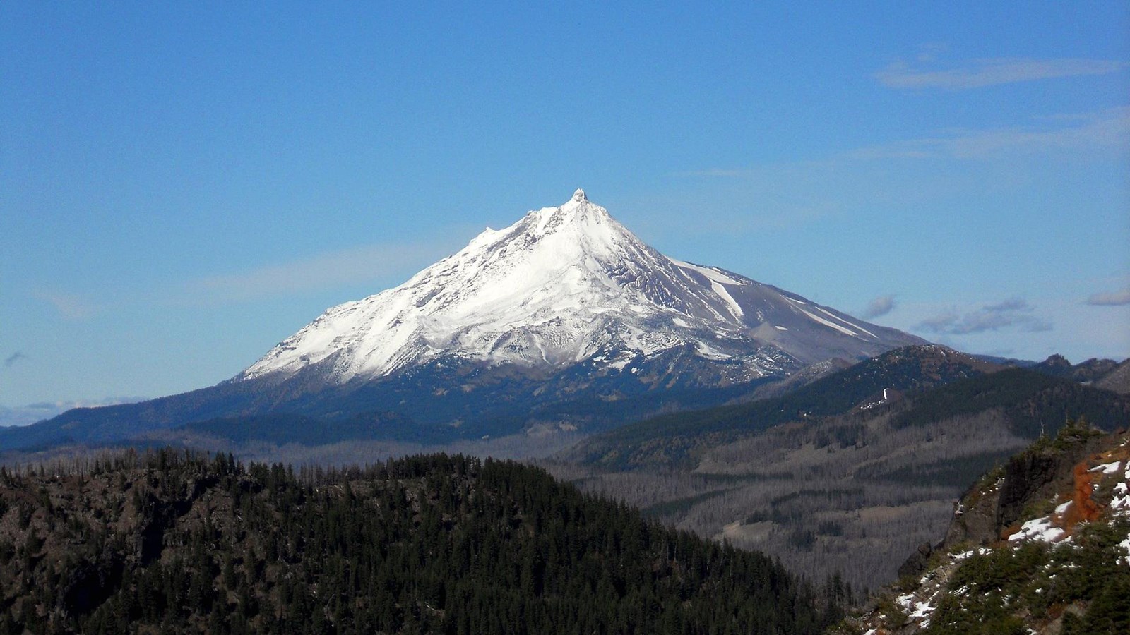
Mt. Jefferson
Creative Commons by SA, 3.0/Jsayre64
Lewis and Clark NHT Visitor Centers and Museums
This map shows a range of features associated with the Lewis and Clark National Historic Trail, which commemorates the 1803-1806 Lewis and Clark Expedition. The trail spans a large portion of the North American continent, from the Ohio River in Pittsburgh, Pennsylvania, to the mouth of the Columbia River in Oregon and Washington. The trail is comprised of the historic route of the Lewis and Clark Expedition, an auto tour route, high potential historic sites (shown in black), visitor centers (shown in orange), and pivotal places (shown in green). These features can be selected on the map to reveal additional information. Also shown is a base map displaying state boundaries, cities, rivers, and highways. The map conveys how a significant area of the North American continent was traversed by the Lewis and Clark Expedition and indicates the many places where visitors can learn about their journey and experience the landscape through which they traveled.
The day was March 30, 1806, and Clark, Meriwether Lewis, and the Corps of Discovery had been on the homeward trail for just five days since leaving Fort Clatsop. They named the towering peak after President Thomas Jefferson, the only volcanic peak they named of the five observed rising over the Cascade Range. At 10,495 feet in elevation, Mount Jefferson ranks as the second highest peak in Oregon.
Mount Jefferson is a stratovolcano that has erupted periodically over the past 300,000 years. The volcano can produce large, explosive eruptions, and the last one was about 15,000 years ago. Smaller events have also occurred, including lava flows and lahars. Much of Mount Jefferson’s history is unknown since erosion by glaciers has long since erased the evidence of past eruptions. Even today, the mountain is covered in glaciers, making it a significant challenge for climbers.