Last updated: December 13, 2023
Place
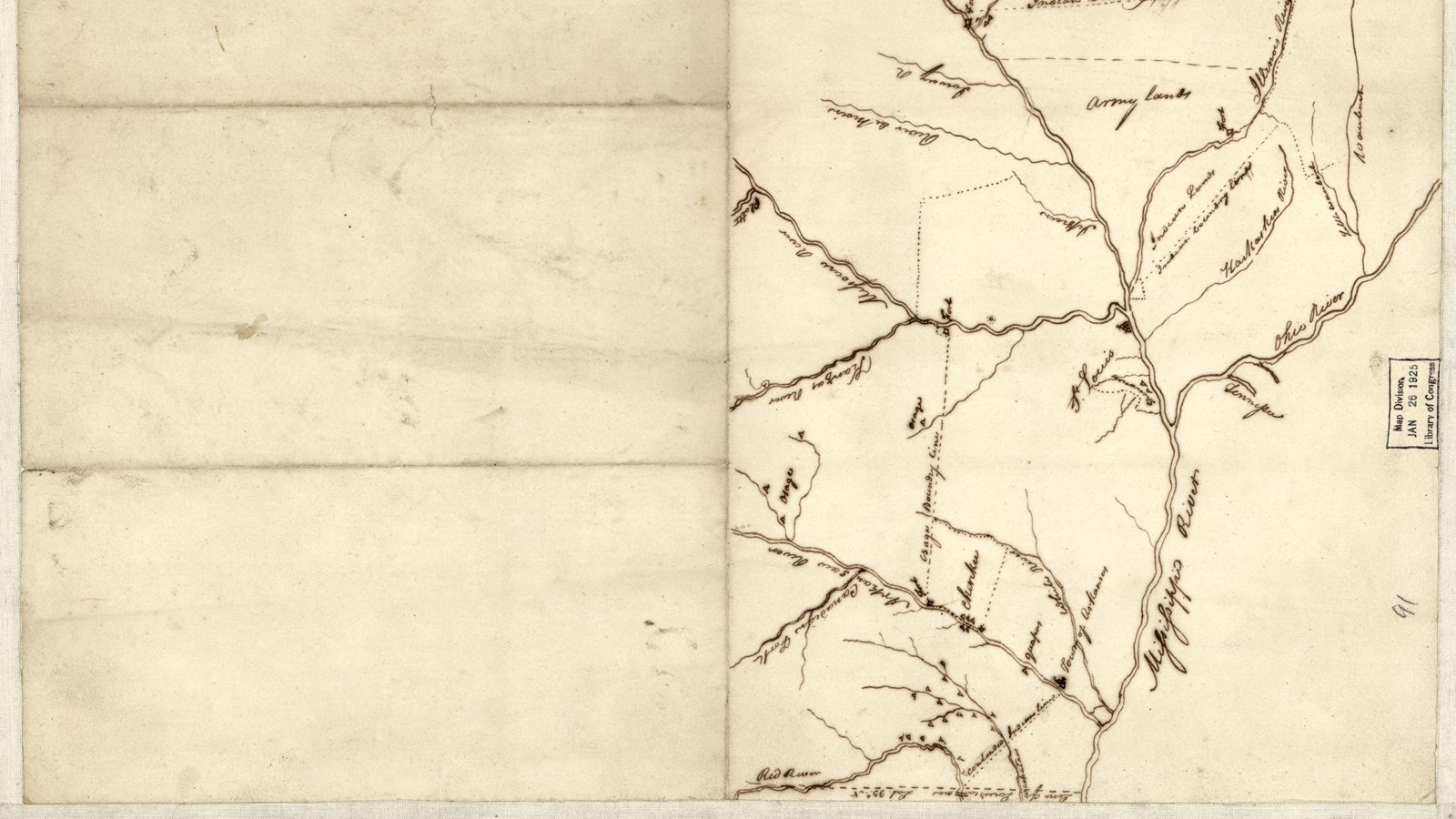
Mississippi/Missouri Confluence
Library of Congress Geography and Map Division
Quick Facts
Location:
435 Confluence Tower Dr, Hartford, IL 62048
Significance:
Meeting point of two of the most important rivers systems in the United States.
Designation:
Lewis and Clark National Historic Trail
MANAGED BY:
Amenities
9 listed
Accessible Rooms, Accessible Sites, Elevator, Entrance Passes for Sale, Historical/Interpretive Information/Exhibits, Information - Ranger/Staff Member Present, Public Transit, Telephone, Wheelchair Accessible
“Water is the blood of life.”—John Thomas, Kickapoo, ca. 2006135
Humans have always known the power of water. Since time immemorial, the Mississippi and Missouri Rivers have been sources of water for communities living along its banks. Indigenous families planted crops of corn, beans, and squash along the rivers. They relied on the regular flooding to both water the crops and provide nutrients to the soil. The land along the Mississippi was fertile enough to support the growth of large cities like Cahokia.
Located near the confluence of two great rivers, Cahokia was a hub for trade and transportation. During its golden age between 1000 and 1350 CE, the population of Cahokia may have reached as many as 20,000 people. People from the Northern Great Plains used canoes and bison-skin boats to travel to this trading center.
The Spanish traveled up the Mississippi River in the 1500s. The French came a century later, followed by the British. Throughout this period, European traders and trappers used the same water routes that Indigenous travelers had utilized for millennia.
European powers fought over control of this river.To them, mastery of the river also meant dominion over the surrounding lands.
European settlers brought with them enslaved people of African descent. Black men worked on the trading vessels that traveled between towns on the Mississippi. The river could also be a source of freedom: many of those enslaved used the river and its thickly vegetated banks as a means of escape.
When Meriwether Lewis and William Clark arrived at the confluence of the Missouri and Mississippi Rivers on a colonial mission in 1803, they entered a long tradition of people traveling the two rivers.
About this article: This article is part of series called “Pivotal Places: Stories from the Lewis and Clark National Historic Trail.”
Lewis and Clark NHT Visitor Centers and Museums
This map shows a range of features associated with the Lewis and Clark National Historic Trail, which commemorates the 1803-1806 Lewis and Clark Expedition. The trail spans a large portion of the North American continent, from the Ohio River in Pittsburgh, Pennsylvania, to the mouth of the Columbia River in Oregon and Washington. The trail is comprised of the historic route of the Lewis and Clark Expedition, an auto tour route, high potential historic sites (shown in black), visitor centers (shown in orange), and pivotal places (shown in green). These features can be selected on the map to reveal additional information. Also shown is a base map displaying state boundaries, cities, rivers, and highways. The map conveys how a significant area of the North American continent was traversed by the Lewis and Clark Expedition and indicates the many places where visitors can learn about their journey and experience the landscape through which they traveled.