Last updated: June 20, 2020
Place
Metropolitan Park System of Greater Boston
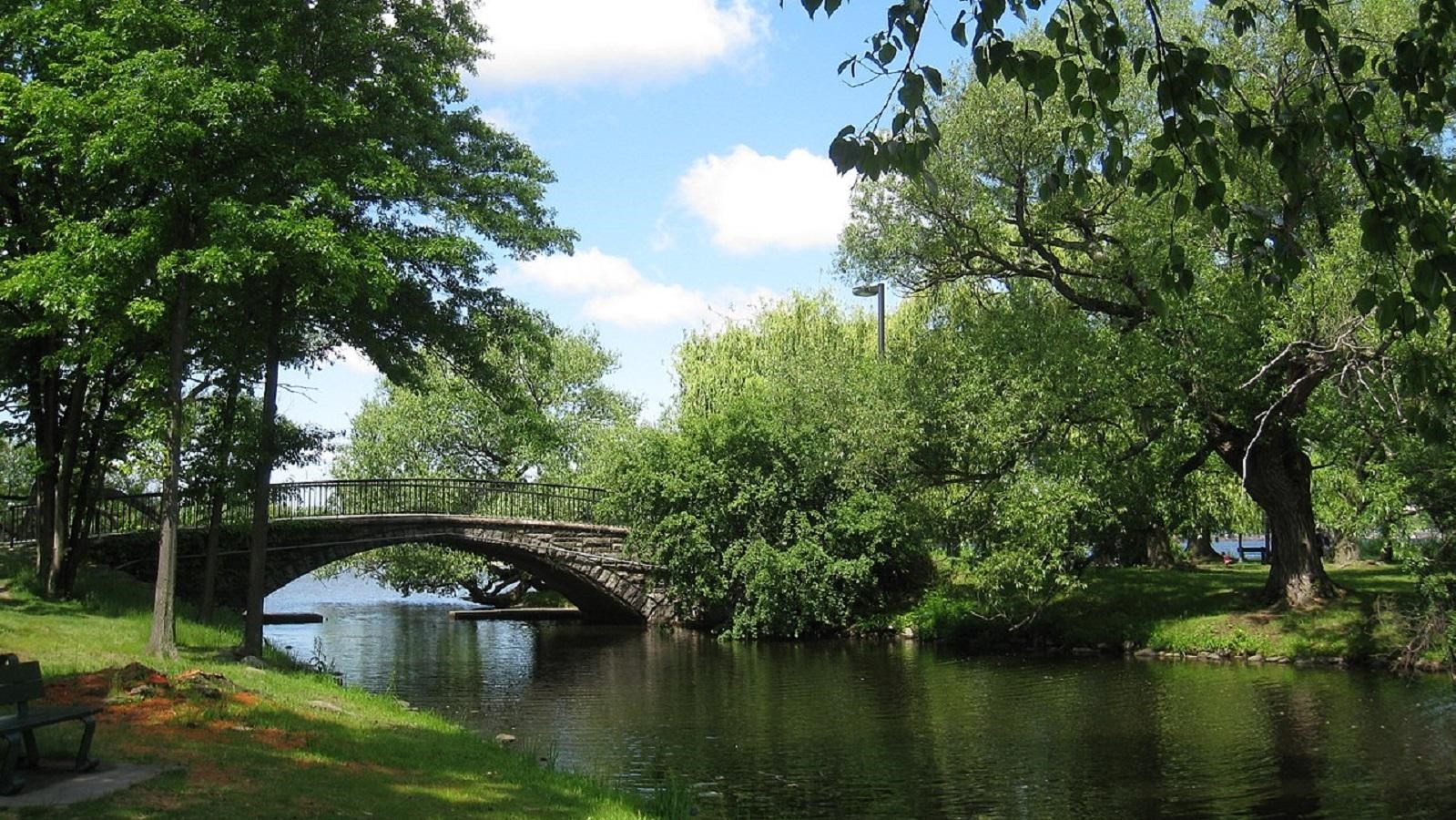
Photo by Daderot, Public Domain, https://commons.wikimedia.org/w/index.php?curid=8568485
Quick Facts
Location:
In and around Boston, MA
Significance:
The Metropolitan Park System of Greater Boston, in Massachusetts, is especially noteworthy because it is the first regional park system in the United States.
Designation:
National Register of Historic Places
The Metropolitan Park System of Greater Boston, in Massachusetts, is especially noteworthy because it is the first regional park system in the United States. Considered a work of visionary regional planning, the park system comprises parks, reservations, parkways, and roads. Established by the Metropolitan Park Commission in 1893, Boston’s park system contributed significantly to the American park movement of the 19th and early 20th centuries. Today, the Metropolitan Park System of Greater Boston includes nearly 20,000 acres of parklands in 37 Boston area communities, encompassing seven forested reservations, three river reservations, and 10 ocean reservations, connected through 162 miles of parkways. The comprehensive planning and swift execution of the Boston metropolitan parks were acclaimed in this country and in Europe, both in the publications of the newly emerging professions of landscape architecture and planning, and through exhibits at a number of international expositions.
The Massachusetts Conservation travel itinerary highlights several important early acquisitions of the Metropolitan Park System in the early 1890s that are listed in the National Register of Historic Places. Charles River Reservation, the first River Reservation; Middlesex Fells Reservation, one of the two largest woodland parks in the system; and Revere Beach Reservation Historic District each are described separately in this itinerary with information on how to plan a visit.
A number of parkways in Essex, Middlesex, Norfolk, Plymouth, and Suffolk Counties that are part of the Metropolitan Park System also are listed in the National Register of Historic Places. Internal and border roads were an integral part of the Metropolitan Park Commission plans for natural and scenic, river, and ocean reservations from the beginning. These roads connect the various park sites together into an expansive network, providing convenient, publicly accessible passage from one site to another along historic and scenic routes, and all within 10 miles of the Massachusetts State House. As the system evolved in the late 19th and 20th centuries, parkways were in almost all of the metropolitan parks and became an integral part of Boston’s regional transportation system during the early years of the streetcar and automobile, and beyond.
Many of the National Register listed parkways, including the Blue Hills Parkway, Lynn Fells Parkway, and Charles River Reservation Parkways, were designed and landscaped by famous landscape architects such as Arthur A. Shurcliff, landscaper for Colonial Williamsburg (1928-41), and the firm of Olmsted, Olmsted & Eliot. The Old Harbor Reservation Parkway, which was originally known as the Strandway, was in fact the final component of Olmsted’s “Emerald Necklace” in Boston.
The parkways can be divided up into five subtypes. Border Roads, like those in the Middlesex Fells Reservation Parkways, define the edges of the Metropolitan Park System, and were originally conceived by Olmsted landscape architect Charles Eliot as a way to clearly delineate the boundaries to the parks and reservations and make those boundaries visible to the public. Internal Roads, like those in the Stony Brook Reservation Parkways, generally follow the natural contours of the landscape, taking advantage of natural scenic elements in the parks. They serve as the circulation system within the parks and reservations. Connecting Parkways link discrete units of the parks, reservations, and parkways system.
The Neponset Valley Parkway connects the Stony Brook Reservation in Boston and Dedham to the Blue Hills Reservation in Milton and Quincy. Many also have rotaries that were typically landscaped as mini parks with memorials or monuments in the center, for example the Horace James Memorial Circle in the Hammond Pond Parkway. River Parkways follow the contours of the existing rivers, like the Alewife Brook Parkway, which, naturally, follows along the Alewife Brook in Cambridge and Somerville. Similarly, Ocean Parkways follow the contours of the shoreline and are usually quite close to the edge of the shore. Winthrop Shore Drive is one of the eight ocean parkways in the system. Like all of the ocean parkways, its primary reason for existence is its connection to the adjacent beach and the ocean views.
All of the parkways, no matter what their subtype, share the design characteristics of the system—the natural and scenic views and historic landscapes—but each has its own specific characteristics derived from its function and from the existing topography of the environments. In addition to their natural and scenic views, many historic roadside structures can also be seen along some of the parkways. The 1933 Metropolitan District Commission bathhouse was built along the VFW Parkway at Havey Beach. The Mystic Valley Parkway has adjacent elements that were added to the National Register of Historic Places through the Water Supply System of Metropolitan Boston Thematic Resource Area, including the Medford Pipe Bridge (1897-8), Mystic Dam (1864), Mystic Pumping Station (1862-4), and Mystic Gatehouse (1862-8). The Furnace Brook Parkway features a view of the Quincy Armory (1924), as well as a partial view of the 17th-18th century Quincy Homestead. Quincy Homestead, a National Historic Landmark added to the National Register in 1971, is a 1.8-acre site that has been owned and interpreted by the National Society of the Colonial Dames of America in the Commonwealth of Massachusetts since 1904. The Quincy Shore Drive Parkway features views of the historic Squantum and Wollaston Yacht Clubs, both of which extend out on piers to the water. Both of these two-story wood frame buildings date to 1903 and were part of the original design for the Quincy Shore Reservation.
By the final decades of the 19th century, the urban parks movement had already begun with many cities throughout the country creating large country parks or park systems. While Boston’s Emerald Necklace park system neared completion, the loss of open space outside of Boston troubled many. Landscape architect Charles Eliot and journalist Sylvester Baxter proposed an extremely ambitious new idea for a regional park system. They hoped to generate public support to acquire several thousand acres of parkland in over two dozen communities within a 10-mile radius of Boston.
Eliot proposed the idea in an article entitled “The Waverly Oaks: A Plan for their Preservation for the People,” published in Forest and Garden magazine in February 1890. In the article, Eliot explained that the creation of a park system required a new type of organization that held lands in trust for the public, “just as the Public Library holds books and the Art Museum pictures—for the use and enjoyment of the public.” The 26 giant oak trees that comprised Waverly Oaks were planted near the Beaver Brook in Belmont and Waltham. Eliot used the beautiful site as an example of the kind of scenic place that development would quickly destroy without some kind of preservation initiative. Eliot and Baxter each lobbied for political support for the proposal. Baxter wrote a series of articles in the Boston Herald, and Eliot, a member of the Appalachian Mountain Club, solicited the club’s help in craft legislation that would need approval by the State in order for the new organization to exist. The desired legislation passed in 1891, enabling the organization and charter for The Trustees of Public Reservations (now called The Trustees of Reservations).The Trustees of Public Reservations became the first organization of its kind in the world and a model for land trusts both in the United States and in Europe.
Next, Charles Eliot called for a meeting inviting officials from Massachusetts communities to suggest properties to be added to the new park system. His eloquent appeal for a Boston Metropolitan Park System on December 16, 1891 reached an enthusiastic audience:
"Here is a rapidly growing metropolis planted by the sea, and yet possessed of no portion of the sea front except what Boston has provided at City Point. Here [Boston] is a city interwoven with tidal marshes and controlling none of them … Here is a district possessed of a charming river already much resorted to for pleasure, the banks of which are continually in danger of spoliation at the hands of their private owners. Here is a community which must have pure drinking water, which yet up to this time has failed to secure even one water basin from danger of pollution… Here is a community, said to be the richest and most enlightened in America, which yet allows its finest scenes of natural beauty to be destroyed one by one, regardless of the fact that the great city of the future which is to fill this land would certainly prize every such scene exceedingly, and would gladly help to pay cost of preserving them today. Compare the two maps—one showing the opportunity, the other the miserable present result. Do not the facts speak for themselves? Is it not evident that present methods are too slow and inefficient? Can this community afford to go so slowly? Is not some form of joint or concerted action advisable at once?"
In 1893, Eliot and Baxter issued a report making final recommendations. The properties recommended for acquisition fit into four different landscape categories: ocean frontage, the shores and islands of Boston’s inner bay, tidal estuaries, and forest uplands. In 1893, legislation known as the Park Act established a Metropolitan Park Commission with powers of eminent domain and funding for acquisition of land in 36 Boston area communities, to be included in the Metropolitan Park System. Soon after passage of the legislation, the Beaver Brook Reservation, home of the Waverly Oaks, became the first Reservation added to the new system. By the end of 1895, 7,000 acres of forest reservations, coastal beaches, and river banks had been acquired in communities within a 10 mile radius of Boston.
The Metropolitan Park System of Greater Boston is a system of parks, reservations, parkways, and roads located in and around Boston, MA. The areas of the Metropolitan Park System provide a wide variety of both natural and recreational uses for its visitors. For more information, visit the Massachusetts Department of Conservation and Recreation.