Last updated: December 13, 2022
Place
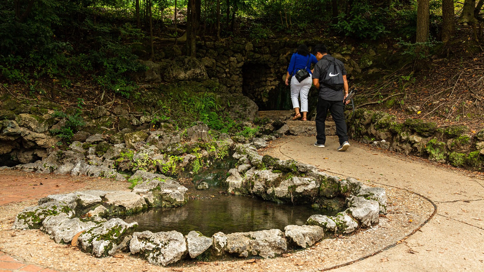
Display Spring
NPS Photo/Mitch Smith
Quick Facts
Location:
Hot Springs, Arkansas
Significance:
The Display Springs are one of the few open-air springs accessible in the Park. In the 1930s, after decades of being covered by a grate, the Display Springs were uncovered to show thermal springs in their natural state.
Amenities
2 listed
Benches/Seating, Historical/Interpretive Information/Exhibits
The Display Springs are some of the few open-air springs accessible in the Park and are an excellent place to learn to “read’ the landscape for clues about the Hot Springs thermal water cycle.
The ridges on either side of the valley are composed of a hard, erosion resistant rock called novaculite. The ridges formed during a mountain-building event hundreds of millions of years ago when the ground was squeezed like an accordion into a wave-like shape.
When rain water falls in the area, some of it is absorbed into the ground, enters the novaculite--and a lower chert layer-- through cracks in the rock, and then follows the plunging rock layers roughly a mile underground, beneath Hot Springs Mountain. As the water travels downwards, the water is heated to roughly 160 degrees fahrenheit by the increasing heat of the Earth, a phenomemon called the geothermal gradient.
Fault lines help direct the heated water back to the surface. In the area where you are standing, two faults “alpha” and “beta” reach the surface. The location of the “alpha” fault is more clearly visible as it roughly follows Central Avenue and Fountain Street. The “beta” fault roughly follows the top edge of Hot Springs Mountain.
The faults also formed from the squeezing pressures of the ancient mountain-building event. Large sections of rocks-- hundreds of feet wide and thousands of feet long-- shifted against each other, with one block section sliding up relative to the other, in what is called a "thrust fault." The long fault zones connect the deep aquifer of heated water to the surface and act as a superhighway to conduct the hot water back upwards.
Most of the four dozen springs, including the Display Springs, emerge in this fault zone, in roughly a 460m by 120m area at the base of Hot Springs Mountain. This area contains several sandstone outcrops associated with the spring openings. The sandstone fractures easily, allowing the thermal water to travel through it. Part of the sandstone layer is visible at the top of the balustrade next to the Display Springs.
Individual springs then tell the unique story of each flow of water. At the Display Springs, the upper spring is generally slightly hotter than the lower spring, suggesting that the cooler lower spring has a greater interaction with non-thermal water as it reaches the surface than slightly warmer upper spring.
Scientists in the 1970s determined that the time it takes one water particle to rain, flow down the rock layers, be heated at depth, and return to the surface via the fault line is over 4,000 years! The roughly four dozen springs produce over 700,000 gallons of water a day, at an average temperature of 143 degrees fahrenheit, easily the hottest springs east of the Rocky Mountains.
The water from the Display Springs, as well as the other thermal water, eventually enters Hot Springs Creek. Today, Hot Springs Creek is covered by the Creek Arch as it passes through Bathhouse Row. Visitors walking on the Magnolia Walk are walking on top of Hot Springs Creek.