Last updated: May 18, 2021
Place
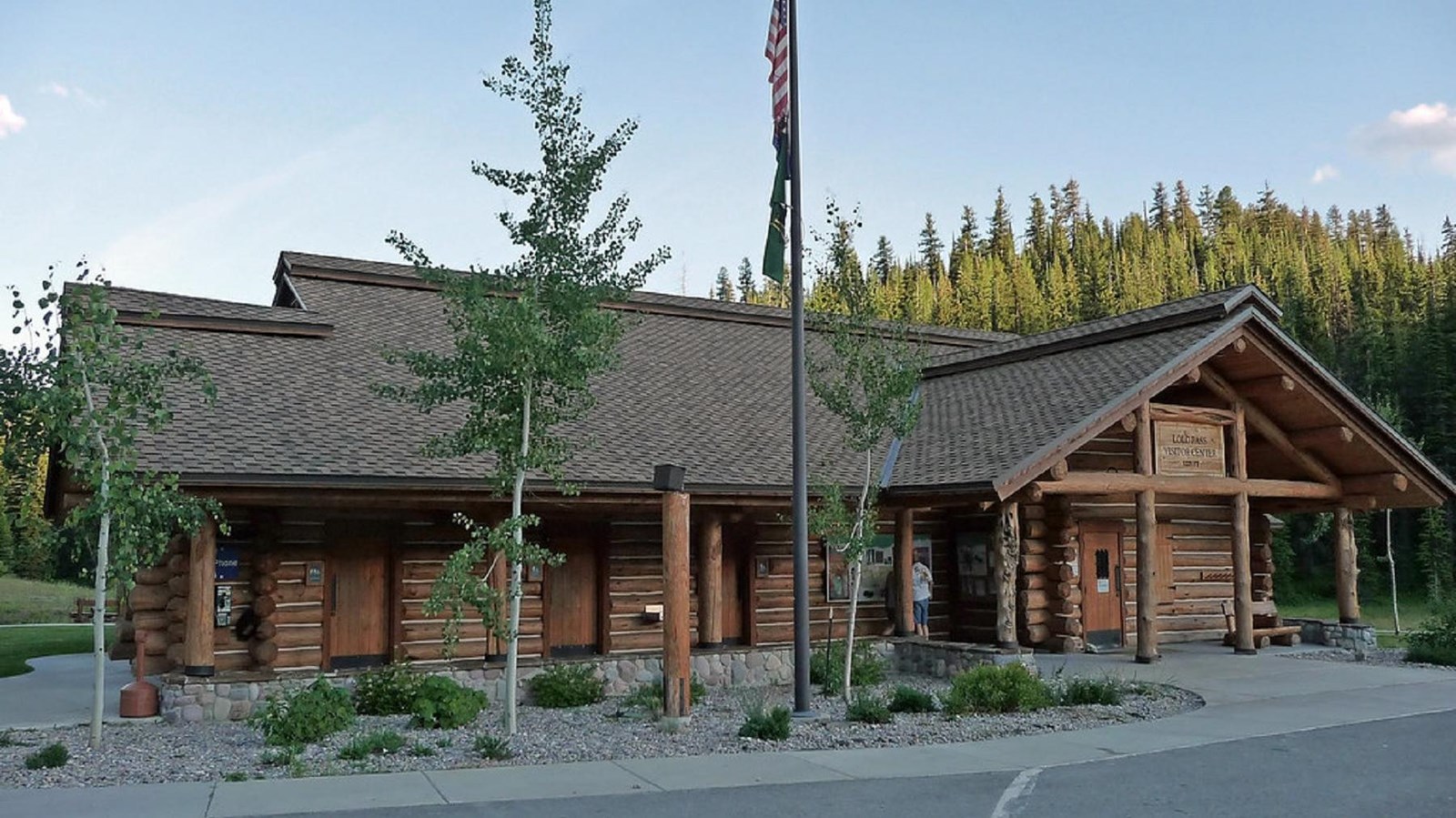
Lolo Pass Visitor Center
"Lolo Pass Montana2" by D Guisinger is licensed under CC BY 2.0
Quick Facts
Location:
Kamiah, ID
MANAGED BY:
Amenities
17 listed
Benches/Seating, Fire Extinguisher, First Aid Kit Available, Historical/Interpretive Information/Exhibits, Information, Information - Maps Available, Information - Ranger/Staff Member Present, Parking - Auto, Parking - Boat Trailer, Parking - Bus/RV, Permits Issued, Picnic Shelter/Pavilion, Restroom, Telephone, Toilet - Flush, Trailhead, Water - Bottle-Filling Station
Lewis and Clark NHT Visitor Centers and Museums
This map shows a range of features associated with the Lewis and Clark National Historic Trail, which commemorates the 1803-1806 Lewis and Clark Expedition. The trail spans a large portion of the North American continent, from the Ohio River in Pittsburgh, Pennsylvania, to the mouth of the Columbia River in Oregon and Washington. The trail is comprised of the historic route of the Lewis and Clark Expedition, an auto tour route, high potential historic sites (shown in black), visitor centers (shown in orange), and pivotal places (shown in green). These features can be selected on the map to reveal additional information. Also shown is a base map displaying state boundaries, cities, rivers, and highways. The map conveys how a significant area of the North American continent was traversed by the Lewis and Clark Expedition and indicates the many places where visitors can learn about their journey and experience the landscape through which they traveled.
At the visitor center, visitors will find information detailing Lewis and Clark's journey across the Bitterroot Mountains and the flight of the Nez Perce Indians, along with other historical, natural, and general information. As a major trailhead for cross-country skiing and snowmobiling, the center also has a warming hut for skiers and recreationists, a 24-hour restroom, a snowmobile parking log, and maps and information pertinent to winter visitors.
For more information or current Lolo Pass conditions, visit Nez Perce-Clearwater National Forests - Lolo Pass Visitor Center (usda.gov) or call (208) 942-3113.