Last updated: May 19, 2025
Place
Lewis & Clark State Historic Site (Camp Dubois)
NPS
Quick Facts
Location:
Hartford, Illinois
Significance:
Winter quarters for the expedition 1803-1804
Designation:
State Historic Site
Lewis and Clark NHT Visitor Centers and Museums
This map shows a range of features associated with the Lewis and Clark National Historic Trail, which commemorates the 1803-1806 Lewis and Clark Expedition. The trail spans a large portion of the North American continent, from the Ohio River in Pittsburgh, Pennsylvania, to the mouth of the Columbia River in Oregon and Washington. The trail is comprised of the historic route of the Lewis and Clark Expedition, an auto tour route, high potential historic sites (shown in black), visitor centers (shown in orange), and pivotal places (shown in green). These features can be selected on the map to reveal additional information. Also shown is a base map displaying state boundaries, cities, rivers, and highways. The map conveys how a significant area of the North American continent was traversed by the Lewis and Clark Expedition and indicates the many places where visitors can learn about their journey and experience the landscape through which they traveled.
To tell visitors the story of the Camp River Dubois and the newly formed Corps of Discovery, the 14,000-square-foot visitor’s center presents the often-untold story of the Illinois portion of the Expedition. Construction of the center began in October 2000 in an area similar to that of the original Camp River Dubois on the south side of the Wood River, where the men of the Corps lived from December 1803 to May 1804.
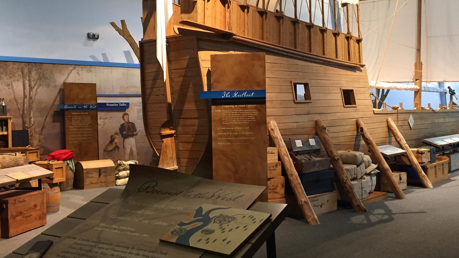
Six galleries discuss the preparation phase of the Corps, including the information and knowledge gathered about the land west of the Mississippi River, and the expectations and anticipations of the newly formed Corps. Everyone enjoys seeing the 55-foot, full-scale cut-away keelboat which demonstrates how the men handled packing the hundreds of bundles, boxes, and barrels of goods and supplies. Outside stands a small replica fort, similar in structure to the original, which gives visitors an idea of what life was like on the frontier for this small military unit.
Lewis & Clark Historic Site is near today’s confluence of the Missouri River, which can be best seen from the top of the nearby 180-foot-tall Confluence Tower. However, due to changes in the course of both the Mississippi and Missouri Rivers over the past 200 years, the actual location of Camp River Dubois cannot be accurately pinpointed. It’s often believed that the original site is now either under the main channel of the Mississippi, or even on the western side of the river, in today’s Missouri.
The Lewis & Clark Historic Site is open from 9 a.m. to 5 p.m., seven days a week in the summer and Wednesday through Sunday during the winter. Please contact the center directly for the most up to date hours. The address is One Lewis and Clark Trail, Hartford, Illinois. For more information call 618-251-5811 or go to www.campdubois.com.