Last updated: May 21, 2021
Place
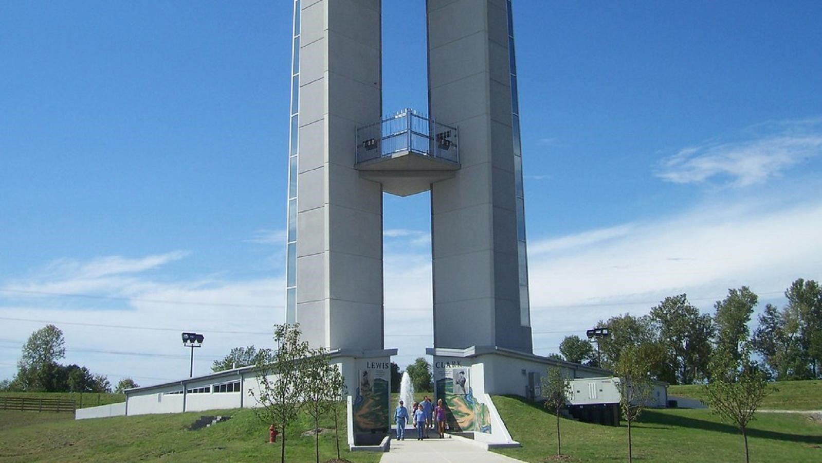
Lewis & Clark Confluence Tower
"Confluence Tower and Lewis and Clark Memorial" by ILMO JOE is licensed under CC BY-NC-SA 2.0
Quick Facts
Location:
Hartford, IL
MANAGED BY:
Amenities
10 listed
Accessible Rooms, Accessible Sites, Elevator, Entrance Passes For Sale, Historical/Interpretive Information/Exhibits, Information - Ranger/Staff Member Present, Public Transit, Scenic View/Photo Spot, Telephone, Wheelchair Accessible
Lewis and Clark NHT Visitor Centers and Museums
This map shows a range of features associated with the Lewis and Clark National Historic Trail, which commemorates the 1803-1806 Lewis and Clark Expedition. The trail spans a large portion of the North American continent, from the Ohio River in Pittsburgh, Pennsylvania, to the mouth of the Columbia River in Oregon and Washington. The trail is comprised of the historic route of the Lewis and Clark Expedition, an auto tour route, high potential historic sites (shown in black), visitor centers (shown in orange), and pivotal places (shown in green). These features can be selected on the map to reveal additional information. Also shown is a base map displaying state boundaries, cities, rivers, and highways. The map conveys how a significant area of the North American continent was traversed by the Lewis and Clark Expedition and indicates the many places where visitors can learn about their journey and experience the landscape through which they traveled.
How does it relate to the Lewis & Clark expedition, you ask? Well, in many ways, it was the first step on what would become known as the Lewis & Clark Expedition. In December of 1803, Meriwether Lewis and William Clark established camp at Wood River, otherwise known as Camp Dubois. Located along the Mississippi River between St. Louis and the modern-day Confluence Tower, the camp served as the winter quarters for the two men and those who joined them on their expedition. Here, they spent the winter gathering supplies and recruiting other intrepid explorers from St. Louis. Then, in May of 1804, the group embarked on their historic journey westward from the confluence of the Mississippi and Missouri rivers.
For those wishing to get a bird’s eye view of the area, the Confluence Tower has observations decks at the 50, 100, and 150-foot marks, and all three levels are accessible by either stairs or elevator. Exhibits focusing on Lewis and Clark and the importance of the Missouri-Mississippi Confluence can be found on every level. Guests can also request a short, guided tour that ends with a trip to the highest level of the structure. On particularly clear days, parts of St. Louis and the Gateway Arch can be seen from the upper decks.