Last updated: November 28, 2023
Place
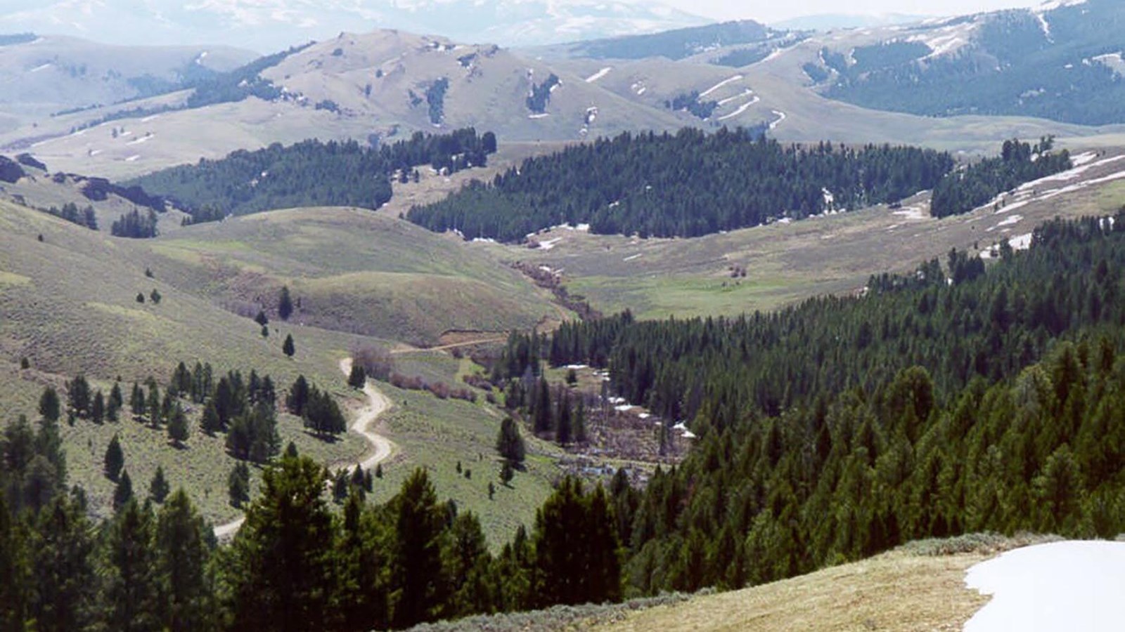
Lemhi Pass, Montana
U.S. Forest Service
Quick Facts
Significance:
Meriwether Lewis, William Clark, Sacagawea, their party, and many Shoshone people crossed the Continental Divide at this pass on their journey westward.
Designation:
Lewis and Clark National Historic Trail, National Register of Historic Places, National Historic Landmark, Beaverhead-Deerlodge National Forest, Salmon-Challis National Forest
Amenities
3 listed
Parking - Auto, Picnic Table, Toilet - Vault/Composting
Meriwether Lewis and William Clark’s mission from President Thomas Jefferson was to inform Indigenous people living in what France called the Louisiana Territory that the United States of America had “purchased” from France the lands that these Indigenous people had lived on since time immemorial. The treaty between France and the United States applied to land between the Mississippi River and the Continental Divide.
In August 1805, the Lewis and Clark Expedition reached that divide.
Shoshone people who they met there knew nothing of the deal between these colonial powers, or of the imaginary line those powers placed on the ridge separating watersheds. Shoshone people traversed this pass regularly. They knew the well-established path over it that their ancestors had spent generations honing to the easiest curves and grades.
Would these Shoshone families have found it strange that Lewis and Clark giving them medallions was a sign of their vassalage to the United States? Perhaps, but then again, the Shawnee, Delaware, and other Indigenous people living farther east, who had long fought displacement by European and American settlers, might have passed these stories westwards down the continent’s river-based communication networks.
But instead of skepticism, Shoshone people, who recognized Sacagawea as a long-lost family member, graciously lent their assistance and sold the expedition members to carry their heavy luggage across the divide, over several trips. In return, they received clothing, tools, and other items that the expedition members had brought with them.
A few Shoshone men, led by Pikee Queenah (also known as Swooping Eagle, but who the travelers called Old Toby), led Lewis and Clark’s party over Lemhi Pass. Shoshone people took the expedition to a route that would cross the Rocky Mountains and continue on to the headwaters of the great river that emptied into the ocean: Lolo Trail.
About this article: This article is part of a series called “Pivotal Places: Stories from the Lewis and Clark National Historic Trail.”
Lewis and Clark NHT Visitor Centers and Museums
This map shows a range of features associated with the Lewis and Clark National Historic Trail, which commemorates the 1803-1806 Lewis and Clark Expedition. The trail spans a large portion of the North American continent, from the Ohio River in Pittsburgh, Pennsylvania, to the mouth of the Columbia River in Oregon and Washington. The trail is comprised of the historic route of the Lewis and Clark Expedition, an auto tour route, high potential historic sites (shown in black), visitor centers (shown in orange), and pivotal places (shown in green). These features can be selected on the map to reveal additional information. Also shown is a base map displaying state boundaries, cities, rivers, and highways. The map conveys how a significant area of the North American continent was traversed by the Lewis and Clark Expedition and indicates the many places where visitors can learn about their journey and experience the landscape through which they traveled.