Last updated: January 12, 2024
Place
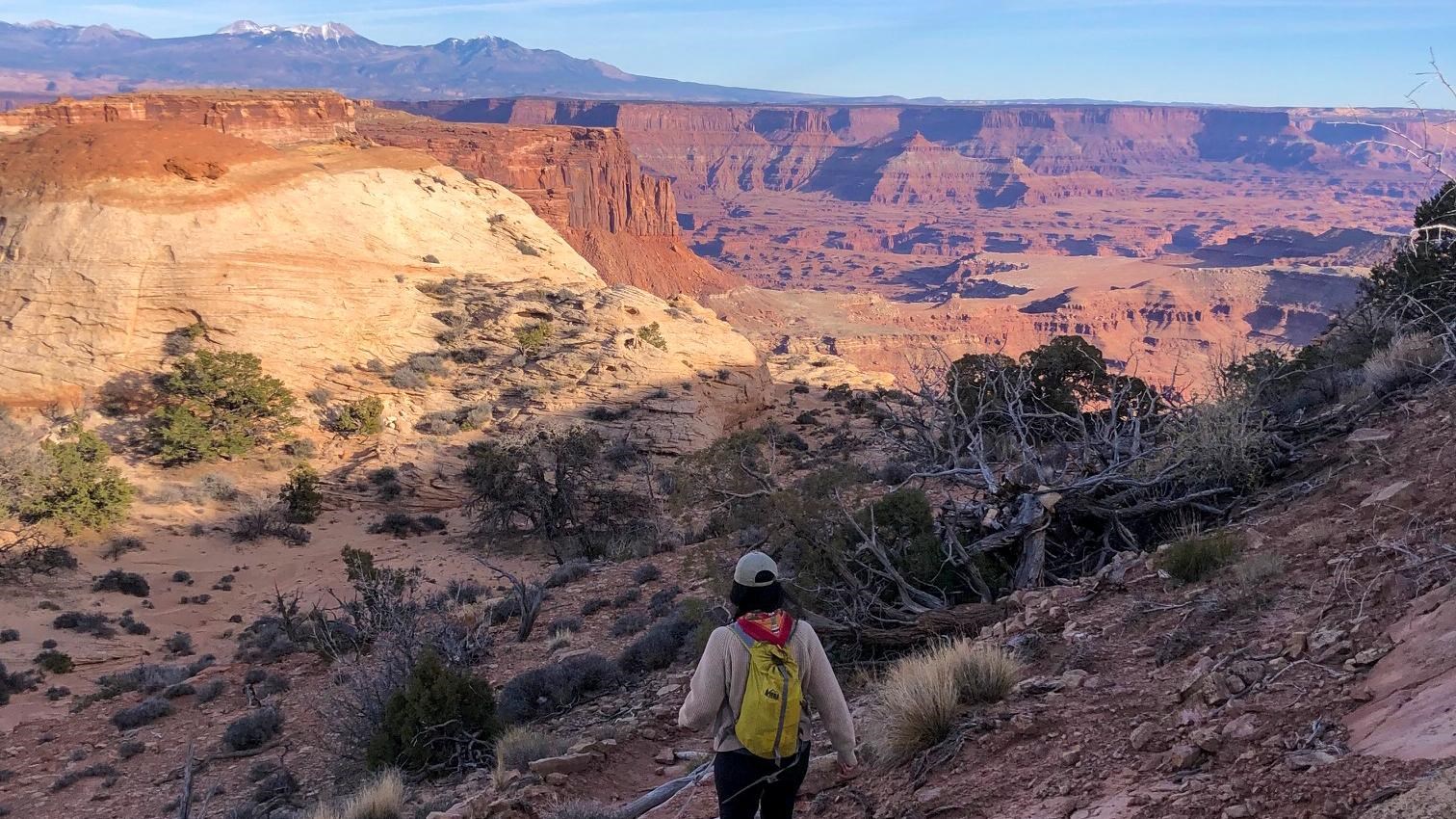
Lathrop Trail

Courtesy of Andrea Noble
Trailhead
The Lathrop Trail crosses a wide grassland on the mesa top, enjoys views of Colorado River, then descends into the canyon below. For a moderate trail option, hikers often turn around at the canyon rim. Continuing down to the White Rim Road means a strenuous hike back out.
Lathrop to Canyon Rim
-
Roundtrip Distance: 5 mi (8 km)
-
Time: 2-3 hrs
-
Elevation Change: 158 ft (48 m)
-
Difficulty: Moderate
-
Hike Description: Trail crosses open grasslands, ending in spectacular views of Airport Tower & Colorado River.
-
Bring: Water (1 L per person, per hour), snacks, sturdy footwear, headlamp, map, and be prepared for, sun, rain, heat, or cold.
-
Accessibility: This trail can be rough, uneven, and requires walking up and down a rocky hill and stone steps. It is not accessible to wheelchairs. In winter, there may be snow or icy conditions; we recommend traction devices for hikers.
- Dogs are not allowed on this trail. Service animals are allowed in national parks. What is a service animal?
Lathrop to White Rim Road
-
Roundtrip Distance: 11.8 mi (19 km)
-
Time: 5-7 hrs
-
Elevation Change: 1,721 ft (525 m)
-
Difficulty: Strenuous
-
Hike Description: Trail crosses open grasslands, then drops 1,600 ft (488 m) into the canyon below. Enjoy views of the La Sal Mountains and fanciful sandstone knobs on this varied and challenging hike to the White Rim.
-
Bring: Water (at least 1 L per person, per hour), snacks, sturdy footwear, headlamp, map, and be prepared for, sun, rain, heat, or cold.
-
Accessibility: This trail can be rough, uneven, and requires walking up and down a rocky hill and stone steps. It is not accessible to wheelchairs.
-
Dogs are not allowed on this trail. Service animals are allowed in national parks. What is a service animal?
