Last updated: October 10, 2024
Place
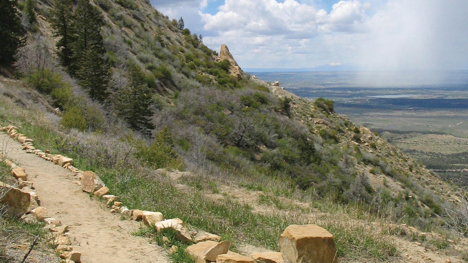
Knife Edge Trail
NPS Photo
Quick Facts
Location:
Trailhead is located in Morefield Campground
Amenities
2 listed
Parking - Auto, Trailhead
Named after the historic Knife Edge Road which was known for it's scenic value, this trail follows the old roadway and leads to a viewpoint that affords excellent views across Montezuma Valley.
A traveler in 1892 once described a trail on this ridge as the Crinkly Edge Trail. In 1911, the trail became the Knife Edge Road, a new section of the main road into the park. Although scenic, the road was narrow and steep and precariously skirted the top of a steep bluff overlooking the Montezuma Valley. Unfortunately, the instability of the soil made it difficult to maintain. Two years later, the park built a bypass road through Morefield and Prater Canyons, and when the first automobile trip was made in 1914, vehicles used the bypass and the Knife Edge Road was soon closed.
The scenic value of the Knife Edge Road prompted the park to reopen it again in 1924. Although it continued to challenge road crews for the next 30 years, it remained in use until 1957 when the Morefield-Prater tunnel was completed. Today, you can still enjoy the views via the Knife Edge Trail.
Trail Description
The 2.0-mile (3.2 km) roundtrip trail is a fairly level trail and follows a portion of the park’s historic entrance road leading to breathtaking views of the Montezuma Valley. Located on the northwestern edge of the mesa, this trail is beautiful in the golden light right before sunset. Sleeping Ute Mountain is near the horizon to the west. Totten Reservoir and Summit Lake, seen further in the distance, shine in the glow of fading light.
Please respect these places by leaving archeological sites, artifacts, plants, and animals undisturbed for all those who follow you.
Be Prepared
-
Easy
-
Pets and bicycles are not allowed on the trail
-
Trails are day-use only
For Your Safety
-
Dehydration and altitude sickness are common problems at Mesa Verde. Drink water and rest often.
-
Avoid hiking during the hottest part of the day. Parts of the trail are exposed and will be particularly hot in summer.
-
While hiking, remain on the trail to avoid walking along unstable cliff edges and fragile soil. Off-trail walking easily destroys the delicate cryptobiotic soil crusts that take decades to form and are essential to soil stability and plant growth in the deserts of the Southwest. Even the smallest impacts have big effects!
-
Please respect wildlife by observing them from a distance.
Trail Data
-
2.0 miles (3.2 km) roundtrip
-
62 feet (18.9 m) elevation change
-
Allow about one hour to complete