Last updated: April 14, 2026
Place
Kansas: Route 66 Historic District-East Galena
NPS Photo
Quick Facts
Location:
Galena, Kansas
Significance:
Historic district along Route 66
Designation:
National Register of Historic Places
Amenities
1 listed
Historical/Interpretive Information/Exhibits
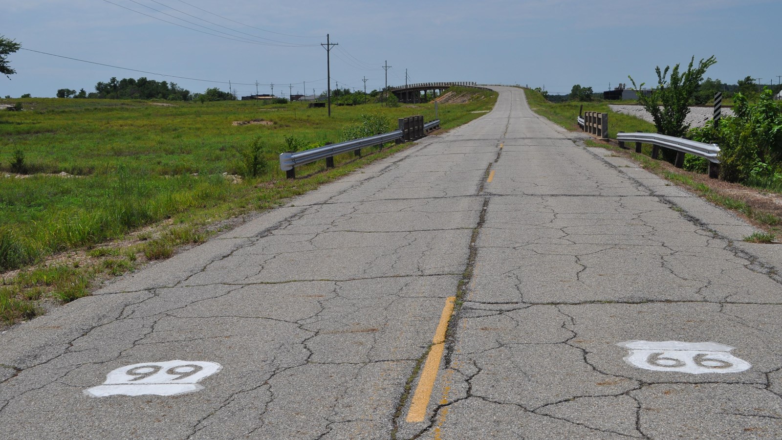
The Kansas Route 66 Historic District, East of Galena includes a 1.2-mile stretch of US Highway 66 (Route 66). The district begins at the Missouri state line and continues west to a point approximately 300 feet northeast of the intersection with Front Street at the north end of the Galena business district. In addition to the historic roadbed, the district includes nine functional concrete structures; seven small box culverts; one large, triple box culvert; and a viaduct.
Both of the larger structures are in good condition and retain a very high degree of integrity. While some of the original railings on the smaller culverts are damaged beyond repair or missing, as a group these elements, together with their setting, form a cultural landscape that clearly conveys the historic feeling of Route 66.
The initial improvements to this segment of Route 66 were made during the peak of the mining boom in the Tri-State lead mining district, an area that extended from Galena east to Joplin and Carthage, Missouri, and south through Baxter Springs into northeastern Oklahoma. Mining in this area began in 1876 with the discovery oflead ore in Galena. Within thirty days, the population of this largely undeveloped area swelled to ten thousand as miners rushed in to capitalize on the potential wealth. By the turn of the twentieth century, the population of Galena had stabilized at around five thousand. The community boasted paved streets, sewers, city water, and both city and interurban electric streetcars.
The initial road improvements were most likely financed by a special benefit district formed by the local mining companies. Kansas Jaw provided adjacent property owners the ability to create such benefit districts to fund road improvements assuming the road was considered a "public utility." As early as 1904, the roads received a hard surface utilizing the tailings, or chat, produced by the local mines. The ground up chat formed a hard concrete-like surface that withstood the heavy traffic the road received.
Additional road improvements occurred in 1922 and 1923. In addition to the special benefit district, money Kansas received through the Federal Highway Act of 1921 funded the construction of the concrete structures, including a viaduct over the railroad tracks. Contemporary improvements along Route 66 also included the construction of the two Marsh Arch Bridges, one at Riverton (now demolished) and one at the Brush Creek Curve (listed on the National Register). Other than repaving, virtually no changes have been made to this section of road over the last 80 years.
The peaceful journey of travelers and truckers along this section ofroad was disrupted in June of 1935 during a strike at the Eagle-Picher lead smelter. Located north of the road, between the triple culvert and the 90-degree curve, this facility was among the leading processors oflead ore in the country during the first part of the 20th century. During the spring of 1935, leaders of the Union of Mine, Mill and Smelter Workers called a strike to protest working conditions and asking the mine operators to recognize the union. On June 28, nearly two months into the strike, a violent attack broke out on Route 66 in front of the Eagle-Picher Smelter. Several hundred strikers gathered near the smelter, throwing rocks and threatening to shoot any scab workers attempting to enter or exit the plant. Automobiles were overturned, and all traffic on Route 66 was stopped. Twelve men were hurt. While the mines and processing facilities had returned to nearly normal production schedules by August, protests and sporadic violent incidents, such as dynamiting the gas lines feeding the smelter, continued for several years.
The setting of this stretch ofroad remains the most distinctive feature of Route 66 through Kansas. From its inception the road entered Kansas through an industrial area created by nearly 50 years of mining. Both the 1937 WPA guidebook to Kansas and a 1946 guidebook to Route 66 comment on the distinctiveness of this particular landscape. The WPA writers noted, "Lying in all directions from the highway are man-made white mountains of chert, residue from the mines, topped occasionally with gaunt black mills and separated by dusty roads, railroad tracks, and patches of rock and cinder-covered wasteland." The guide calls out the Galena Smelter, "a great gray hulk surrounded by a maze of chat covered roads and railroad tracks." This ubiquitous detritus has unequivocally "destroyed the original beauty of the country." A decade later, the Rittenhouse guide notes the "great piles of 'chert' or 'chat,' the waste from the lead and zinc mines," that dominate the landscape between Joplin and Galena. Today, most of the mines have played out, and efforts have been made to reclaim the damaged landscape. North of Route 66, buildings from the Eagle-Picher smelting facility still stand, although the hulking Galena Smelter is no longer extant. And, a reclamation project in the 1990s planted prairie grasses on the remaining chat piles south of 66 and sealed most of the remaining open mine shafts.
One mile west of the state line is the crown jewel of the national register district, the Route 66 viaduct. A graceful structure measuring 215.9 feet in length, it curves gently as it carries the two-Jane road across the tracks of the Missouri Kansas and Texas Railroad. The steel girder bridge structure is encapsulated in concrete. The main span rises 21 feet above the railroad tracks below. Supporting the ends of the central span and the inner ends of the approach spans are pairs of square posts that are connected at the center to form an "H." The tops of the posts flare slightly to form trapezoidal caps. The road is 20 feet wide with 5-foot-wide concrete sidewalks on either side. Railings run along either side of the viaduct next to the sidewalks.
In 2002, the Route 66 Viaduct received a rating of "Substandard" on its
Kansas Department of Transportation Bridge Inspection Report. The concrete structure had sever cracking and spalling, and steel rebar was exposed in many areas. The county understood the significance and legacy of the viaduct, and rather than demolish and replace it with a new structure, they prioritzed its rehabilitation. With support from two grants from the National Park Service extensive work was undertaken to repair the railings, deck, superstructure and substructure, resulting in the continued appreciation and enjoyment of the viaduct today.
In 2010, the Kansas Chapter of the American Concrete lnstitute awarded the Cherokee County Galena Viaduct Improvements Project (Concrete Rehabilitation of Substructure Elements) the prestigious Concrete Construction Award in the category of Bridges. The purpose of the award was.to recognize and encourage excellence in architectural and concrete work within the State of Kansas.
Site Information
Location (Galena, Kansas)