Last updated: June 26, 2024
Place
"Island Remediation" Sign

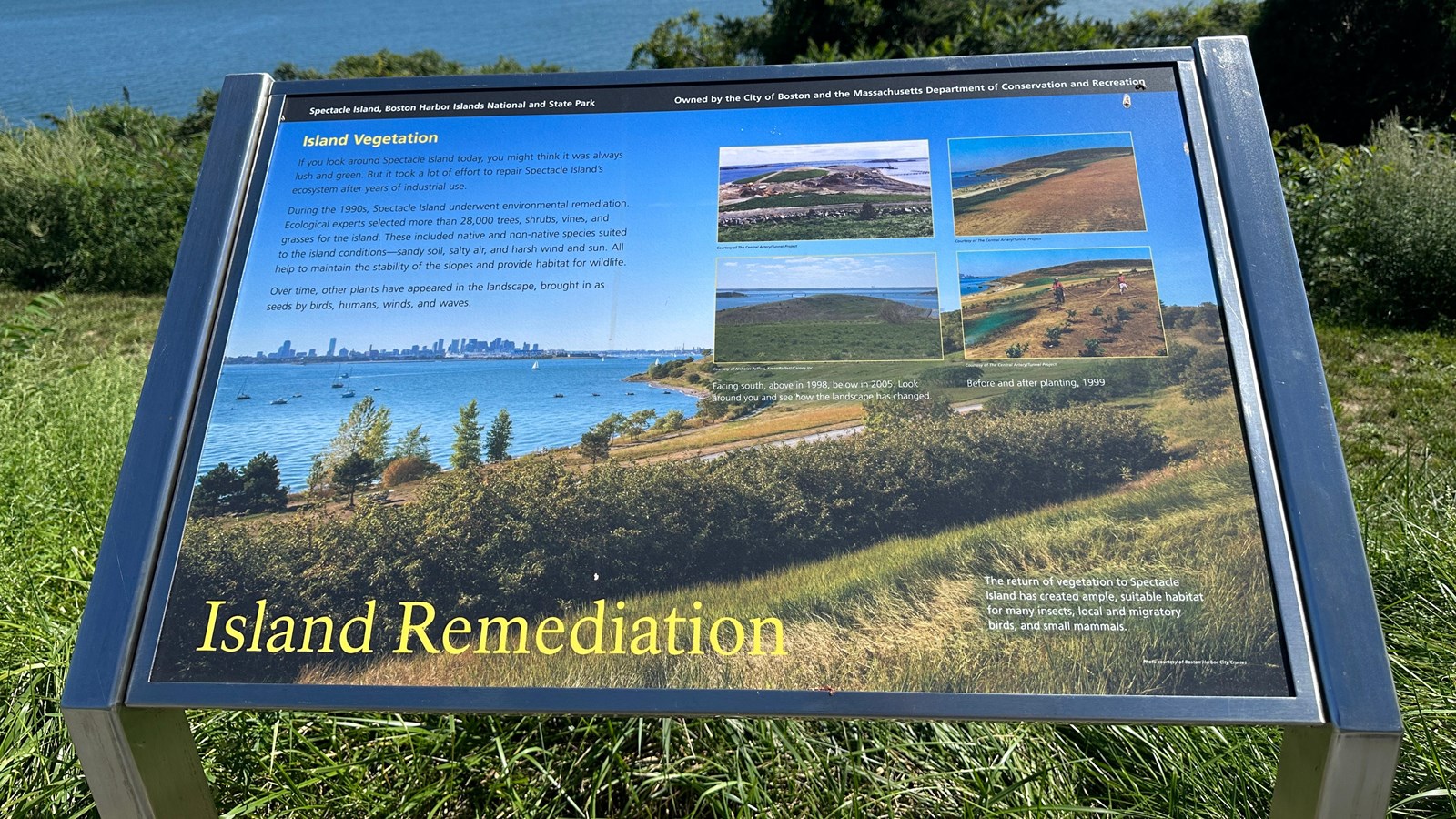
NPS Photo/M Mark
Historical/Interpretive Information/Exhibits
Description
Low-profile wayside that is 40.5 x 24 3/8 inches, with interpretation panel spanning 36.5 inches wide. It has a grey square base with two rectangular pillars supporting the panel. The panel is framed in grey metal. The sign is located on the interpretive trail on the North Drumlin.
Layout
At the top of the sign is a black banner with white text. Aligned to the left is text that reads “Spectacle Island, Boston Harbor Islands National and State Park.” Aligned to the right is text that reads “Owned by the City of Boston and the Massachusetts Department of Conservation and Recreation.” The section of text is titled, “Island Vegetation” in yellow text aligned to the left just underneath the black banner. The panel background is a photo of a lush Spectacle Island looking towards the Boston skyline. There is one column of text on the left made up of three paragraphs. On the right is four photos, with two stacked on top of the other two. The far bottom corner has a small caption regarding the background photo. At the bottom of the panel the title reads “Island Remediation” in yellow text.
Image (top left)
View of the south drumlin of Spectacle Island. It is half filled in, with a hump on the top, and a barren stretch to the right. The hump is grassy with a dirt road cutting across it. In front of the humps are heavy machinery and piles of dirt. To the right of the humps are the permanent pier being constructed and the temporary pier behind it. In the far background is Long Island and the bridge connecting it to Moon Island. In the foreground is a grassy hill sloping down towards the construction site, a big pinecone sits very close to the camera and the hill is split by a dirt road, which on the left side the construction for the south drumlin begins.
Image Credit (top left)
Courtesy of The Central Artery/Tunnel Project
Image (top right)
View looking towards the beach and the North Drumlin. Most of the image is filled with dirt that makes up the newly formed connection between the south and north drumlins, and slopes down towards the beach where there is a small sandy strip. In the distance, the connection between the dirt and the sand is interrupted by a dirt road and a green strip made from marking spray that curves up the hill toward the drumlin. Along the left side of the drumlin, the remains of the old pier sit in the water and a skyline is barely visible in the distance.
Image Credit (top right)
Courtesy of The Central Artery/Tunnel Project
Image (bottom left)
View looking towards the South drumlin of Spectacle Island, from the side of the North Drumlin. The foreground is covered in grass and has some scrubby vegetation before it slopes down to a spit of land before the South Drumlin begins. The South Drumlin is covered in grass and has spots of bushes and trees. There are walking paths carved along the circumference of the drumlin. In the distance is the Long Island Bridge, connecting Long Island to Moon Island. In the distance is the Dorchester and Quincy shoreline.
Image Credit (bottom left)
Courtesy of Nicholas Paffett, Krent/Paffett/Carney Inc.
Image Caption (beneath top left and bottom left)
Facing south, above in 1998, below in 2005. Look around you and see how the landscape has changed.
Image (bottom right)
View of the North Drumlin from the South Drumlin. Standing on a hill that slopes down towards the beach are two people wearing orange vests and hard hats, holding a long hose and spraying green fertilizer around plants. The ground in the foreground is mostly dirt but has three rows of shrubs and trees. Behind the workers are more rows of trees and green sprayed area. The North Drumlin in the distance is also covered with rows of plants. In the top left corner is the curve of the Spectacle Island beach, with the remains of the old pier sticking out of the water.
Image Credit (bottom right)
Courtesy of The Central Artery/Tunnel Project
Image Caption (top right and bottom right)
Before and after planting, 1999.
Image (background)
View of Spectacle Island looking out on the North Drumlin from the South Drumlin. The foreground is filled with the gentle slope of the hill up to the North Drumlin. The hillside is filled with trees and shrubs that are green and lush, and a pathway cuts across leading to the top of the North Drumlin. On the right, the top of the drumlin is covered by the four images and cannot be clearly seen. The left side of the image is filled with blue water with many boats docked in the marina, which meets the beach. Remnants of the old pier stick out above the water. In the left top corner, the Boston City Skyline is clearly visible. Above is a clear blue sky.
Image Caption (background)
The return of vegetation to Spectacle Island has created ample, suitable habitat for many insects, local and migratory birds, and small mammals.
Image Credit (background)
Photo courtesy of Boston Harbor City Cruises
Main Text
If you look around Spectacle Island today, you might think it was always lush and green. But it took a lot of effort to repair Spectacle Island’s ecosystem after years of industrial use.
During the 1990s, Spectacle Island underwent environmental remediation. Ecological experts selected more than 28,000 trees, shrubs, vines, and grasses for the island. These included native and non-native species suited to the island conditions – sandy soil, salty air, and harsh wind and sun. All help to maintain the stability of the slopes and provide habitat for wildlife.
Over time, other plants have appeared in the landscape, brought in as seeds by birds, humans, winds, and waves.
