Last updated: October 6, 2020
Place
Ionia Volcano
Quick Facts
OPEN TO PUBLIC:
No
Lewis and Clark NHT Visitor Centers and Museums
This map shows a range of features associated with the Lewis and Clark National Historic Trail, which commemorates the 1803-1806 Lewis and Clark Expedition. The trail spans a large portion of the North American continent, from the Ohio River in Pittsburgh, Pennsylvania, to the mouth of the Columbia River in Oregon and Washington. The trail is comprised of the historic route of the Lewis and Clark Expedition, an auto tour route, high potential historic sites (shown in black), visitor centers (shown in orange), and pivotal places (shown in green). These features can be selected on the map to reveal additional information. Also shown is a base map displaying state boundaries, cities, rivers, and highways. The map conveys how a significant area of the North American continent was traversed by the Lewis and Clark Expedition and indicates the many places where visitors can learn about their journey and experience the landscape through which they traveled.
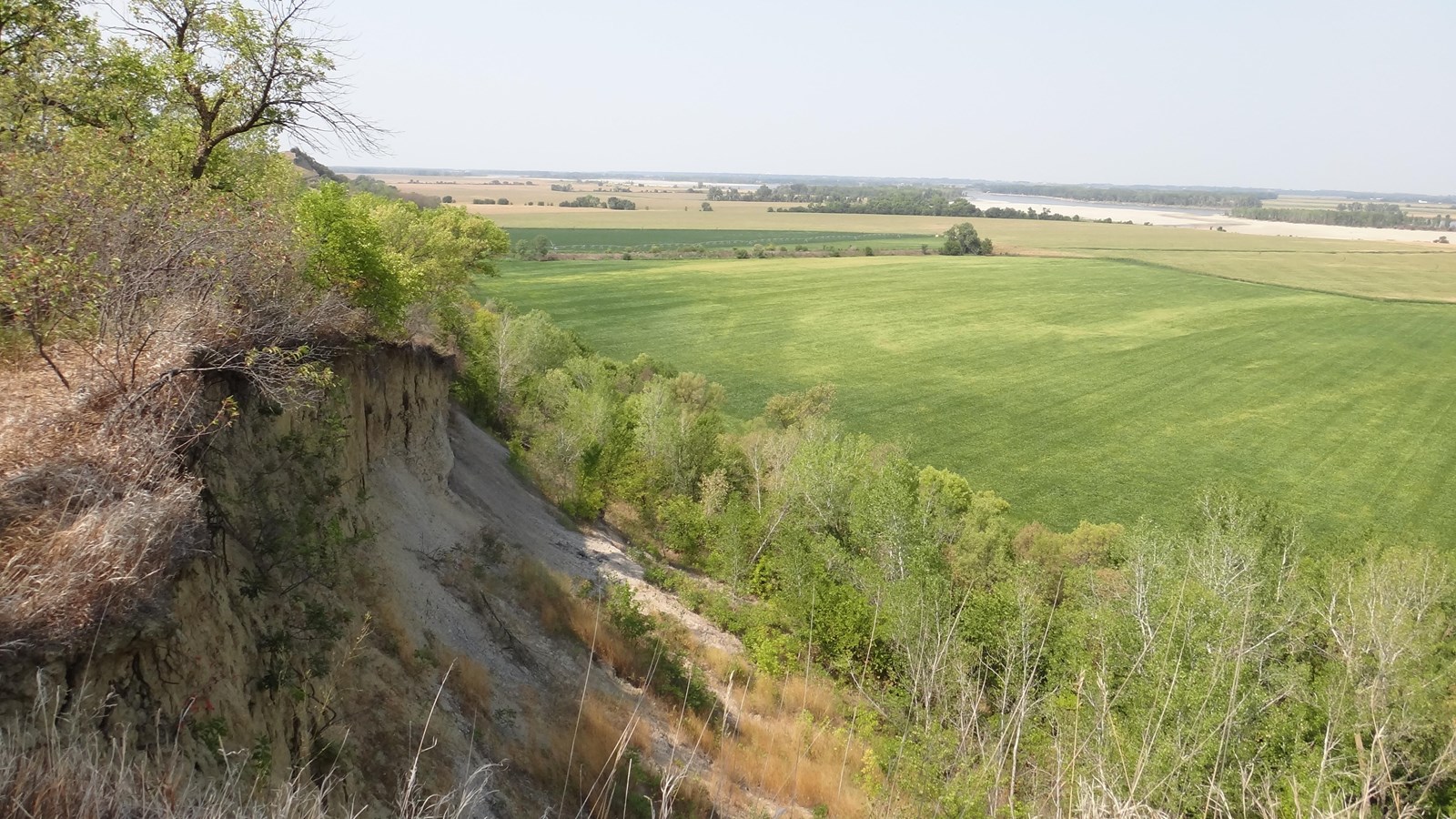
On August 24, 1804, Clark explored a distinctive “180 or 190 feet high” bluff along the west side of the Missouri River. He wrote, “Those Bluffs appear to have been laterly on fire, and at this time is too hot for a man to bear his hand in the earth at any debth, gret appearance of Coal. An emence quantity of Cabalt or a Cristolised Substance which answers its discription is on the face of the Bluff.” Ordway further elaborated that the bluff “had a Sulpheras Smell”.
Following Lewis and Clark, later fur traders and travelers frequently noticed dense smoke and fire in this region. In 1839, French explorer J. N. Nicollet attempted to prove that these phenomena were not of volcanic origin. He theorized that the decomposition of beds of iron pyrites in contact with water resulted in a heat capable of igniting other combustible materials. Still, by the late 1800s the bluff was known as the Ionia Volcano. It was named after the nearby town of Ionia, established in 1856. In 1878, a flooded Missouri River undermined the bluffs and a large section of the “volcano” fell into the river. The same flood heavily damaged the town of Ionia, which was later completely abandoned. By 1900, there was scientific consensus that the eruptions were due to the heat caused by the oxidation of damp pyritiferous and carbonaceous shale exposed by erosion. The Ponca Tribe consider the bluff to be a sacred site. Located north of Newcastle, Nebraska, the Ionia Cemetery is across the road from a small overlook and the top of the Ionia Volcano remnants.
Learn more at Discovering Lewis and Clark