Last updated: March 2, 2024
Place
"Into the Lakebed: Two Miles Long, One Mile Wide!" Wayside
NPS
Quick Facts
Amenities
1 listed
Historical/Interpretive Information/Exhibits
Description of Wayside: The wayside is 36 x 24 inches and is surrounded by black metal. It has a black rectangular base with two rectangular pillars supporting the panel. The wayside along the Walk Through the Ruins trail.
Wayside Layout: At the top of the wayside is a thin black banner with white text. To the left is "Johnstown Flood National Memorial." To the right is "National Park Service, U.S. Department of the Interior." Next to the text is the National Park Service arrowhead. The title of the wayside is below the black banner in large black font. The panel has a cream-colored background. There are two columns of text and two images.
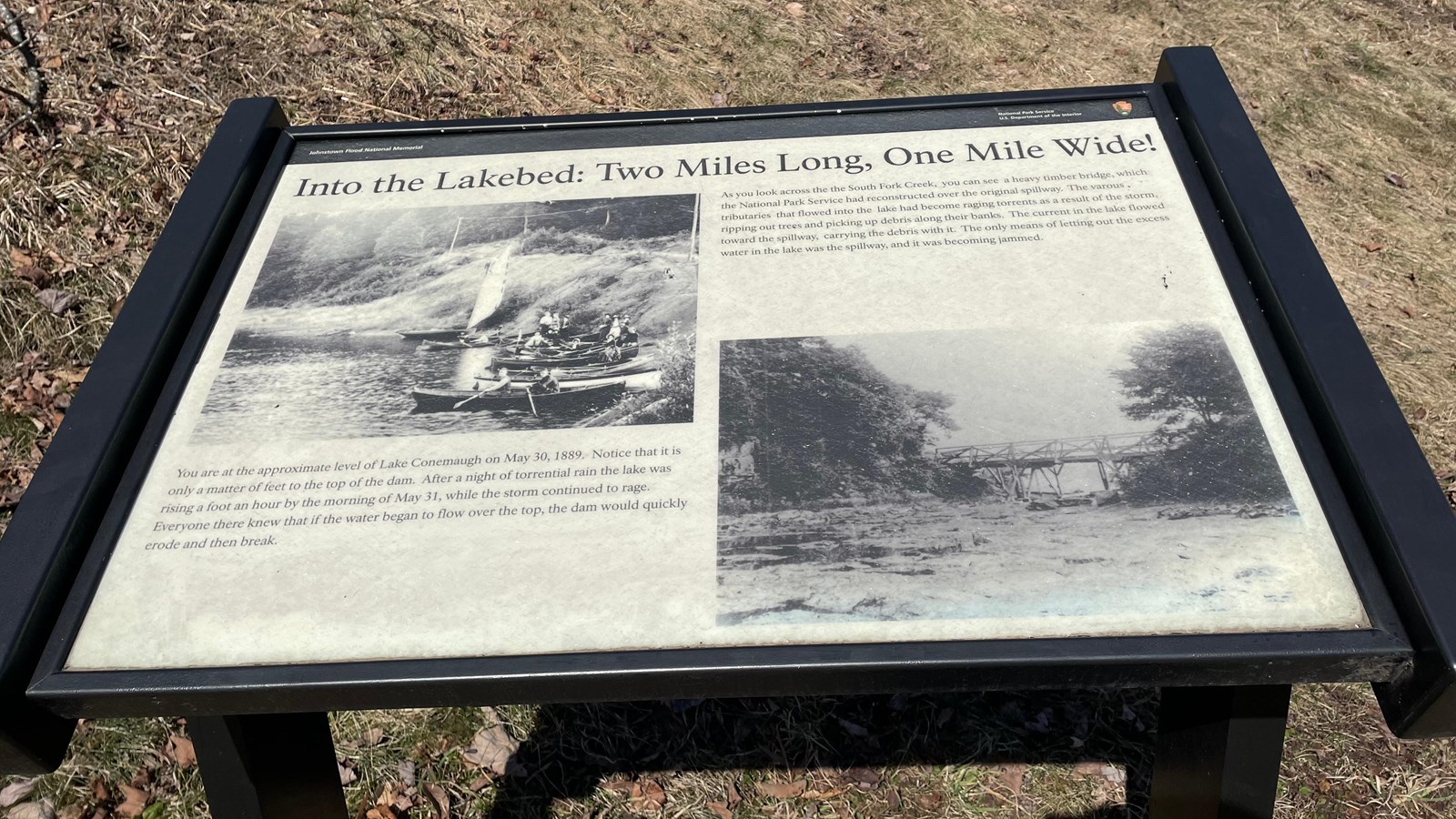
Wayside Title: Into the Lakebed: Two Miles Long, One Mile Wide!
Text: You are at the approximate level of Lake Conemaugh on May 31, 1889. Notice that it is only a matter of feet to the top of the dam. After a night of torrential rain the lake was rising a foot an hour by the morning of May 31, while the storm continued to rage. Everyone there knew that if the water began to flow over the top, the dam would quickly erode and then break.
As you look across the South Fork Creek, you can see a heavy timber bridge, which the National Park Service reconstructed over the original spillway. The various tributaries that flowed into the lake had become raging torrents as a result of the storm ripping out trees and picking up debris along their banks. The current in the lake flowed toward the spillway, carrying the debris with it. The only means of letting out the excess water in the lake was the spillway, and it was becoming jammed.
Image: A photo from the 1880s showing the water level of Lake Conemaugh with boats and oars. Lewis Semple Clarke Collection.
Image: The original spillway in Lake Conemaugh.
Wayside Layout: At the top of the wayside is a thin black banner with white text. To the left is "Johnstown Flood National Memorial." To the right is "National Park Service, U.S. Department of the Interior." Next to the text is the National Park Service arrowhead. The title of the wayside is below the black banner in large black font. The panel has a cream-colored background. There are two columns of text and two images.
Wayside Title: Into the Lakebed: Two Miles Long, One Mile Wide!
Text: You are at the approximate level of Lake Conemaugh on May 31, 1889. Notice that it is only a matter of feet to the top of the dam. After a night of torrential rain the lake was rising a foot an hour by the morning of May 31, while the storm continued to rage. Everyone there knew that if the water began to flow over the top, the dam would quickly erode and then break.
As you look across the South Fork Creek, you can see a heavy timber bridge, which the National Park Service reconstructed over the original spillway. The various tributaries that flowed into the lake had become raging torrents as a result of the storm ripping out trees and picking up debris along their banks. The current in the lake flowed toward the spillway, carrying the debris with it. The only means of letting out the excess water in the lake was the spillway, and it was becoming jammed.
Image: A photo from the 1880s showing the water level of Lake Conemaugh with boats and oars. Lewis Semple Clarke Collection.
Image: The original spillway in Lake Conemaugh.