Last updated: December 13, 2023
Place
Independence Creek
John Warner Barber, illustration in "The Loyal West I nteh Times of the Rebellion," 1865.
Quick Facts
Significance:
The Lewis and Clark Expedition camped here, near a Kanza village, on July 4, 1804, the first Independence Day on the journey.
Designation:
Lewis and Clark National Historic Trail
Amenities
3 listed
Historical/Interpretive Information/Exhibits, Parking - Auto, Trailhead
On July 4, 1804, members of the Lewis and Clark Expedition camped near what they named Independence Creek in honor of the holiday.
William Clark described the area as “one of the most butifull Plains, I ever Saw, open & butifully diversified with hills & vallies all presenting themselves to the river covered with grass and a few scattering trees.”
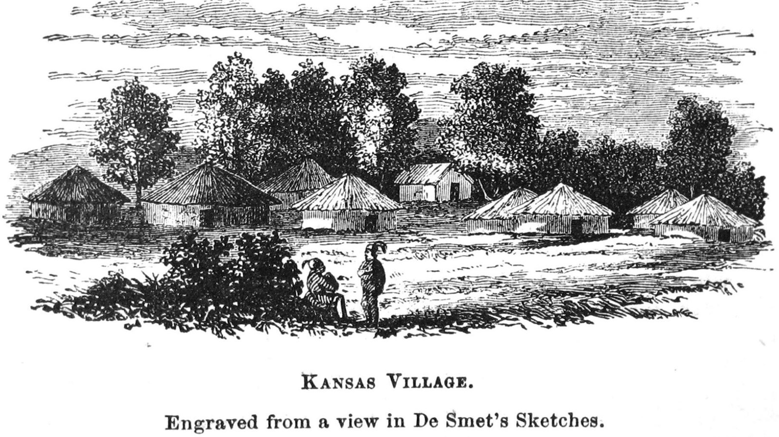
Kanza people had lived in this region for thousands of years. They resided in semi-permanent villages, usually located along rivers. Winter months were spent in their villages, and they spent the summers hunting and gathering food. Large hunting parties would journey out over the grasslands in search of bison and other game. Women foraged for edible plants on the fertile plains. They cultivated corn, beans, squash, and watermelon in gardens along the river.
For generations, a large Kanza village existed near where Independence Creek meets the Missouri River. The village, with some 1,500 residents, consisted of nearly 150 lodges. It was large enough that Frenchman Étienne Veniard de Bourgmont documented it in on his map in 1724.
When Lewis and Clark arrived in July 1804, they found the village empty and mistakenly assumed that Kanza people had abandoned it. But Kanza families actually lived in communities along Independence Creek as late as 1811.
Where were they?
Out on a summer bison hunt.
Lewis and Clark’s lack of understanding of Indigenous lifeways led them to incorrectly assume that Kanza people were a part of the past.
That wasn’t true then, and it isn’t true today. Kanza people today are members of the Kaw Nation in Oklahoma.
Lewis and Clark NHT Visitor Centers and Museums
This map shows a range of features associated with the Lewis and Clark National Historic Trail, which commemorates the 1803-1806 Lewis and Clark Expedition. The trail spans a large portion of the North American continent, from the Ohio River in Pittsburgh, Pennsylvania, to the mouth of the Columbia River in Oregon and Washington. The trail is comprised of the historic route of the Lewis and Clark Expedition, an auto tour route, high potential historic sites (shown in black), visitor centers (shown in orange), and pivotal places (shown in green). These features can be selected on the map to reveal additional information. Also shown is a base map displaying state boundaries, cities, rivers, and highways. The map conveys how a significant area of the North American continent was traversed by the Lewis and Clark Expedition and indicates the many places where visitors can learn about their journey and experience the landscape through which they traveled.