Last updated: April 13, 2021
Place
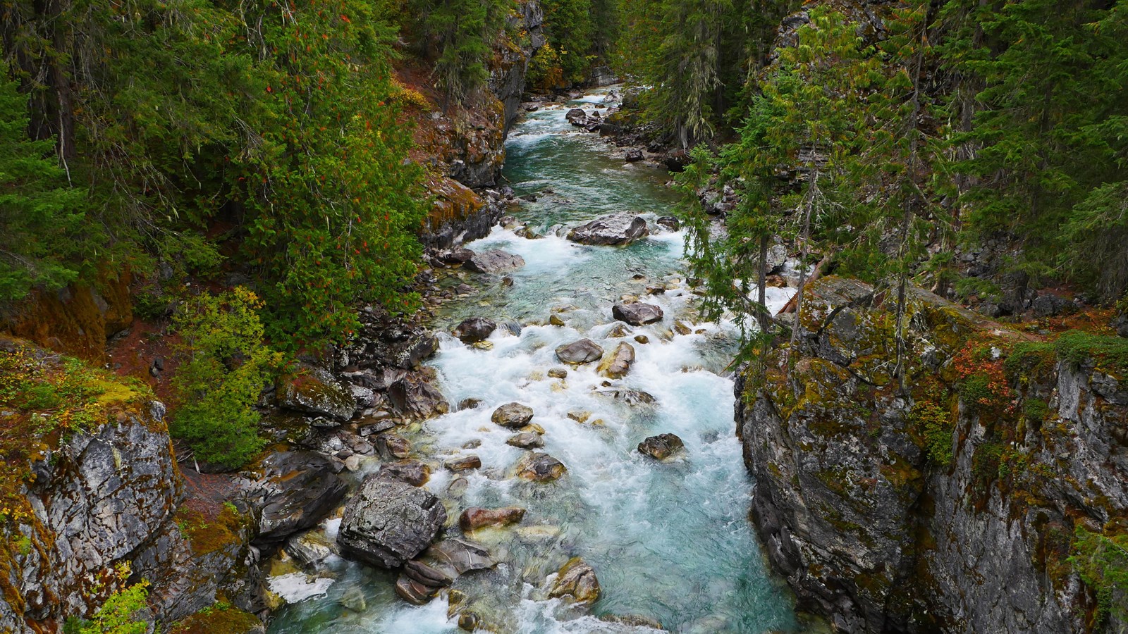
High Bridge
NPS/Marcel Ray
Quick Facts
Location:
Along the Stehekin Valley Road, 11 miles up valley from Stehekin Landing
Designation:
Historic ranger station and scenic river views.
Amenities
5 listed
Bus/Shuttle Stop, Historical/Interpretive Information/Exhibits, Picnic Table, Scenic View/Photo Spot, Toilet - Vault/Composting
With spectacular views of the rushing Stehekin River, High Bridge marks the transition from Lake Chelan National Recreation Area to North Cascades National Park. During peak season, this is the turn-around stop for the public shuttle along the Stehekin Valley Road.
The High Bridge area been used by Native Americans for nearly 10,000 years. In more recent times, the U.S. Forest Service and the National Park Service have administered the land. The historic High Bridge Ranger Station was built by the U.S. Forest Service as a base for fire and trail crews working in the high country. The buildings and horse corral were constructed in 1933-34 by the Civilian Conservation Corps and are listed on the National Register of Historic Places. The main house is used as a residence for National Park Service staff during the summer; please respect staff privacy.
The Pacific Crest National Scenic Trail (PCT) crosses High Bridge, with the route south to Stevens Pass one-quarter miles up the road and the route north to Rainy Pass just behind the horse corral. The Pacific Crest Trail winds 2,650 miles from the border of Mexico to Canada.
From High Bridge, the dirt road continues for approximately two miles to the backcountry camps of High Bridge and Tumwater; permit required for overnight stays. The road ends at a washout at Carwash Falls, though hikers and stock may connect to the Old Wagon Trail and the PCT beyond.