Last updated: January 11, 2024
Place
Grave Creek Mound

Benches/Seating, Historical/Interpretive Information/Exhibits, Information, Information - Ranger/Staff Member Present, Information Kiosk/Bulletin Board, Parking - Auto, Restroom, Scenic View/Photo Spot
“I . . . went on shore to view a remarkable artificial mound of earth called by the people in this neighbourhood the Indian grave.—
This remarkable mound of earth stands on the east bank of the Ohio 12 miles below Wheeling and about 700 paces from the river, as the land is not cleard the mound is not visible from the river . . .
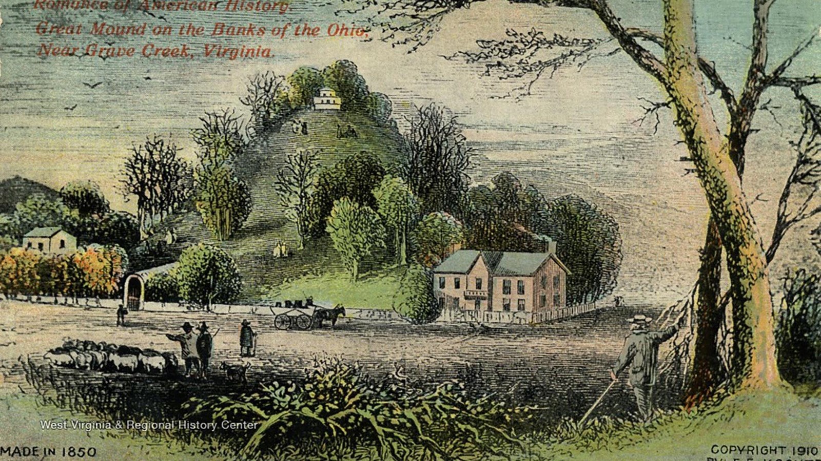
near the summet of this mound grows a white oak tree whose girth is 13 ½ feet, from the aged appeance of this tree I think it’s age might resonably calculated at 300 years, the whole mound is covered with large timber, sugar tree, hickory, poplar, red and white oak &c—”—Meriwether Lewis, September 7, 1803
This massive earthen mound was approximately 70 feet tall and 900 feet in circumference. There were smaller mounds around the large mound. A trench surrounded the largest mound, with one ledge as an entrance (a moat with an entry ramp).
But if the mounds were covered in trees and not visible from the river, how did Lewis know to stop at them?
Lewis knew about the mound because European and American archeologists had already been there. They had already taken human remains and other cultural artifacts from it and sent them to a museum in Boston.
The archeological explanation of these mounds is that people built them between 3,000 and 2,000 years ago, in what is known as the Adena cultural tradition. They lived throughout the Ohio River Valley. They buried their loved ones in timbered vaults inside these mounds. The mound that Lewis visited is one of the largest earthworks from the Adena culture and the largest known conical mound in the Western hemisphere.
Many Indigenous nations maintain connections with this and other mounds across the United States. They are sacred religious and cultural sites.
Americans who had visited the mound before Lewis took some human remains and other items from the burials in this mound. This desecration of Indigenous graves has unfortunately been common in American history.
About this article: This article is part of a series called “Pivotal Places: Stories from the Lewis and Clark National Historic Trail.”
Lewis and Clark NHT Visitor Centers and Museums
This map shows a range of features associated with the Lewis and Clark National Historic Trail, which commemorates the 1803-1806 Lewis and Clark Expedition. The trail spans a large portion of the North American continent, from the Ohio River in Pittsburgh, Pennsylvania, to the mouth of the Columbia River in Oregon and Washington. The trail is comprised of the historic route of the Lewis and Clark Expedition, an auto tour route, high potential historic sites (shown in black), visitor centers (shown in orange), and pivotal places (shown in green). These features can be selected on the map to reveal additional information. Also shown is a base map displaying state boundaries, cities, rivers, and highways. The map conveys how a significant area of the North American continent was traversed by the Lewis and Clark Expedition and indicates the many places where visitors can learn about their journey and experience the landscape through which they traveled.
