Last updated: September 3, 2025
Place
Georgetown
Quick Facts
Location:
Georgetown, PA
OPEN TO PUBLIC:
No
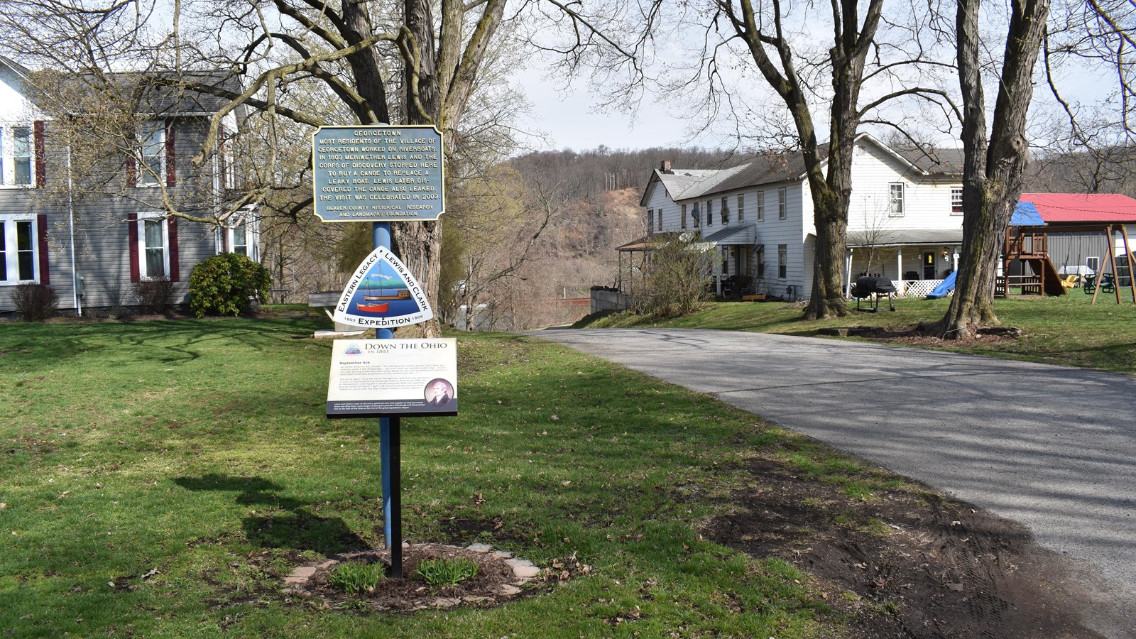
An hour after disembarking on September 4, 1803, Lewis found that a pirogue “had sprung a leak and had nearly filled.” To alleviate the craft’s load, the expedition stopped at Georgetown to purchase a canoe “compleat with two paddles and two poles” at a cost of $11. But Lewis found that “my new purchase leaked so much that she was unsafe without some repairs.” Items stowed in the craft were wet, and the expedition stopped for the night not far downriver to repair the canoe and dry out the cargo.
Benoni Dawson laid out a town across from the mouth of Little Beaver Creek in 1793, seven years after he had constructed a fortified log cabin on the site. Later named Georgetown, it was an active river town until railroads became the primary means of transport. Extant structures from when Lewis visited Georgetown include the ca. 1802 River Hotel, today a private residence.
Lewis and Clark NHT Visitor Centers and Museums
This map shows a range of features associated with the Lewis and Clark National Historic Trail, which commemorates the 1803-1806 Lewis and Clark Expedition. The trail spans a large portion of the North American continent, from the Ohio River in Pittsburgh, Pennsylvania, to the mouth of the Columbia River in Oregon and Washington. The trail is comprised of the historic route of the Lewis and Clark Expedition, an auto tour route, high potential historic sites (shown in black), visitor centers (shown in orange), and pivotal places (shown in green). These features can be selected on the map to reveal additional information. Also shown is a base map displaying state boundaries, cities, rivers, and highways. The map conveys how a significant area of the North American continent was traversed by the Lewis and Clark Expedition and indicates the many places where visitors can learn about their journey and experience the landscape through which they traveled.