Last updated: September 3, 2025
Place
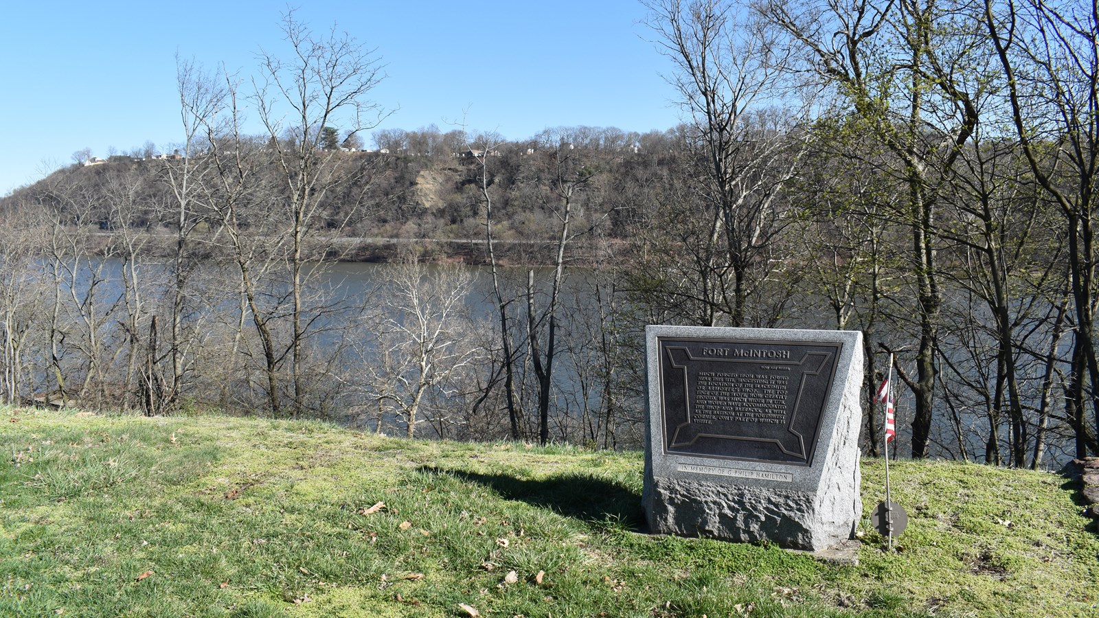
Fort McIntosh
Quick Facts
Location:
Beaver, Pennslyvania
MANAGED BY:
Amenities
4 listed
Historical/Interpretive Information/Exhibits, Information, Information Kiosk/Bulletin Board, Parking - Auto
On September 3, 1803, the expedition “came to ancor off Mackintosh,” the site of former Fort McIntosh near the mouth of the Beaver River. Here, Lewis discharged one of his hands, and the expedition continued downriver. They encountered two more riffles, which caused considerable delay, and stopped for the night three miles downriver from Beaver.
Fort McIntosh was built in 1778 as part of a string of forts to launch an American offensive against the British in the Northwest. A treaty with the Lenape and Wyandot in 1785 led to settlement in northwest Pennsylvania, and the fort was abandoned in 1791. That same year Beaver was established, and the town grew as the fort decayed. Today, the site of Fort McIntosh, which was excavated in the 1970s, is a riverside park and is part of the Beaver National Historic District.
Lewis and Clark NHT Visitor Centers and Museums
This map shows a range of features associated with the Lewis and Clark National Historic Trail, which commemorates the 1803-1806 Lewis and Clark Expedition. The trail spans a large portion of the North American continent, from the Ohio River in Pittsburgh, Pennsylvania, to the mouth of the Columbia River in Oregon and Washington. The trail is comprised of the historic route of the Lewis and Clark Expedition, an auto tour route, high potential historic sites (shown in black), visitor centers (shown in orange), and pivotal places (shown in green). These features can be selected on the map to reveal additional information. Also shown is a base map displaying state boundaries, cities, rivers, and highways. The map conveys how a significant area of the North American continent was traversed by the Lewis and Clark Expedition and indicates the many places where visitors can learn about their journey and experience the landscape through which they traveled.