Last updated: October 5, 2020
Place
Fort Belle Fontaine
Quick Facts
Location:
Saint Louis, Missouri
Designation:
National Register of Historic Places
MANAGED BY:
Lewis and Clark NHT Visitor Centers and Museums
This map shows a range of features associated with the Lewis and Clark National Historic Trail, which commemorates the 1803-1806 Lewis and Clark Expedition. The trail spans a large portion of the North American continent, from the Ohio River in Pittsburgh, Pennsylvania, to the mouth of the Columbia River in Oregon and Washington. The trail is comprised of the historic route of the Lewis and Clark Expedition, an auto tour route, high potential historic sites (shown in black), visitor centers (shown in orange), and pivotal places (shown in green). These features can be selected on the map to reveal additional information. Also shown is a base map displaying state boundaries, cities, rivers, and highways. The map conveys how a significant area of the North American continent was traversed by the Lewis and Clark Expedition and indicates the many places where visitors can learn about their journey and experience the landscape through which they traveled.
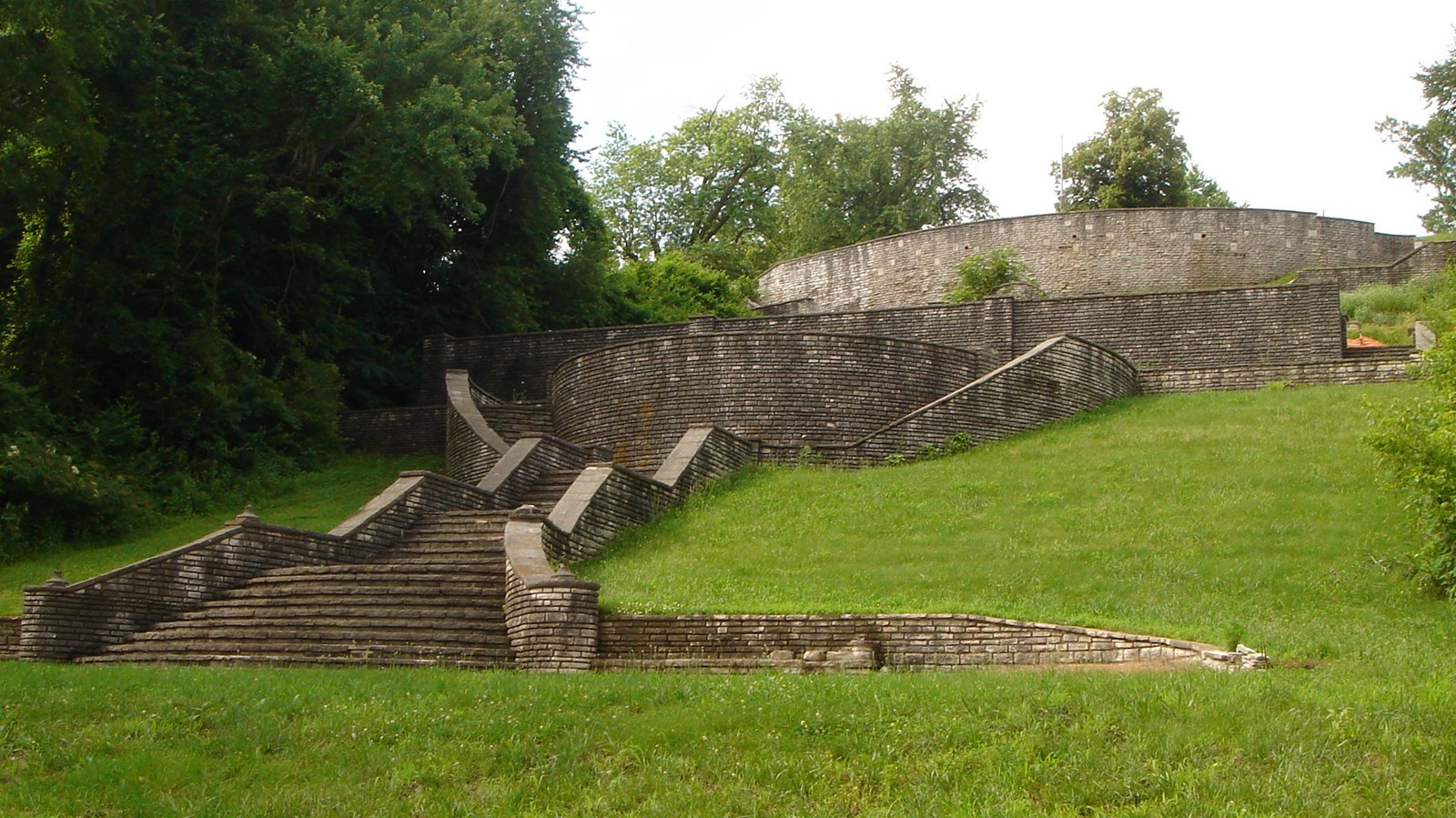
The original site of the Corps campsite and the first Fort Belle Fontaine have been destroyed by shifts in the Missouri River channel. The grounds below the bluff became a popular summer retreat during the late 1930s and in 1936 the Works Progress Administration (WPA) built a grand limestone staircase down from the bluff along with a number of other structures. Today, Fort Belle Fontaine Park is a 305-acre park of St. Louis County.
Fort Belle Fontaine is a High Potential Historic Site on the Lewis and Clark National Historic Trail.
The expedition first camped on an island opposite Coldwater Creek on May 14, 1804. During 1805, Cantonment Belle Fontaine was built on the south bank of the Missouri River at the mouth of Coldwater Creek by companies of the 1st U.S. Infantry under Lt. Colonel Jacob Kingsbury. The expedition visited the new fort on their return journey. On September 22, 1806, Ordway wrote that “towards evening we arived at Bell fountain a Fort or cantonement on South Side which was built since we ascended the Missouri & a handsome place. we moovd. a short distance below and Camped, the Company of Artillery who lay at this fort fired 17 Rounds with the field peaces the most of our party was Quartered in the Canonment.” The next day they returned to St. Louis.
The original cantonment housed a government-operated trading post (or factory), until that function was transferred to Fort Osage and Fort Madison in 1808. By 1809, the post had deteriorated and relocation to a new site above a bluff began. The new Fort Belle Fontaine, completed in 1811, included 30 buildings, several blockhouses, a rectangular palisade, and an arsenal. In 1826, the second fort was abandoned and replaced by Jefferson Barracks, a new post located in St. Louis. The City of St. Louis acquired the Fort Belle Fontaine property in 1913 and built a detention home and training school for boys. In the 1930s the Work Progress Administration (WPA) built a “grand staircase” of stone steps from the riverbank to the top of the bluff, as well as trails and facilities. Now a St. Louis County park, Fort Belle Fontaine is listed on the National Register as an archeological site.