



Last updated: June 9, 2026
Place
Flowery Lake Springs Nevada
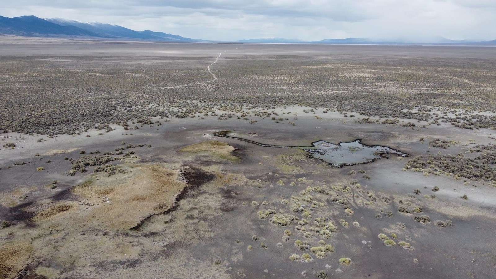
Photo/Kevin Lee
Quick Facts
Location:
Flowery Lake Springs is about 21 miles south of I-80 Exit 233 and 25 miles due west of West Wendover, Nevada, in Steptoe Valley. GPS trail marker 40.7309666667, -114.5245666667; GPS lake (PRIVATE PROPERTY) 40.728991 -114.523521. The springs are on remote private property and the public trail marker is difficult to reach.
Significance:
Flowery Lake Springs, a marshy area with several spring mounds, provided water for thousands of emigrants who traveled the Hastings Cutoff (1846-1850). The Donner-Reed Party reportedly cached the contents of several wagons here, as the oxen could no longer pull them.
Designation:
Historic Site on the California NHT.
OPEN TO PUBLIC:
No
MANAGED BY:
Private
Amenities
2 listed
Historical/Interpretive Information/Exhibits, Scenic View/Photo Spot
The 1841 Bidwell-Bartleson Party, now a pack company traveling without wagons, crossed the Pequop Mountains north of Flowery Lake Springs and so never saw this place. However, emigrants on the Hastings Cutoff continued south and found the springs in 1846, and others on the route through 1850 camped here, as well. Edwin Bryant’s company of mule packers stayed here on the night of Aug. 6, 1846.
“[W]e struck an oasis of about fifty acres of green grass, reeds, and other herbage,” he recorded, “surrounding a number of springs, some of cool fresh water, others of warm sulphur water. . . .The grass immediately around the springs, although not being the best quality, is very luxuriant. . .”
While preparing to depart the next morning, though, two men of Bryant’s company cocked rifles at each other over some “trivial matter,” and Bryant shamed them into lowering their weapons. “It was truly a deplorable spectacle to witness two men, in this remote desert, surrounded by unnumerable dangers (to guard against which they were mutually dependent),” wrote Bryant, “so carried away by their passions as to seek each other’s destruction.”
Over a month later, on Sept. 13, the Donner-Reed Party experienced some friction at this place, too, for James Reed jotted in his journal that here “all the women in Camp ware mad with anger.” He called the springs Mad Woman Camp. Reed did not say why they were angry.
What possibly could have upset the party’s women? Having to comfort crying, exhausted children on the long day’s march? Needing to chop sagebrush for the evening fires and cook supper for the company, all while bone tired, themselves? Being dragged across this hostile desert by husbands who had dismissed their objections to leaving the established trail? Certainly, the ladies had their reasons for being “mad.”
Utah historian Charles Kelly retraced the Hastings Cutoff and described Flowery Lake Springs in his 1930 book, Salt Desert Trails:
In the center of a shallow depression covering perhaps ten acres, are several low mounds, each of which covers considerable ground, and out of the top of which flow many springs of slightly saline water. Some of these are very cool, others lukewarm. The marsh so formed is at certain times of the year covered with a peculiar variety of blue flower, from which the place takes its name. The water is clear, and good enough, if one is thirsty. Walking on top of one of these mounds shakes the whole structure. The sensation is like walking across an enormous glass of jelly.
When Kelly saw the springs, they probably were little changed since the covered wagon era. Today, though, satellite imagery reveals a shrinking, gray-green marsh with a line of brown spots—possibly old mounds—all surrounded by desert rangeland. They are on remote private property and challenging to reach.
Site Information
Location (Flowery Lake Springs is about 21 miles south of I-80 Exit 233 and 25 miles due west of West Wendover, Nevada, in Steptoe Valley. GPS trail marker 40.7309666667, -114.5245666667; GPS lake (PRIVATE PROPERTY) 40.728991 -114.523521.) The springs are on remote private property and the public trail marker is difficult to reach.