Last updated: March 28, 2024
Place
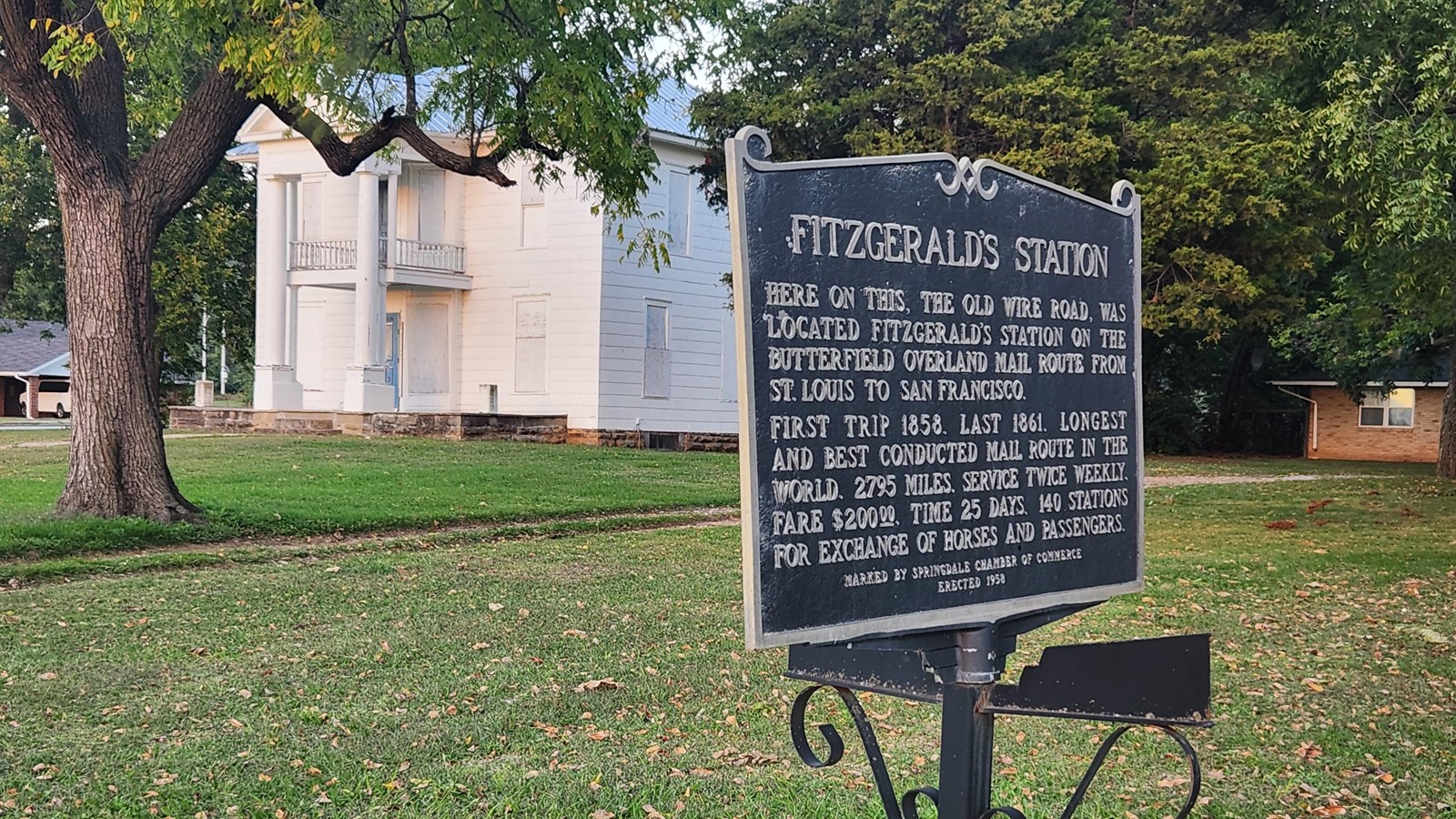
Fitzgerald’s Station and Farmstead

Photo/John McLarty
Historical/Interpretive Information/Exhibits
In the early 1830s, the John and Mary Fitzgerald family settled on land located alongside the Military Road (also called Old Missouri Road), which ran from Springfield, Missouri to Fort Smith, Arkansas. The Fitzgerald’s took advantage of their location by establishing an inn and tavern on their farm. By the late 1830s it was a well-known stop for travelers. It became a supply source for many of the Trail of Tears Cherokee removal detachments in the late 1830s.
All of the detachments that did not turn west in Benton County north of here would have passed by the Fitzgerald Farmstead. One of the detachments was mentioned by William Isaac Irvins Morrow, a physician traveling with the Taylor detachment, who noted the Fitzgerald farm in his journal:
March 20, 1839. Wednesday 20th Cloudy & cool – traveled 15 miles to the X Hollows, eat dinner at Homeslys & came on 5 miles to Fitzgeralds in company with Cox Fields Hemger & George D. Morrow. A mean house.”
Some Cherokee moved west before the forced removal in 1838-1839 that became known of the Trail of Tears. B.B Cannon, a disbursing agent who accompanied an earlier group kept a journal recording that they used much of the same route, passing by Fitzgerald Station, and receipts show numerous purchases from John Fitzgerald in December of 1837.
Most Cherokee detachments next took a road to the southwest from Fitzgerald’s and travelled through the small settlement of Shiloh on their way to their destination in Indian Territory. Some of the detachment leaders travelled south into Fayetteville as well.
John and Mary Fitzgerald played an important role as they were witness to Cherokee removal and sold needed provisions to the weary and often sick Cherokee. John and Mary are buried in the Fitzgerald Cemetery near the route of the Trail of Tears National Historic Trail just to the south of their farmstead on Old Wire Road through the intersection of Hwy 265 where it becomes E Randall Wobbe Lane.
Site Information
Location (The old Fitzgerald Farmstead is located on the Old Wire Road in north Springdale. Parking for this site is located at the Fitzgerald Mountain Trailhead on Dodd Avenue just off of the Old Wire Road, 2700 Dodd Avenue, Springdale, AR 72764)
Access
The public can park at the Fitzgerald Mountain Trailhead on Dodd Avenue just east of the Old Wire Road. From this Trailhead the open field of the Fitzgerald Farmstead can be seen. The historic structures are closed to the public.
Amenities
The parking lot for viewing Fitzgerald Station is a trailhead for hiking and biking for nearby Bayyari Park & Mountain Bike Trails, a 15-acre site offering the following amenities: 0.5 Mile Natural Surface Trail, 1 Playground with Wood Chip Fall Zone for Ages 5-12, 1 Separate Swing Set, 3 Covered Picnic Tables, Pavilion with Picnic Tables and Restroom, Picnic Areas, Access to many miles of developed biking and hiking trails.
More Site Information
Trail of Tears National Historic Trail
Trail of Tears: Northwest Arkansas Itinerary
This site is on the Old Wire Road Itinerary which helps the public explore Trail of Tears sites in northwest Arkansas. Each site features one aspect or story about the Cherokee experience traveling the Trail of Tears in this area as they approach the end of their journey and arrive in Indian Territory (today’s Oklahoma).
