Last updated: December 13, 2021
Place
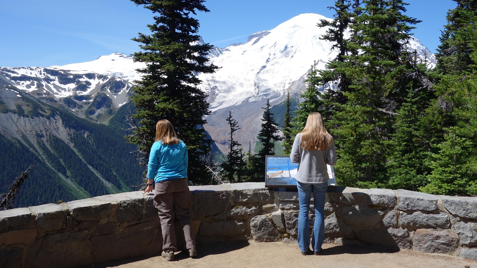
Emmons Vista Overlook 1
NPS Photo
Quick Facts
Location:
Emmons Vista Trail at Sunrise
Amenities
2 listed
Historical/Interpretive Information/Exhibits, Scenic View/Photo Spot
Season: Summer Only (July - September)
Sunrise Road is open to vehicles during the summer only, typically from early July to mid-September.
From the Sunrise parking lot, take the short walk down to the first of the Emmons Vista Overlooks. From there the whole northeast side of the mountain is visible, from the summit to the bottom of the White River Valley. The trail starts from the left side of the parking lot as you look towards the Sunrise Visitor Center where you may also pick up a trail map.
Sunrise Road Geology – Emmons Vista Overlook 1
If you stood at this point 5,600 years ago just before the occurrence of several major volcanic events, the volcano would have looked very different. Instead of the smooth sweep of the Emmons Glacier from the summit down to the valley floor, the northeast face of the volcano would have been broken up with craggy buttresses and ridges, much as the other sides of the volcano appear today. However, 5,600 years ago the summit and northeast flank of Mount Rainier collapsed in a gigantic avalanche during an eruption, forming a fast-moving slurry ofmud and debris called the Osceola Mudflow, which washed up as high as the present site of the Sunrise Visitor Center. You may remember seeing some of the loose Osceola sediment in the hillside road cuts as you drove up the road. The eruption that created the Osceola Mudflow left a large horseshoe-shaped crater in the northeast flank of the volcano, much like the crater left on the north flank of Mount St. Helens after the 1980 eruption. The enormous Osceola Mudflow had a total volume of about a cubic mile. The mudflow filled the valleys of theWhite River system to depths of 300 feet or more and flowed more than sixty miles to the Puget Sound. Carolyn Driedger, with the United States Geologic Survey:
“Mount Rainier has an east-west fracture zone across its summit and that’s where magma has risen in the past and as it has risen in there it has baked the surrounding rocks... The surrounding rocks were bathed in a weakly acidic solution of sulfuric acid and that actually transformed the chemistry of the rocks, transforming the rocks from a hard rock to a soft clay... The fact that it was hydrothermally altered made the slide much more extensive than it would have been otherwise, and it slid much further down valley. Most of the hydrothermally altered rock on the east side of Mount Rainier was carried down in that mighty Osceola mudflow. The west side of the mountain and the summit still contain a fair amount of hydrothermally altered rock and that creates a hazard for people who live on the Puyallup river valley on the west side of the volcano because the rock remains and will fall someday.”
Subsequent lava eruptions filled-in the horseshoe-shaped crater left by the Osceola mudflow, forming the smooth summit cone of the volcano that you see today. Glaciers reformed on the peak, but have not yet had time to carve the volcano into the craggy forms visible on other sides of the mountain. Instead, the expanse of the Emmons Glacier smoothly wraps around the northeast side of Mount Rainier.
A wayside exhibit panel provides additional information about Mount Rainier. Continue east along the path to visit the second Emmons Vista Overlook.