Last updated: November 27, 2020
Place
Ecola Creek / Cannon Beach
Quick Facts
Location:
Cannon Beach, Oregon
MANAGED BY:
Lewis and Clark NHT Visitor Centers and Museums
This map shows a range of features associated with the Lewis and Clark National Historic Trail, which commemorates the 1803-1806 Lewis and Clark Expedition. The trail spans a large portion of the North American continent, from the Ohio River in Pittsburgh, Pennsylvania, to the mouth of the Columbia River in Oregon and Washington. The trail is comprised of the historic route of the Lewis and Clark Expedition, an auto tour route, high potential historic sites (shown in black), visitor centers (shown in orange), and pivotal places (shown in green). These features can be selected on the map to reveal additional information. Also shown is a base map displaying state boundaries, cities, rivers, and highways. The map conveys how a significant area of the North American continent was traversed by the Lewis and Clark Expedition and indicates the many places where visitors can learn about their journey and experience the landscape through which they traveled.
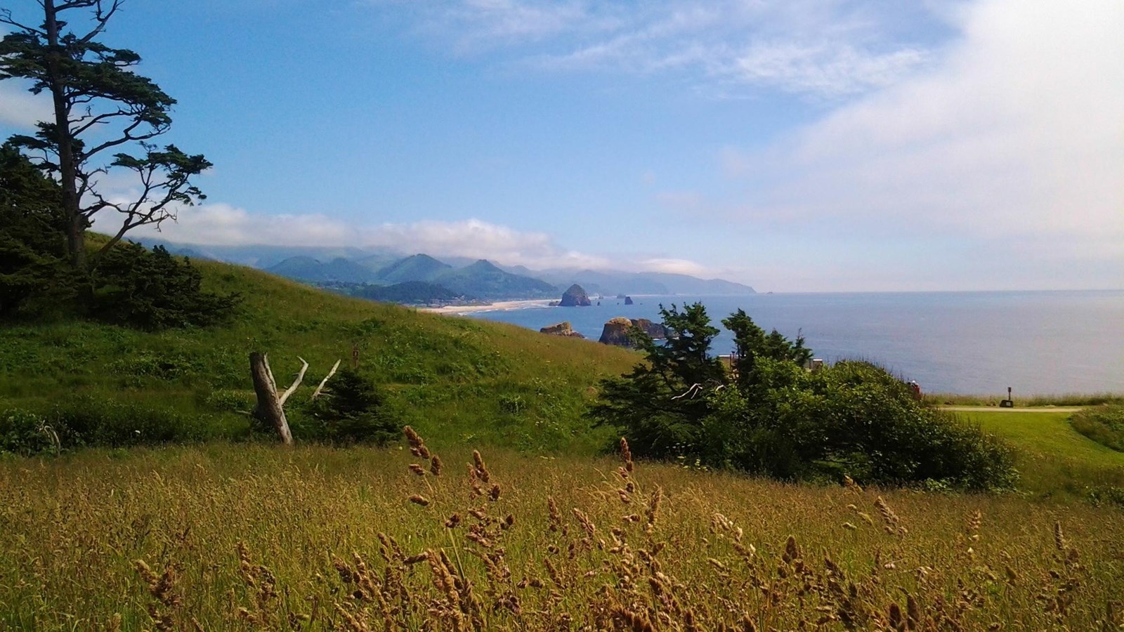
On January 5, 1806, privates Willard and Weiser returned to Fort Clatsop from the salt works camp with news of a beached whale carcass (nearly eighteen miles south), and a sample of the blubber they received from a lodge of Tillamooks. It proved quite tasty, resembling “the beaver or the dog in flavor.” Clark decided “to Set out early tomorrow with two canoes & 12 men in quest of the whale or at all events to purchase from the indians a parcel of the blubber.” The party reached its destination on January 8. Clark marveled at the “inoumerable rocks of emence Sise out at a great distance from the Shore and against which the Seas brak with great force [and] gives this Coast a most romantic appearance.” He also noted a “village of 5 Cabins on the Creek which I shall call E co-la or whale Creek.” Unfortunately, the whale was “pillaged of every valuable part” and “noting more than the Sceleton.” At the village, Clark “purchased some oile and about 120 w of Blubber after rendered, finding they would not trade I Deturmined to return home with what we have.” On the journey back to Fort Clatsop, an attempt to rob and kill Hugh McNeal was thwarted. This episode inspired to Clark nickname the Necanicum River “McNeal’s Folly.”
Located within the city of Cannon Beach, the Ecola Creek/Cannon Beach site comprises three sections. North of Ecola Creek is Les Shirley Park, with restored wetlands and interpretive wayside exhibits commemorating the Corps of Discovery. South of Ecola Creek is Ne Cus’ Park, encompassing the Ecola Creek Village archeological site. To the west and south is the distinctive Cannon Beach coastline with the sea stack rock formations noted by Clark.