Last updated: July 3, 2025
Place
Dune and Swale Exhibit
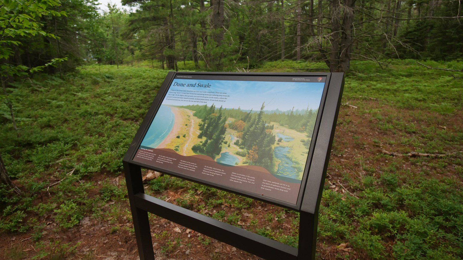
Dune and Swale
Unique to the Great Lakes shorelines are dune and swale complexes. These are areas where long “waves” of sand have formed an undulating landscape radiating away from the lake’s edge. On the higher, drier ground, trees and shrubs grow. In the swales, where the ground is wetter and water stands in ponds, wetland plants thrive. If you look closely at the ground around you, you can see the rise and fall of the land.
Forming the Landscape
Currents, wind, and waves stack sand along the shore. Over time, as lake levels fall and the land rises (glacial rebound)—dunes and swales form.
On the higher, drier ground upland plants take root—stabilizing the sand and preventing it from blowing away.
The bottom of the swales are nearly the same level as the lake, and groundwater forms ponds. These wet areas form wetlands.
On the older, inland dunes, the seasonal cycle of vegetation (leaves falling and decaying) begins to build a layer of soil.
Water accumulates in the swales forming larger ponds. The ponds support wetland plants, fish, and other aquatic life.
Over time, wetlands will fill in as the layers of sediment thicken and as groundwater levels drop with drier seasons.