Last updated: March 14, 2024
Place
"Dorchester Bay" Sign

NPS Photo/M Mark
Historical/Interpretive Information/Exhibits
Description
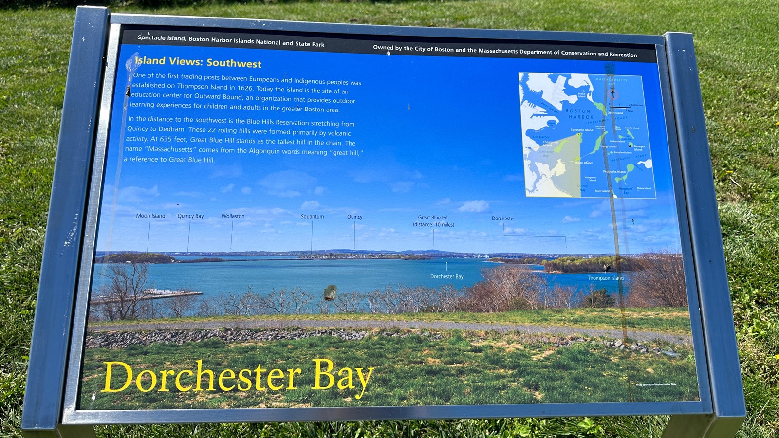
Low-profile wayside that is 36 x 24 inches, with interpretation panel spanning 36.5 inches wide. It has a grey square base with two rectangular pillars supporting the panel. The panel is framed in grey metal. The sign is located on the interpretive trail on the North Drumlin.
Layout
At the top of the sign is a black banner with white text. Aligned to the left is text that reads “Spectacle Island, Boston Harbor Islands National and State Park.” Aligned to the right is text that reads “Owned by the City of Boston and the Massachusetts Department of Conservation and Recreation.” The section of text is titled, “Island Views: Southwest” in yellow text aligned to the left just underneath the black banner. The panel background is a view of Dorchester Bay from Spectacle Island with different features labeled. There is one column of text broken up into two paragraphs on the left under the title. On the right there is an illustrated ariel map which shows Boston Harbor and the area covered in the view from this vantage point. At the bottom of the panel the title reads “Dorchester Bay” in yellow text.
Image Description (background)
A photo taken from the top of the North Drumlin looking onto Dorchester Bay. In the foreground is a grassy area with a grey gravel path. Beyond the path is a section of scrubby brush that drops down into the water. To the far left in the mid-ground is the Spectacle Island dock jutting out into the blue water. In the distance, points of interest are labeled in black or white text; from left to right: Moon Island, Quincy Bay, Wollaston, Squantum, Quincy, Great Blue Hill (distance: 10 miles), Dorchester Bay, Dorchester, and Thompson Island. Moon Island and Thompson Island stand out as a little closer, but Quincy, Wollaston, and Dorchester are one connected land mass with small houses dotting it in the distance.
Image Credit (background)
Photo courtesy of Boston Harbor Now
Image Description (upper right)
An illustrated map of Boston Harbor featuring East Boston, Downtown Boston, South Boston, and Dorchester’s land masses that make up the Boston coastline in white. The Harbor Islands are all depicted in green with their names in white text. Islands included (from approximately north to south): Snake Island, Deer Island, Long Island (with Long Island Head Light labeled on the north edge of the island), Nixes Mate, Lovells Island, Spectacle Island, Gallops Island, Georges Island, Thompson Island, Rainsford Island, Moon Island, Peddocks Island, Hangman Island, Nut Island, and Sheep Island. Georges Island has a small white question mark in a black box indicating a visitor center. “Boston Harbor” is labeled in dark blue in the center. Other water features going down the coastline are labeled in the same dark blue: “Inner Harbor,” “Pleasure Bay,” “Old Harbor,” “Dorchester Bay,” and “Quincy Bay.” Two beaches on the coastline are labeled in white, the first is above Old Harbor “L Street Beach” and the second is in Quincy Bay, “Wollaston Beach.” Out in the harbor, “President Roads,” between Deer Island and Long Island, is labeled in dark blue, along with “The Narrows” between Gallops Island and Lovells Island. Also labeled in dark blue is “Nantasket Roads” between Peddocks Island and Rainsford Island and Georges Island to the north, as well as “Hull Gut” between Peddocks and an outstretch of land that is presumably Hull. Beneath the harbor islands, at the bottom of the map “Quincy Bay” and Hingham Bay are labelled, with “Hull Gut” labeled on an outstretch of land that is presumably Hull. The top right of the map is labeled “Massachusetts Bay” in a light blue with an arrow pointing upwards in a red circle that indicates “North.” Underneath the arrow is a graphic depicting the scale of the map. On top it has 2 kilometers labeled in a black line, and 1 mile labeled in a white line. On Spectacle Island there is a yellow dot which has a triangulated yellow field showing the field of vision from that spot on Spectacle Island. Within this yellow field it includes Thompson Island, Dorchester Bay, Moon Island, Wollaston Beach, and parts of Quincy Bay.
Main Text
One of the first trading posts between Europeans and Indigenous peoples was established on Thompson Island in 1626. Today the island is the site of an education center for Outward Bound, an organization that provides outdoor learning experiences for children and adults in the greater Boston area.
In the distance to the southwest is the Blue Hills Reservation stretching from Quincy to Dedham. These 22 rolling hills were formed primarily by volcanic activity. At 635 feet, Great Blue Hill stands as the tallest hill in the chain. The name “Massachusetts” comes from the Algonquin words meaning “great hill,” a reference to Great Blue Hill.
