Last updated: March 18, 2026
Place
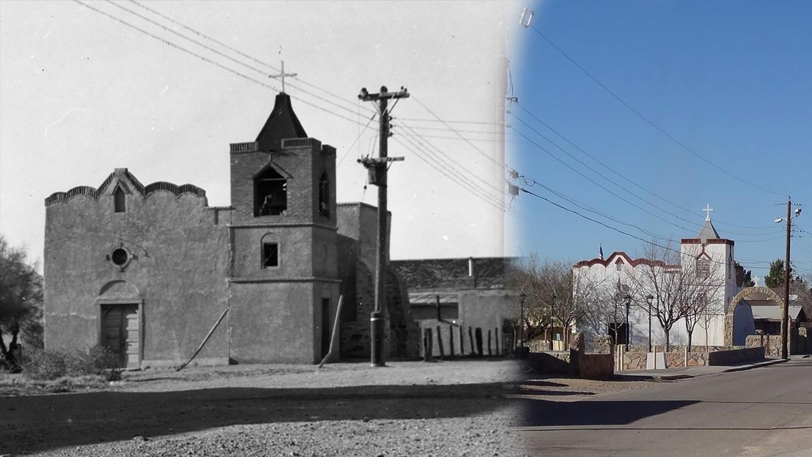
Doña Ana Village Historic District
Photos/Doña Ana Village Historic Preservation Committee
Quick Facts
Location:
Five miles north of Las Cruces off Interstate-25 and just south of New Mexico Highway 320, in Doña Ana, NM
Significance:
Cristo Rey Street leads down the original path of El Camino Real de Tierra Adentro
Designation:
National Register of Historic Places
MANAGED BY:
Amenities
3 listed
Food/Drink - Restaurant/Table Service, Gifts/Souvenirs/Books, Historical/Interpretive Information/Exhibits
The dusty road that heads from New Mexico Highway 320 to the Doña Ana village church and plaza is named, appropriately enough, Dusty Lane. Even so, the true grit and glory of Doña Ana’s 19th-century heyday lies on what is now a narrow backstreet adjacent to the church. Cristo Rey Street leads down the original path of El Camino Real de Tierra Adentro and through the Doña Ana Village Historic District, the historic heart of the oldest permanent Hispano settlement in southern New Mexico.
Today, in ambiance and architecture, Doña Ana is an exceptionally well-preserved example of a traditional rural 19th-century Hispano village of southern New Mexico. Although milled lumber, window glass and brick were integrated into most village houses and buildings in the late 19th century, and the 20th century brought mobile homes and other modern development, Cristo Rey Street is a largely undiluted version of the Spanish-Mexican plan.
Site Information
Location (5 miles north of Las Cruces off Interstate-25 and just south of New Mexico Highway 320, in Doña Ana, NM)
Safety Considerations