Last updated: October 5, 2020
Place
Discovery Hill Recreation Area
Bureau of Land Management
Quick Facts
Location:
Salmon, ID
MANAGED BY:
Lewis and Clark NHT Visitor Centers and Museums
This map shows a range of features associated with the Lewis and Clark National Historic Trail, which commemorates the 1803-1806 Lewis and Clark Expedition. The trail spans a large portion of the North American continent, from the Ohio River in Pittsburgh, Pennsylvania, to the mouth of the Columbia River in Oregon and Washington. The trail is comprised of the historic route of the Lewis and Clark Expedition, an auto tour route, high potential historic sites (shown in black), visitor centers (shown in orange), and pivotal places (shown in green). These features can be selected on the map to reveal additional information. Also shown is a base map displaying state boundaries, cities, rivers, and highways. The map conveys how a significant area of the North American continent was traversed by the Lewis and Clark Expedition and indicates the many places where visitors can learn about their journey and experience the landscape through which they traveled.
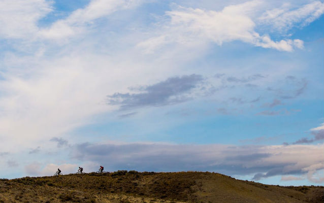
Just a few miles north of downtown Salmon, mountain bikers enjoy exceptional single-track riding trails – smooth terrain through rolling sage hills set against the stunning backdrops of the Continental Divide above and the Salmon River Valley below. This is Discovery Hill Recreation Area where the trails are generally smooth, fast and moderately challenging, making it an idea place for riders of all skills and abilities.
Managed by the Bureau of Land Management, Discovery Hill has over 30 miles of trails. While it’s open for riding all year, the BLM asks that riders not ride during periods of heavy rain or snow – to avoid damaging the trail. When in doubt, be sure to contact the BLM office in Salmon by calling 208-756-5400.
Ride on and enjoy the Lewis and Clark National Historic Trail!