Last updated: October 10, 2024
Place
Toklat River
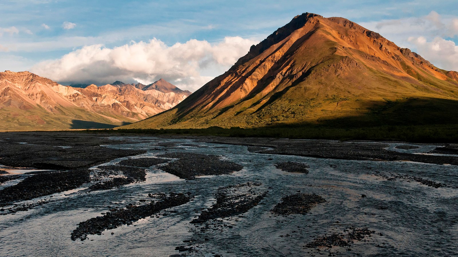
NPS Photo / Tim Rains
Quick Facts
Location:
Mile 53, Denali Park Road
Amenities
3 listed
Gifts/Souvenirs/Books, Restroom - Seasonal, Scenic View/Photo Spot
Toklat River flows out of the Alaska Range and under the Denali Park Road at roughly Mile 53.
In summer, rangers and Alaska Geographic staff can be found living and working here. There is also a rest area for bus passengers. The location is a great jumping off point for day hikers or backpackers.
Geology
The Toklat is the largest braided river that is crossed by the Denali Park Road. To the south, different channels of the river flow together near the foot of Divide Mountain. To the north, the channels largely form a few major braids, which can be difficult to cross on foot when water is high.
The vast plain of cobbles, gravel, sand, and silt deposited by the river is a renewable resource. Every other year, large machinery excavates 22,000 cubic yards (17,000 m3) of sediment from the Toklat riverbed for use in resurfacing the park road. Geology and maintenance staff design the excavations to mimic braided river channels to minimize impacts on natural processes and visual aesthetics.
The park road loses material over time because of erosion, slumping, and dust, and this material must be replaced to maintain a safe surface for travel. Toklat sediment provides a local source for the material, rather than it being imported from outside the park. This reduces the number of vehicles traveling the road. Using locally-sourced materials also prevents the spread of invasive plants whose seeds can hitchhike to new places when transported from outside the park. Finally, because the material does not need to be purchased and transport distances are shorter, the park saves money and produces less carbon dioxide emissions.