Last updated: October 4, 2021
Place
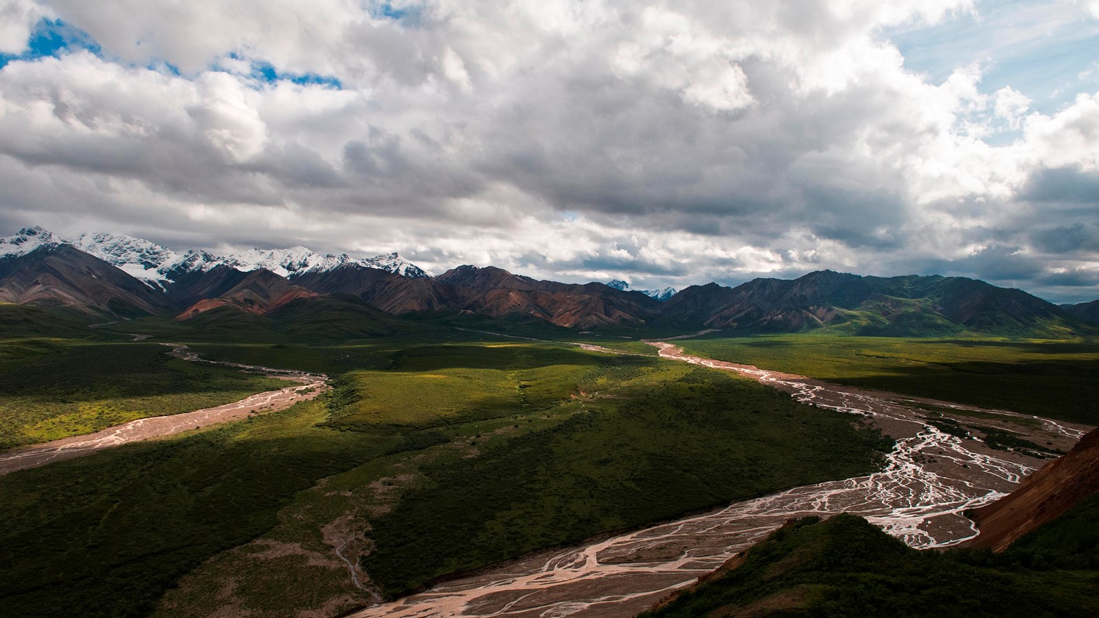
Polychrome Overlook
NPS Photo / Tim Rains
Quick Facts
Location:
Mile 45.8, Denali Park Road
Amenities
1 listed
Scenic View/Photo Spot
Polychrome Overlook is a popular scenic view from the Denali Park Road.
Once the Denali Park Road crosses the East Fork of the Toklat River, it climbs steadily upwards onto Polychrome Mountain, with a sharp drop-off to the south. At Mile 45.8, there is a wide area in the road where buses pause for scenic views. Far below, visitors can see the Plains of Murie, which is crossed by numerous braided river channels and dotted with kettle ponds and large boulders, called glacial erratics. On the far side of the Plains of Murie, the Polychrome Glaciers and numerous peaks of the Alaska Range can be seen.
In summer, nearly all transit and tour buses travel to this point. In spring and fall, intrepid visitors can cycle out to this point or visit it on a backpacking trip, but it is too far to reach otherwise.
Geology
Looking South
If you’re a fan of geology, this is a great place to get out and walk around! A number of interesting glacial features can be seen from the Polychrome Overlook. High in the valleys to the south are the Polychrome Glaciers, barely visible as white patches of ice flowing towards the park road. Each of these glaciers terminates in a dark, stagnant, debris-covered ice field. The Polychrome Glaciers have retreated and downwasted substantially since they were first documented, and will likely disappear completely in the coming decades if the climate continues to warm.
Between the glaciers and the road is a large outwash plain referred to as the Plains of Murie after famous wildlife biologist Adolph Murie. On days with clear skies, kettle ponds, mostly located towards the east end of this expanse, shine brightly on the plains. Overcast days more easily reveal solifluction lobes on some of the lower mountains. These lobes look like dripping paint from far away, and indeed they are dripping in a sense, as they are caused by the slow, downslope creep of water-saturated soils and sediments. Solifluction lobes are common in areas with permafrost and can be seen on hillsides throughout the park.
A 35-foot-high (11m), house-sized erratic boulder on the lowlands to the south, transported to its current location by glaciers in the Pleistocene Epoch, looks small upon the vast Plains of Murie. See if you can spot it!
Looking North
An arcing light-green layer of clay has stained the rocks below it on the north side of Polychrome Overlook. This clay is the product of volcanic ash weathering over time.
Beginning in 2002, a layer of this slippery clay at the overlook caused half of the road to slump over four feet (~1.5 m) during several episodes of heavy precipitation. To mitigate the slumping, Federal Highways Administration and park staff removed the clay, backfilled with materials that were less susceptible to slumping, and added perforated pipes to drain water from the area. The pipes have no obvious inlets, but their outlets can be seen poking out of the slope on the south side of the road.